Darupey
Jump to navigation
Jump to search
Darupey
دروپي | |
|---|---|
village | |
 Darupey | |
| Coordinates: 36°27′12″N 53°08′53″E / 36.45333°N 53.14806°E | |
| Country | |
| Province | Mazandaran |
| County | Sari |
| Bakhsh | Kolijan Rostaq |
| Rural District | Kolijan Rostaq-e Olya |
| Population (2006) | |
| • Total | 212 |
| Time zone | UTC+3:30 (IRST) |
| • Summer (DST) | UTC+4:30 (IRDT) |
Darupey (Persian: دروپي, also Romanized as Darūpey, Daroopey, and Darow Pay)[1] is a village in Kolijan Rostaq-e Olya Rural District, Kolijan Rostaq District, Sari County, Mazandaran Province, Iran. At the 2006 census, its population was 212, in 54 families.[2]
-
 Hosseinieh
 -
 Hosseinieh
 -
 Hosseinieh
 -
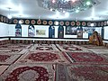
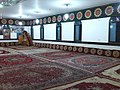
 Mosque
 -
 Mosque
 -
 Mosque
.jpg)
.jpg)
.jpg)
.jpg)
.jpg)
.jpg)
References
- ^ Darupey can be found at GEOnet Names Server, at this link, by opening the Advanced Search box, entering "-3059876" in the "Unique Feature Id" form, and clicking on "Search Database".
- ^ "Census of the Islamic Republic of Iran, 1385 (2006)" (Excel). Statistical Center of Iran. Archived from the original on 2011-09-20.
This Sari County location article is a stub. You can help Wikipedia by expanding it. |