Paygelan
Jump to navigation
Jump to search
Paygelan
Persian: پايگلان | |
|---|---|
Village | |
| Coordinates: 35°08′18″N 46°36′10″E / 35.13833°N 46.60278°E[1] | |
| Country | Iran |
| Province | Kurdistan |
| County | Sarvabad |
| District | Central |
| Rural District | Paygelan |
| Population (2016)[2] | |
| • Total | 1,440 |
| Time zone | UTC+3:30 (IRST) |
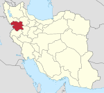
Paygelan (Persian: پايگلان), also Romanized as Pāygelān and Pāygalān; also known as Pai Gilan, Pa yi Gīlān, Pāy Kalān, and Pāykalān,[3] is a village in, and the capital of, Paygelan Rural District[4] of the Central District of Sarvabad County, Kurdistan province, Iran. The village is populated by Kurds.[5]
At the 2006 National Census, its population was 1,920 in 457 households.[6] The following census in 2011 counted 1,645 people in 505 households.[7] The latest census in 2016 showed a population of 1,440 people in 475 households. It was the most populous village in its rural district.[2]
References
- ^ OpenStreetMap contributors (4 March 2024). "Paygelan, Sarvabad County" (Map). OpenStreetMap. Retrieved 4 March 2024.
- ^ a b "Census of the Islamic Republic of Iran, 1395 (2016)". AMAR (in Persian). The Statistical Center of Iran. p. 12. Archived from the original (Excel) on 8 May 2022. Retrieved 19 December 2022.
- ^ Paygelan can be found at GEOnet Names Server, at this link, by opening the Advanced Search box, entering "-3078121" in the "Unique Feature Id" form, and clicking on "Search Database".
- ^ Mousavi, Mirhossein (18 May 1366). "Creation and formation of 12 rural districts including villages, farms and places in Marivan County under Kurdistan province". Islamic Parliament Research Center (in Persian). Ministry of Interior, Board of Ministers. Archived from the original on 5 September 2015. Retrieved 22 January 2024.
- ^ Mohammadirad, Masoud; Anonby, Erik; et al. "Language distribution in Kordestan Province, Iran". Atlas of the languages of Iran (ALI). Geomatics and Cartographic Research Centre, Carleton University. Archived from the original on 28 May 2023.
- ^ "Census of the Islamic Republic of Iran, 1385 (2006)". AMAR (in Persian). The Statistical Center of Iran. p. 12. Archived from the original (Excel) on 20 September 2011. Retrieved 25 September 2022.
- ^ "Census of the Islamic Republic of Iran, 1390 (2011)". Syracuse University (in Persian). The Statistical Center of Iran. p. 12. Archived from the original (Excel) on 19 January 2023. Retrieved 19 December 2022.
Categories:
- CS1 Persian-language sources (fa)
- Articles with short description
- Short description is different from Wikidata
- Use dmy dates from August 2023
- Articles containing Persian-language text
- Coordinates on Wikidata
- Populated places in Sarvabad County
- Kurdish settlements in Kurdistan Province
- All stub articles
- Sarvabad County geography stubs


