Itaperuna Airport
Jump to navigation
Jump to search
Ernani do Amaral Peixoto Airport Aeroporto Ernani do Amaral Peixoto | |||||||||||
|---|---|---|---|---|---|---|---|---|---|---|---|
 Itaperuna airport landside in 2024 | |||||||||||
| Summary | |||||||||||
| Airport type | Public | ||||||||||
| Operator | Infraero (2024–present) | ||||||||||
| Serves | Itaperuna | ||||||||||
| Opened | 8 August 1954 | ||||||||||
| Time zone | BRT (UTC−03:00) | ||||||||||
| Elevation AMSL | 110 m / 361 ft | ||||||||||
| Coordinates | 21°13′09″S 041°52′33″W / 21.21917°S 41.87583°W | ||||||||||
| Map | |||||||||||
 ITP Location in Brazil  ITP ITP (Brazil) | |||||||||||
| Runways | |||||||||||
| |||||||||||
Ernani do Amaral Peixoto Airport (IATA: ITP, ICAO: SDUN), is the airport serving Itaperuna, Brazil.
It is operated by Infraero.
History
The airport was commissioned on August 8, 1954. Previously, the area was occupied by an air-club.[3]
On January 2, 2024, the Municipality of Itaperuna signed a contract of operation with Infraero.[4]
Airlines and destinations
No scheduled flights operate at this airport.
Access
The airport is located 4 km (2 mi) from downtown Itaperuna.
Gallery
-
 Itaperuna Airport terminal landside
 -
 Itaperuna Airport terminal landside
 -
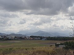 Itaperuna Airport panoramic view


See also
References
- ^ "Aeródromos". ANAC (in Portuguese). 29 June 2020. Retrieved 17 May 2021.
- ^ "Itaperuna (SDUN)". DECEA (in Portuguese). Retrieved 13 August 2023.
- ^ "Obras do aeroporto começam oficialmente". o Dia (in Portuguese). 26 June 2024. Retrieved 1 July 2024.
- ^ "Aeroporto Regional de Itaperuna-RJ passa a ser administrado e operado pela Infraero". Aeroin (in Portuguese). 2 January 2024. Retrieved 2 January 2024.
External links
- Airport information for SDUN at Great Circle Mapper. Source: DAFIF (effective October 2006).
- Current weather for SDUN at NOAA/NWS
- Accident history for SDUN at Aviation Safety Network
Airports in Rio de Janeiro State | |
|---|---|
This article about an airport in Brazil is a stub. You can help Wikipedia by expanding it. |
Categories:
- Pages using gadget WikiMiniAtlas
- CS1 Portuguese-language sources (pt)
- Articles with short description
- Short description is different from Wikidata
- Articles containing Portuguese-language text
- Coordinates on Wikidata
- Airports in Rio de Janeiro (state)
- All stub articles
- South American airport stubs
- Brazil transport stubs
- Brazilian building and structure stubs