Berlaar
Berlaar | |
|---|---|
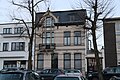
 Personnel houses of Gestelhof Castle | |
 Flag  Coat of arms | |
Location of Berlaar  | |
 Berlaar Location in Belgium
Location of Berlaar in the province of Antwerp  | |
| Coordinates: 51°07′N 04°39′E / 51.117°N 4.650°E | |
| Country | |
| Community | Flemish Community |
| Region | Flemish Region |
| Province | Antwerp |
| Arrondissement | Mechelen |
| Government | |
| • Mayor | Walter Horemans (CD&V) |
| • Governing party/ies | CD&V, N-VA |
| Area | |
| • Total | 24.53 km2 (9.47 sq mi) |
| Population (2020-01-01)[1] | |
| • Total | 11,656 |
| • Density | 480/km2 (1,200/sq mi) |
| Postal codes | 2590 |
| NIS code | 12002 |
| Area codes | 03, 015 |
| Website | www.berlaar.be |
Berlaar (Dutch pronunciation: [ˈbɛrlaːr] ⓘ) is a municipality located in the Belgian province of Antwerp. The municipality comprises the towns of Berlaar proper and Gestel. In 2021, Berlaar had a total population of 11,710. The total area is 24.57 km2.[2]
History
The current municipality of Berlaar was founded on 1 January 1965. Berlaar is actually a fusion of the former municipality Gestel and the Core of Berlaar itself. Berlaar is a part of the Belgische Kempen.
According to legend, the citizens of the early Middle Ages couldn't agree on where the church had to be built. They let fate decide and let two bears fight over it. Where the one bear killed the other, that would be the location the church should be built. Hence the exceptional position of the church at the end of the village square and not in the centre as usual.[3]
Climate
| Climate data for Berlaar (1991−2020 normals) | |||||||||||||
|---|---|---|---|---|---|---|---|---|---|---|---|---|---|
| Month | Jan | Feb | Mar | Apr | May | Jun | Jul | Aug | Sep | Oct | Nov | Dec | Year |
| Mean daily maximum °C (°F) | 6.7 (44.1) |
7.7 (45.9) |
11.4 (52.5) |
15.7 (60.3) |
19.3 (66.7) |
22.0 (71.6) |
24.0 (75.2) |
23.8 (74.8) |
20.2 (68.4) |
15.6 (60.1) |
10.5 (50.9) |
7.1 (44.8) |
15.3 (59.5) |
| Daily mean °C (°F) | 4.0 (39.2) |
4.4 (39.9) |
7.1 (44.8) |
10.4 (50.7) |
14.1 (57.4) |
17.0 (62.6) |
19.1 (66.4) |
18.7 (65.7) |
15.4 (59.7) |
11.5 (52.7) |
7.3 (45.1) |
4.5 (40.1) |
11.1 (52.0) |
| Mean daily minimum °C (°F) | 1.2 (34.2) |
1.0 (33.8) |
2.8 (37.0) |
5.1 (41.2) |
9.0 (48.2) |
12.1 (53.8) |
14.2 (57.6) |
13.5 (56.3) |
10.6 (51.1) |
7.4 (45.3) |
4.2 (39.6) |
1.9 (35.4) |
6.9 (44.4) |
| Average precipitation mm (inches) | 72.0 (2.83) |
63.9 (2.52) |
56.8 (2.24) |
43.6 (1.72) |
56.5 (2.22) |
73.5 (2.89) |
78.0 (3.07) |
83.5 (3.29) |
70.8 (2.79) |
66.0 (2.60) |
77.3 (3.04) |
89.3 (3.52) |
831.2 (32.72) |
| Average precipitation days (≥ 1.0 mm) | 12.5 | 11.5 | 10.8 | 8.7 | 9.5 | 9.9 | 10.5 | 10.5 | 9.6 | 10.9 | 12.6 | 13.9 | 131.0 |
| Mean monthly sunshine hours | 61 | 76 | 134 | 187 | 217 | 217 | 223 | 209 | 162 | 117 | 67 | 51 | 1,718 |
| Source: Royal Meteorological Institute[4] | |||||||||||||
Gallery
-
 Berlaar church
 -
 Town hall
 -
 Pub in Berlaar
 -
 House on the market


References
- ^ "Bevolking per gemeente op 1 januari 2020". Statbel.
- ^ "Bevolking per statistische sector - Sector 12002". Statistics Belgium. Retrieved 9 May 2022.
- ^ "Geschiedenis | Berlaar".
- ^ "Luchttemperatuur en neerslag Referentieperiode: 1991-2020" (PDF) (in Dutch). Royal Meteorological Institute. Retrieved 8 July 2022.
External links
 Media related to Berlaar at Wikimedia Commons
- Official website (Dutch only)
Places adjacent to Berlaar | ||||||||||||||||
|---|---|---|---|---|---|---|---|---|---|---|---|---|---|---|---|---|
| ||||||||||||||||

| International | |
|---|---|
| National | |
| Geographic | |
This Antwerp Province location article is a stub. You can help Wikipedia by expanding it. |
- Pages using the Phonos extension
- CS1 Dutch-language sources (nl)
- Use dmy dates from May 2022
- Articles with short description
- Short description is different from Wikidata
- Coordinates on Wikidata
- Pages using infobox settlement with image map1 but not image map
- Pages with Dutch IPA
- Pages including recorded pronunciations
- Commons category link from Wikidata
- Articles with VIAF identifiers
- Articles with J9U identifiers
- Articles with LCCN identifiers
- Articles with MusicBrainz area identifiers
- Berlaar
- Municipalities of Antwerp Province
- Populated places in Antwerp Province
- All stub articles
- Antwerp geography stubs
- Pages using the Kartographer extension