Wilkowice, Bielsko County
Wilkowice | |
|---|---|
Village | |
 Hospital in Wilkowice | |
 Coat of arms | |
 Wilkowice | |
| Coordinates: 49°45′N 19°6′E / 49.750°N 19.100°E | |
| Country | |
| Voivodeship | Silesian |
| County | Bielsko |
| Gmina | Wilkowice |
| Established | early 14th century |
| Elevation | 380−909 m (−2,602 ft) |
| Population | 6,496 |
| Website | www |
Wilkowice [vilkɔˈvit͡sɛ] is a village in Bielsko County, Silesian Voivodeship, in southern Poland. It is the seat of the gmina (administrative district) called Gmina Wilkowice.[1] It lies approximately 10 kilometres (6 mi) south of Bielsko-Biała and 56 km (35 mi) south of the regional capital Katowice.
It is one of the oldest villages in Żywiec Basin. It was established in the early 14th century by the Cistercian monastery in Rudy, which owned the area alongside Łodygowice and Pietrzykowice.
Tourist attractions
The main attraction of the village are the tourist mountain trails running to the top of Magurka and Rogacz. Other natural assets include rocks and mountain streams. Among the Monuments of Wilkowice it is worth mentioning:
- Saint Michael Church from 1900
- Parish cemetery
- Epidemic cemetery from 1847
- Old railway station from 19th century
- Hospital from 19th century
- Old mill by the river Biała
Gallery
-
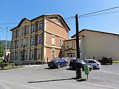 School numer 1 in Wilkowice
 -
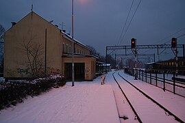 Railway station Wilkowice-Bystra
 -
 Little park in center of village
 -
 Wyzwolenia Street
 -
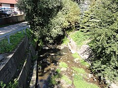 Wilkówka River in front of school
 -
 Saint Michael Church
 -
 Mountain Hostel in Magurka
 -
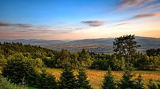 View from Magurka (909 a.s.l.)


References
- ^ "Central Statistical Office (GUS) – TERYT (National Register of Territorial Land Apportionment Journal)" (in Polish). 1 June 2008.
| Seat | ||
|---|---|---|
| Other villages | ||
This Bielsko County location article is a stub. You can help Wikipedia by expanding it. |
- Pages with non-numeric formatnum arguments
- CS1 Polish-language sources (pl)
- Use dmy dates from December 2019
- Articles with short description
- Short description is different from Wikidata
- Coordinates on Wikidata
- Villages in Bielsko County
- Kingdom of Galicia and Lodomeria
- Kraków Voivodeship (1919–1939)
- All stub articles
- Bielsko County geography stubs