Whittaker Wood
Jump to navigation
Jump to search
| Whittaker Wood | |
|---|---|
| Geography | |
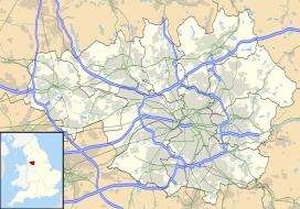
| Location | Greater Manchester, England |
| OS grid | SD946154 |
| Coordinates | 53°38′06″N 2°04′55″W / 53.635°N 2.082°W |
| Area | 1.88 hectares (4.65 acres) |
| Administration | |
| Governing body | Woodland Trust |
Whittaker Wood is a woodland in Greater Manchester, England, near Littleborough. It covers a total area of 1.88 hectares (4.65 acres). It is owned and managed by the Woodland Trust.[1]
References
- ^ "Whittaker Wood - a Woodland Trust Wood". Woodland Trust. Retrieved 2 August 2012.
