Viali di Circonvallazione
Jump to navigation
Jump to search
_33.JPG)


_381.JPG)
The Viali di Circonvallazione are a series of 6-lane boulevards surrounding the north part of the historic centre of Florence.
History
The boulevards follow the outline of the ancient walls of Florence, that were demolished in 1865 according to Giuseppe Poggi's project to make Florence, then the capital of Italy, a modern city with wide boulevards inspired by those of Paris. Around the former gates of the city, squares and palaces were created.
Today
Today the viali di Circonvallazione are the main arterial street of Florence for the traffic from west to east.
The route (from west) starting from Ponte alla Vittoria bridge is:
- Viale Fratelli Rosselli (with Torre della Serpe and Leopolda Station)
- Piazzale of Porta al Prato
- Viale Filippo Strozzi (around the Fortezza da Basso)
- Viale Spartaco Lavagnini
- Piazza della Libertà (with Porta San Gallo, Triumphal Arch of the Lorraine and the Parterre)
- Viale Giacomo Matteotti
- Piazzale Donatello (around the English Cemetery)
- Viale Antonio Gramsci
- Piazza Beccaria (with Porta alla Croce, Archive of State and La Nazione headquarters)
- From here the boulevards divide into:
- Viale Giovine Italia (with the Torre della Zecca and Arno River)
- Viale Giovanni Amendola
Gallery
-
 Viale Strozzi
 -
 Viale Spartaco Lavagnini
 -
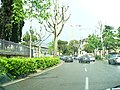 Piazzale Donatello

_6.JPG)

This Italian road or road transport-related article is a stub. You can help Wikipedia by expanding it. |
Categories:
- Articles with short description
- Short description matches Wikidata
- Articles lacking sources from June 2016
- All articles lacking sources
- EngvarB from January 2019
- Italy articles missing geocoordinate data
- All articles needing coordinates
- Articles missing coordinates without coordinates on Wikidata
- Streets of Florence
- Boulevards
- All stub articles
- Italy road stubs