User talk:Goran tek-en/talk/2014
Talks 2014.
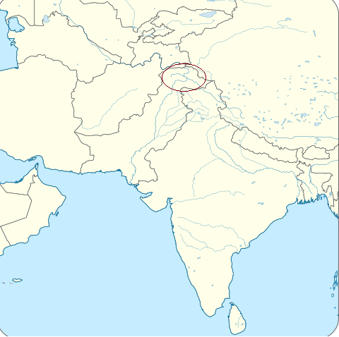
Bengali map
hi Goran tek-en, thank you for the map. It looks good. Could you just change the border between west and east into white instead, like this map here File:Badakhshan.svg? Thank you. Gryffindor (talk) 09:22, 29 November 2013 (UTC)
- So, now it's changed to white. Do you want me to add it to this category, Linguistic maps of the Bengali language?
- I'm not really sure (new to this) how to state the source but maybe you could check after its uploaded, but tell me which category in advance.
- I forgot, what name do you want on it? Goran tek-en (talk) 18:10, 29 November 2013 (UTC)
- You can add it to the category "Category:Maps of Bengal" on the Commons[1]. The name can be "Map of Bengal" I would say. Thank you. Gryffindor (talk) 11:25, 30 November 2013 (UTC)
- So now it's uploaded as you wanted. Let me know if it's anything, thanks. Goran tek-en (talk) 19:15, 30 November 2013 (UTC)
- Great. Do you mind maybe enlargening the map a little bit more so that more of Bengal can be seen? Maybe by 10-15%? Sorry for the trouble. Gryffindor (talk) 11:23, 1 December 2013 (UTC)
- Done. What I can see (I'm not totally sure) you have removed one map I added as source. To me you can not do that because you do not know what sources I have used. I have used that third image also so please leave it there. Goran tek-en (talk) 17:18, 1 December 2013 (UTC)
- Thank you. In that case, you have to use the correct source map, which is the world map file. Placing a map of Badakshan is confusing for anyone looking at it. Gryffindor (talk) 18:24, 1 December 2013 (UTC)
- Okay but I took it from the map of Badakshan and not from the world map so to me it was correct. I didn't know there was another world map. I made a note about what I used on the file map of Badakshan.Goran tek-en (talk) 18:40, 1 December 2013 (UTC)
- I understand. But the world view in the map of Badakshan was taken from another file. So by indicating the exact original file, it makes the actual sourcing more accurate. Gryffindor (talk) 01:05, 2 December 2013 (UTC)
- I understand. But the world view in the map of Badakshan was taken from another file. So by indicating the exact original file, it makes the actual sourcing more accurate. Gryffindor (talk) 01:05, 2 December 2013 (UTC)
- Okay but I took it from the map of Badakshan and not from the world map so to me it was correct. I didn't know there was another world map. I made a note about what I used on the file map of Badakshan.Goran tek-en (talk) 18:40, 1 December 2013 (UTC)
- Thank you. In that case, you have to use the correct source map, which is the world map file. Placing a map of Badakshan is confusing for anyone looking at it. Gryffindor (talk) 18:24, 1 December 2013 (UTC)
- Done. What I can see (I'm not totally sure) you have removed one map I added as source. To me you can not do that because you do not know what sources I have used. I have used that third image also so please leave it there. Goran tek-en (talk) 17:18, 1 December 2013 (UTC)
- Great. Do you mind maybe enlargening the map a little bit more so that more of Bengal can be seen? Maybe by 10-15%? Sorry for the trouble. Gryffindor (talk) 11:23, 1 December 2013 (UTC)
- So now it's uploaded as you wanted. Let me know if it's anything, thanks. Goran tek-en (talk) 19:15, 30 November 2013 (UTC)
- You can add it to the category "Category:Maps of Bengal" on the Commons[1]. The name can be "Map of Bengal" I would say. Thank you. Gryffindor (talk) 11:25, 30 November 2013 (UTC)
![]() Done --Goran tek-en (talk) 18:50, 6 March 2014 (UTC)
Done --Goran tek-en (talk) 18:50, 6 March 2014 (UTC)
Email link
You are trying to contact Arb. You should see a link to "Email this user" on the sidebar of the user page or talk page. You might have to click "Tools" to make it appear. (Thanks in advance for helping)--S Philbrick(Talk) 15:03, 10 December 2013 (UTC)
![]() Done --Goran tek-en (talk) 18:50, 6 March 2014 (UTC)
Done --Goran tek-en (talk) 18:50, 6 March 2014 (UTC)
Red Fort
hi Goran tek-en, I hope you had a good New Year's. I have a left a message on the talk page, the second option would be great. Thank you. Gryffindor (talk) 12:45, 2 January 2014 (UTC)
- hi there, I left some feedback for you, thank you. Gryffindor (talk) 00:55, 6 January 2014 (UTC)
- I got it and I'm working on it. --Goran tek-en (talk) 13:17, 6 January 2014 (UTC)
- Hi Goran tek-en, I have written some responses and also sent you an email with more details. Thank you. Gryffindor (talk) 00:19, 21 January 2014 (UTC)
- Hi there, sorry I just don't get a reminder as soon as you have posted your reply. I will create a png draft based on your graphic with the corrections and upload it here. Thank you for your patience. Gryffindor (talk) 19:44, 30 January 2014 (UTC)
- Thank you for waiting, I have uploaded the revised file, you can see it on the Project page. Gryffindor (talk) 15:30, 10 February 2014 (UTC)
- I have been able to comment on the png file. Also the current SVG file is nominally 497 × 989 pixels. Could we have that larger file, otherwise it's difficult to see things? Thank you. Gryffindor (talk) 16:39, 21 February 2014 (UTC)
- Gryffindor I didn't understand your sentence "I have been able to comment on the png file."?
- Now I have made the nominal size larger (1000px in width), do you want it even larger?
- How can a larger nominal size help to see details, is that not depending on the image size you show on the page? --Goran tek-en (talk) 16:59, 21 February 2014 (UTC)
- Hi Goran, if you take a look at the png file, I wrote the comments on it on what needs to be corrected. Gryffindor (talk) 20:40, 2 March 2014 (UTC)
- Now I have made the nominal size larger (1000px in width), do you want it even larger?
- Gryffindor I didn't understand your sentence "I have been able to comment on the png file."?
- I have been able to comment on the png file. Also the current SVG file is nominally 497 × 989 pixels. Could we have that larger file, otherwise it's difficult to see things? Thank you. Gryffindor (talk) 16:39, 21 February 2014 (UTC)
- Thank you for waiting, I have uploaded the revised file, you can see it on the Project page. Gryffindor (talk) 15:30, 10 February 2014 (UTC)
- Hi there, sorry I just don't get a reminder as soon as you have posted your reply. I will create a png draft based on your graphic with the corrections and upload it here. Thank you for your patience. Gryffindor (talk) 19:44, 30 January 2014 (UTC)
- Hi Goran tek-en, I have written some responses and also sent you an email with more details. Thank you. Gryffindor (talk) 00:19, 21 January 2014 (UTC)
- I got it and I'm working on it. --Goran tek-en (talk) 13:17, 6 January 2014 (UTC)
I don't know where you got that png file from because it's not the same as the present svg file.
- Is it really good to upload a file like that which is not the final version. Don't we have any way to mark them as "working versions" or similar? The best would be if we had an area/category or something like that which maybe should not be visible to everyone and that you could delete after you don't need it any more.
- The walls are lilac and not grey as in your png.
- I have made the rest of the changes. --Goran tek-en (talk) 14:35, 3 March 2014 (UTC)
Would you like to do the honors?

I nominated the 250px version for Featured Picture-- so now I ask before nominating things :). I think you're SVG version is great! Do you think it should be nominated? --HectorMoffet (talk) 23:07, 19 January 2014 (UTC)
@HectorMoffet: I would be honored if you think it's good enough. I tried to read about the nominating and what I understand it's up to you if you think it fits, but from my point of view it would be great, so thanks. --Goran tek-en (talk) 13:17, 20 January 2014 (UTC)
We'll see, I've nominated it.! Either way, you did an incredible job! --HectorMoffet (talk) 11:54, 24 January 2014 (UTC)
![]() Done --Goran tek-en (talk) 18:49, 6 March 2014 (UTC)
Done --Goran tek-en (talk) 18:49, 6 March 2014 (UTC)
Mesopotamia map
Here are the translations:
German           English

Mittelmeer       Mediterranean Sea
Kapisches Meer   Caspian Sea
Persischer Golf  Persian Gulf
Türkei           Turkey
Iran             Iran
Libanon          Lebanon
Syrien           Syria
Jordanien        Jordan
Irak             Iraq
Kuwait           Kuwait
MESOPOTAMIEN     MESOPOTAMIA
Chabur           Khabur
Tigris           Tigris
Euphrat          Euphrates
Zāgros-Gebirge   Zagros Mountains
Taurus-Gebirge   Taurus Mountains
ungefähre Ausdehnung des Persischen Golfs um 5500 v. Chr.
                 approximate extent of the Persian Gulf until 5500 B.C.
Maproom (talk) 18:34, 24 January 2014 (UTC)
![]() Done --Goran tek-en (talk) 18:49, 6 March 2014 (UTC)
Done --Goran tek-en (talk) 18:49, 6 March 2014 (UTC)
Hello
Hi Goran,
Can you please if you can make the same kind of map with same green background as you've did recently with the Kingdom of Georgia map with this map? Jaqeli (talk) 22:22, 30 January 2014 (UTC)
- Yes I can do that for you but you have to tell me how you want the underlying map to look. The same as the other I did or this one, and how much do you want of the details on this, names and so on. --Goran tek-en (talk) 17:44, 31 January 2014 (UTC)
- Thank you. Same as you've did in the recent map. Just put a name on it "Democratic Republic of Georgia". Jaqeli (talk) 17:53, 31 January 2014 (UTC)
- @Jaqeli: Now you can find it here Democratic Republic of Georgia 1490, I had to change the name some as the other was taken. Let me know if you want something changed or other, thanks. --Goran tek-en (talk) 18:30, 4 February 2014 (UTC)
- Thank you. Same as you've did in the recent map. Just put a name on it "Democratic Republic of Georgia". Jaqeli (talk) 17:53, 31 January 2014 (UTC)
Sorry about the wrong date in the name. --Goran tek-en (talk) 19:25, 4 February 2014 (UTC)
Hello Goran again, can you please make a map like you've did up above with giving the same green background to this map? Just unite all those coloured lands into one green background and write "Kingdom of Iberia". Jaqeli (talk) 09:24, 1 March 2014 (UTC)
- Jaqeli Now you can look at this draft and give me feedback.
- The two maps I'm working from doesn't have the same relationship in width*height so they don't fit together absolutely.
- In the eastern part of the kingdom it follows some rivers. I'm not really sure which rivers this should be on the map I'm using so there are three options in this draft;
- The green not really connecting to the rivers.
- Red connecting to some rivers.
- The yellow connecting to other rivers.
- You have to tell me which of those that is the right one or any other, thanks. --Goran tek-en (talk) 15:30, 6 March 2014 (UTC)
- Thanks Goran. Rivers are not that important so you can remove them. Jaqeli (talk) 15:44, 6 March 2014 (UTC)
- I found a way to go around the problem (I think) and I didn't remove the rivers as I think they make the map look much more alive.
- How do you want me to upload it, new file or as a version of a file?
- If new file then I will need the following otherwise which file to upload it as a version of (it has to be a file with an ending *.svg)
- Name of the file
- Description
- Category/ies --Goran tek-en (talk) 17:30, 6 March 2014 (UTC)
- I found a way to go around the problem (I think) and I didn't remove the rivers as I think they make the map look much more alive.
- Thanks Goran. Rivers are not that important so you can remove them. Jaqeli (talk) 15:44, 6 March 2014 (UTC)
Upload it as a new file as a SVG, name it "Map of Kingdom of Iberia, III c. BC", put it in the category of Maps of the Kingdom of Iberia. Thank you again. Jaqeli (talk) 17:49, 6 March 2014 (UTC)
- Thanks for the info, now you can find it here Map of Kingdom of Iberia, III c. BC.
 Done --Goran tek-en (talk) 18:46, 6 March 2014 (UTC)
Turkey Geographical Name Changes Map
The map looks great! Sorry for the late response...I thought that page was totally dead. Thank you for the wonderful work you have done!!! :) Étienne Dolet (talk) 20:10, 11 February 2014 (UTC)
![]() Done --Goran tek-en (talk) 18:47, 6 March 2014 (UTC)
Done --Goran tek-en (talk) 18:47, 6 March 2014 (UTC)
Burger King countries
Thank you for taking my request to fix the map for European countries with Burger King franchises. I made two mistakes on my list: Denmark and Georgia do, according to the Burger King franchises page, have Burger King franchises. Please don't remove those two countries. As far as the other countries go, I have checked them and am sure they are the ones needed to be removed. Disclaimer: I have not visited every country listed, nor have I contacted Burger King personally. I am going solely by the Wikipedia listing. But I am sure this is what we'll have to do with at the moment. JIP | Talk 20:50, 21 February 2014 (UTC)
![]() Done --Goran tek-en (talk) 18:48, 6 March 2014 (UTC)
Done --Goran tek-en (talk) 18:48, 6 March 2014 (UTC)
Adana map
Can the concerns raised here by a user be considered valid? If so, can we go along and fix them? For example, the green text for the parks? The orange districts are landmarks. So I think we should have a key for those as well. Étienne Dolet (talk) 22:43, 22 February 2014 (UTC)
- Of course we can change the map but I have redrawn this from the "original" File:The City of Adana.gif and that is all the knowledge I have of this subject.
- I will make changes on how the "major" roads connect to the older roads so it's not that abruptly ended.
- For the markings that appear to be railroad tracks I'm not sure if they are because some of the names tells something else. If you have knowledge or know how to find out if it's railroads and where should go I will change according to that.
- For the colored text I just followed the original but I will make an all black version and show you. --Goran tek-en (talk) 12:17, 23 February 2014 (UTC)
- EtienneDolet Now there is a new draft with the changes discussed, give me feedback, thanks. --Goran tek-en (talk) 13:19, 23 February 2014 (UTC)
- Thanks Goran. Sorry to put you through this. Yes those aren't railroads come to think of it. I'm thinking we should just change the way the "Field Road" looks and make it look like all the other roads. Also, I think the colors for the cemeteries should remain: Green for Muslim and red for Armenian. A side note, Cretan quarters is spelled Cretan quartes. Also, is there anyway possible we can do a scale for this? Sorry to bother you about this Goran. Your work is much much appreciated. Étienne Dolet (talk) 18:38, 23 February 2014 (UTC)
- It's no problem, this is the way to create something. You have to test and see what it looks like. Of course I can do a scale but then I need some reference measurement in the image. If you can find some other map or from google maps or similar I can put it in but you will have to try to find it. Hope that is OK. --Goran tek-en (talk) 19:09, 23 February 2014 (UTC)
- Thanks Goran. Sorry to put you through this. Yes those aren't railroads come to think of it. I'm thinking we should just change the way the "Field Road" looks and make it look like all the other roads. Also, I think the colors for the cemeteries should remain: Green for Muslim and red for Armenian. A side note, Cretan quarters is spelled Cretan quartes. Also, is there anyway possible we can do a scale for this? Sorry to bother you about this Goran. Your work is much much appreciated. Étienne Dolet (talk) 18:38, 23 February 2014 (UTC)
- The spelling you are talking about, is that above Armenian cemetery and this is how it's spelled there Cretan quartes and to me that's the same as you your correction? --Goran tek-en (talk) 19:31, 23 February 2014 (UTC)
Yes yes, it should be Cretan quarters* (See original map). I'm going to try and find a scale for you. I think I'm going to end up using google maps though. Nevertheless, the streets on google maps are outstandingly accurate with this map. Étienne Dolet (talk) 21:10, 23 February 2014 (UTC)
- Goran thanks for everything you did. Just upload whatever we have done so far far. Greatly appreciate it. Étienne Dolet (talk) 08:05, 28 February 2014 (UTC)
- EtienneDolet Latest version now uploaded. I'm not 100% sure about the scale so you should check that. If anything needs to be changed just get back to me, thanks. --Goran tek-en (talk) 18:18, 28 February 2014 (UTC)
- Great! I'm going to renominate this in the near future. Thanks. Étienne Dolet (talk) 18:25, 28 February 2014 (UTC)
- Hello Goran...so can we have the map the same way before you reverted it? Basically bolden the font to increase visibility and keep the colors of the mosques and churches as green and red respectively. Thanks. Étienne Dolet (talk) 07:46, 5 March 2014 (UTC)
- Now the texts you wanted colored are so. The text is already bold. There is a lot of text in the map so it's really hard to do some more for the visibility. If possible you will have to show a bigger image on the page. --Goran tek-en (talk) 14:16, 6 March 2014 (UTC)
- Hello Goran...so can we have the map the same way before you reverted it? Basically bolden the font to increase visibility and keep the colors of the mosques and churches as green and red respectively. Thanks. Étienne Dolet (talk) 07:46, 5 March 2014 (UTC)
Gupta Empire map
Hi Goran, Regarding the map (File:Map for Gupta Empire and tributaries.svg), I've added the necessary description to the file. Last minute adjustments were really good. It has turned out to be the best map on the history of Indian Subcontinent. Many thanks. --Fasi100 (talk) 21:05, 2 March 2014 (UTC)
![]() Done --Goran tek-en (talk) 18:48, 6 March 2014 (UTC)
Done --Goran tek-en (talk) 18:48, 6 March 2014 (UTC)
Indo Greek Empire map, PNG version.
Dear Goran,
Please look at the end of this thread: Wikipedia:Graphics Lab/Map workshop/Archive/March 2014#Indo_Greek_Empire_map.. I asked your permission about uploading another version of that image. You didn't respond, so I assumed it won't be a problem. My sole purpose for uploading a PNG version was making visible the granular surface; crop and font were not the issue. If it bothers you, just tell me and I will file it for deletion.
I am not very happy with the blurry PNG, and was already thinking of deleting it. Kind regards. --Fasi100 (talk) 17:26, 24 March 2014 (UTC)
Fasi100 There is a problem with the "watch" functions on pages at wikipedia, they don't give information/email about changes there so I haven't seen that question. Please always ping me so I know things like that. It's not a problem for me and I try to think what is best for commons, not me. As you can see on the png version rendered from the svg the surface is visible there. I will see if there is something I can do about the granular surface, thanks for the info. --Goran tek-en (talk) 19:05, 24 March 2014 (UTC)
- Fasi100 I have now made some changes to the granular surface and uploaded a new version, removed the blurr and now it renders better. It will take up to a couple of days before the preview is updated. If you want to look at how the rendered image will look like just download the latest svg version and then test it at this link svg rendering at commons. So I think I have to skip the blurr on the surface. It looks different now so if you want some changes to it just tell me. --Goran tek-en (talk) 20:19, 24 March 2014 (UTC)
- Goran tek-en Its perfect. Thank you for taking the time to apply these changes. I believe the PNG version is useless now, you may delete it or do whatever you want with it. Regards. --Fasi100 (talk) 07:59, 25 March 2014 (UTC)
- Fasi100 I have never deleted or asked for it so as you uploaded the image I would preefer that you did that. Also I think it would be the best for commons, thanks. --Goran tek-en (talk) 10:44, 25 March 2014 (UTC)
- Goran tek-en Hello. I hope you remember when working on Gupta Empire map, you extracted a map out of this giant pdf map: File:Blank map world gmt.pdf. So basically you removed the grid > removed heavy stuff > made correction to Indus River > and cropped it to this (File:Blank rivers lakes boundries asia.svg). I was wondering if you have that middle-stage map of the world ( i.e. grid removed and heavy stuffed removed, Indus corrected .. but map not cropped). If you have it with you, please upload it on Wikipedia; I need that. Waiting. Thanks.--Fasi100 (talk) 22:30, 4 April 2014 (UTC)
- Fasi100 I have never deleted or asked for it so as you uploaded the image I would preefer that you did that. Also I think it would be the best for commons, thanks. --Goran tek-en (talk) 10:44, 25 March 2014 (UTC)
- Goran tek-en Its perfect. Thank you for taking the time to apply these changes. I believe the PNG version is useless now, you may delete it or do whatever you want with it. Regards. --Fasi100 (talk) 07:59, 25 March 2014 (UTC)
Fasi100 I'm sorry but I didn't keep that. So if you need it I will have to do it again. If you want me to do it I will probably not have time to start immediately, let me know if you want me to do it. --Goran tek-en (talk) 15:45, 5 April 2014 (UTC)
- Goran tek-en I want it. And Wikipedia needs it, badly. There is not a single map that features accurate river lines and modern boundaries. How about this: You tell me when will you be able to start. So in the mean time, I will research all the major world rivers that need correction in that pdf, and point out inaccuracies by precisely showing them on photobucket (like I showed you the Indus, previously). This way, your work will be easy. If we can do it, it will be used in hundreds of images for years to come. --Fasi100 (talk) 16:10, 5 April 2014 (UTC)
Fasi100 Sure, and that sounds great with your work on rivers. That's exactly how this should work, each do there part of what they can. Let's say that I can start in one week but I can't work every day on it. Spring is always a busy time with everything. So you just get back to me and we will work on it, thanks. --Goran tek-en (talk) 17:33, 5 April 2014 (UTC)
I found this map File:Blank_map_world_gmt_(simplified).svg, is that something we can use as base? --Goran tek-en (talk) 17:37, 5 April 2014 (UTC)
Yeah, this too will work. --Fasi100 (talk) 18:17, 5 April 2014 (UTC)
A barnstar for you!

|
The Original Barnstar |
| Thanks for making those great maps--I really appreciate it. Drmies (talk) 16:48, 30 March 2014 (UTC) |
Upload away!
Frenchmalawi never got back, so I think it's safe to upload the Russia map. Thank you again for making that fix! EvergreenFir (talk) 18:46, 8 April 2014 (UTC)
New map is needed
Hello Goran. Please take a look at this suggestion. Can you do it? --UA Victory (talk) 14:21, 23 April 2014 (UTC)
Graphics Lab Top 4
As you've recently been editing the Top 4, I was wondering if you could have your input into some thoughts I've posted here. Thanks! NikNaks talk - gallery 14:21, 8 May 2014 (UTC)
request
Hello Goran tek-en,
Hope all is well. I stumbled upon this map asbarez.com/App/Asbarez/eng/2011/08/0823churches1.jpg and I'd really like to see a nice rendition of it on Wikipedia. Can you help me out this request? I'd be happy if it was in a .svg format as well. That'll be really good. Étienne Dolet (talk) 19:18, 16 May 2014 (UTC)
- EtienneDolet Hi, I could do that but you have to be aware that the image is very small/blurry and it's hard to see where all the churches were placed.
- It will not be possible to get it 100% right.
- Can I leave out the regions or do you want them as well?
- Do you want a cross as place mark?
- Some of the text can be mistaken for a church but you will have to help me with checking on accuracy.
- Give me feedback on the above and I will not be able to start work on it directly. --Goran tek-en (talk) 07:29, 17 May 2014 (UTC)
- Awesome! You know what? Just give me a week and I'll try to find a better quality photograph. This project is going to be very important. Especially with the centennial coming up. It needs to be done right. Étienne Dolet (talk) 05:17, 18 May 2014 (UTC)
Antarctic Waters
Hello, Goran tek-en, I'm finally online again and have responded to your amazingly persistent efforts. I'm sorry it's been so long. HLHJ (talk) 18:03, 29 June 2014 (UTC)
A barnstar for you!

|
The Special Barnstar |
| Thanks for your awesome Graphic design and teamwork skills. I also award you with the gift of scrupulosity and I hope you will use it well. UA Victory (talk) 19:27, 4 July 2014 (UTC) |
A barnstar for you!

|
The Graphic Designer's Barnstar |
| For your hard work on this excellent map of Georgia. Keep up the good work! RGloucester — ☎ 17:24, 5 July 2014 (UTC) |
Interested in drawing up a map?
I've seen the excellent work you did on the Russo-Georgian War map, and I was wondering if you'd be interested in helping me to create a map for the War in Donbass. My request is listed at Wikipedia:Graphics Lab/Map workshop#War in Donbass. Thanks very much! RGloucester — ☎ 02:25, 5 August 2014 (UTC)
RGloucester Right now I have some private issues and I will not be able to do this kind of work for some weeks or so. If you can wait I will be glad to help you then. --Goran tek-en (talk) 12:12, 5 August 2014 (UTC)
- That's fine. It isn't urgent. I was justing trying to get the map-drawing in motion, so that we are not left without maps when the article becomes historical. RGloucester — ☎ 15:18, 5 August 2014 (UTC)
You've been inducted!

|
Order of Merit of Ukraine | |
| I cannot thank you enough for your work on this map of the War in Donbass. Your patience and hard work is of great help to Wikipedia. For this work, I've decided to induct you into the WikiProject Ukraine Order of Merit. Please keep up the good work! | ||
| this WikiAward was given to Goran tek-en by RGloucester — ☎ on 17:09, 24 November 2014 (UTC) |
SVG
About hand-writing SVG, you just write some code and save the file in Notepad++ and then load the SVG file in your favorite browser. Whenever you make any progress, you just refresh the SVG in the browser to get the updated preview. That's how I work with my SVG maps. -- Sameboat - 同舟 (talk · contri.) 02:32, 9 December 2014 (UTC) If I have to use Inkscape for tracing path of raster image, I save a separate file and then copy the path data and paste to another SVG file for cleaner code structure. -- Sameboat - 同舟 (talk · contri.) 02:42, 9 December 2014 (UTC)
- @Sameboat:Could you please help me with this, thanks.
- In Inkscape I can save as Optimized svg and I have made a test and it gives much much smaller code. I run a test on the svg check tool and it passed without anything. I also tested it at w3 validator and there I got an ERROR
Line 15, Column 336: Attribute line-height not allowed on SVG element text at this point.
- In Inkscape I can save as Optimized svg and I have made a test and it gives much much smaller code. I run a test on the svg check tool and it passed without anything. I also tested it at w3 validator and there I got an ERROR
…ans" line-height="125%" fill="#000000"><tspan id="tspan2989" x="112.85714" y="…
- I have uploaded both of my test files here inkscape-svg and inkscape-optimized-svg so you can download them if you have the time for it.
- Now when I view them in a browser they show differently. The optimized version is much larger, do you know why?
- The error I got on w3 seems strange to me as "line-height" exist in both files, do you know why I get the error?
- I really would like to understand this as I think it's importent to upload only validated code to wikimedia, thanks. --Goran tek-en (talk) 10:07, 10 December 2014 (UTC)
- To my understanding the "line-height" property is illegal by now for a good reason: SVG 1.1 does not support soft return. This property would be useful for the now obsoleted SVG 1.2 which Inkscape partially supports its flowed text function. Although it's not recommended to include this property, it's practically harmless to keep it which would be recognized by SVG 2. If you really are bothered by the error warning from w3 validator, just remove that
line-height="125%"in Notepad. - The optimized SVG has been "overly optimized" because it lacks
widthandheightproperties in thesvgelement (width="233.07143"andheight="133.69199"which are present in your non-optimized version). -- Sameboat - 同舟 (talk · contri.) 11:58, 10 December 2014 (UTC)
- Thanks for your feedback and knowledge. --Goran tek-en (talk) 15:52, 10 December 2014 (UTC)
- To my understanding the "line-height" property is illegal by now for a good reason: SVG 1.1 does not support soft return. This property would be useful for the now obsoleted SVG 1.2 which Inkscape partially supports its flowed text function. Although it's not recommended to include this property, it's practically harmless to keep it which would be recognized by SVG 2. If you really are bothered by the error warning from w3 validator, just remove that
Bolivia's recognition of the Armenian Genocide
Hello Goran,
Hope all is well.

.svg)
Can you please make Bolivia dark green? It has recently recognized the Armenian Genocide. I'd really appreciate it. Étienne Dolet (talk) 19:56, 14 December 2014 (UTC)
@EtienneDolet: ![]() Done --Goran tek-en (talk) 09:32, 15 December 2014 (UTC)
Done --Goran tek-en (talk) 09:32, 15 December 2014 (UTC)
New map
Do you think you could work on a new map for the Minsk Protocol article? I found this map, which depicts the buffer zones established by the Protocol. Such a map would be quite useful for the article. This one should be simple. It should simply show the buffer zones, nothing else. RGloucester — ☎ 23:34, 18 December 2014 (UTC)
- By the way, if you need someone to translate the text, I know editors that can oblige. RGloucester — ☎ 00:03, 19 December 2014 (UTC)
- There's no need to add any of the battle markers, either. Just the buffer lines (green, blue, red), their accompanying "15km" markers, and the cities. RGloucester — ☎ 00:05, 19 December 2014 (UTC)
- By the way, if you need someone to translate the text, I know editors that can oblige. RGloucester — ☎ 00:03, 19 December 2014 (UTC)
@RGloucester: Yes I can do that but I will go away for some days and will be back in early January. If you could get translation for names of, countries, regions, major cities and other things you want included so I can orientate myself that would be great. Give me both languages so I can find the names, thanks. --Goran tek-en (talk) 10:23, 20 December 2014 (UTC)
- Never mind the cities, as it seems like it would be more work to translate than is worth it. Just do the buffer zones, and perhaps add Donetsk and Luhansk cities. The map shows Donetsk and Luhansk oblasts of Ukraine. RGloucester — ☎ 16:28, 24 December 2014 (UTC)
- @RGloucester: As usual the map you provide doesn't fit with the base map I will use War in donbass in any way. So you have to help me here;
- Does the "light brown" area in your map correspond to any dated area in my base map War in donbass?
- Give me translations for thoose three; red, blue and green lines? --Goran tek-en (talk) 14:38, 6 January 2015 (UTC)
- The shaded area is essentially equivalent to the August line in the Donbass map. The green line is a buffer zone, wherein no heavy artillery of greater than 100mm is allowed. The red line is the insurgent line of control, and the blue line is the Ukrainian line of control. RGloucester — ☎ 16:32, 6 January 2015 (UTC)
- Now I need you to look at this draft.
- The thick black line is an imagined line between the red and blue line. Give me feedback if it needs to be changed? This before I add the rest.
- Give me feedback on if you want the whole map to keep it's size or if you want it to be cut closer, if so where?
- I put the roads back as I used them to find out where the line should be and I think the are useful here, they can be dimmed down or other. Give me feedback. --Goran tek-en (talk) 17:22, 6 January 2015 (UTC)
- The line is right. I'd like the map to be similar to the one I provided, i.e. zoomed in more. Essentially, I'd prefer if the map looked as close to the one I provided as is reasonably possible. RGloucester — ☎ 19:24, 6 January 2015 (UTC)
- Now I need you to look at this draft.
- The shaded area is essentially equivalent to the August line in the Donbass map. The green line is a buffer zone, wherein no heavy artillery of greater than 100mm is allowed. The red line is the insurgent line of control, and the blue line is the Ukrainian line of control. RGloucester — ☎ 16:32, 6 January 2015 (UTC)
- @RGloucester: As usual the map you provide doesn't fit with the base map I will use War in donbass in any way. So you have to help me here;
- Never mind the cities, as it seems like it would be more work to translate than is worth it. Just do the buffer zones, and perhaps add Donetsk and Luhansk cities. The map shows Donetsk and Luhansk oblasts of Ukraine. RGloucester — ☎ 16:28, 24 December 2014 (UTC)
I will not make a pure "copy" of the other map, I make a version based on the information in it.
Now you can look at a new draft, reload the page to get the new one. Give me feedback on it, thanks. --Goran tek-en (talk) 15:04, 8 January 2015 (UTC)
- Looking good. I'm quite opposed, however, to the pink and green, which is a bit queer. Can we have a simple Ukrainian blue and insurgent red? Other than that, Horlivka is in the wrong place. It is on the insurgent side. I'd also recommend simple flat lines for the lines of control/buffer zone, rather than the rounded ones that are used. RGloucester — ☎ 17:27, 8 January 2015 (UTC)
- No problem, I have changed the colors, pattern and I removed Horlivka. If you don't want me to remove Horlivka then I will have to #1 Move it towards east but still west of the road. #2 Change the lines (blue, red, buffer) a bit to the west at that location to make it all fit in.
 Question: I will do if but I want you to tell which option you want; with or without Horlivka?
 - Look at a new draft, reload the page. --Goran tek-en (talk) 20:20, 8 January 2015 (UTC)
- Looks good. No need to add in Horlivka. The last thing I'd say is that the legend should read "Insurgent-controlled area" rather than "insurgent area of control". I'd also recommend adding a dot for Sloviansk on the map. Other than that, we're done here. RGloucester — ☎ 21:20, 8 January 2015 (UTC)
- Then I want you to check the position of Sloviansk and the rest of the map Look at this draft.
- I will also need the following;
- Name of the file
- Description
- Category/ies
- to be able to upload it as a new file at commons, thanks. --Goran tek-en (talk) 10:55, 9 January 2015 (UTC)
- It looks like everything is in order. I'd name it "Minsk Protocol". For a description, one can say "A map of the buffer zone established by the Minsk Protocol during the War in Donbass". For categories, put it in the "War in Donbass" Commons category. Thanks once again for your prompt work! RGloucester — ☎ 17:14, 9 January 2015 (UTC)
- Then I want you to check the position of Sloviansk and the rest of the map Look at this draft.
- Looks good. No need to add in Horlivka. The last thing I'd say is that the legend should read "Insurgent-controlled area" rather than "insurgent area of control". I'd also recommend adding a dot for Sloviansk on the map. Other than that, we're done here. RGloucester — ☎ 21:20, 8 January 2015 (UTC)
- No problem, I have changed the colors, pattern and I removed Horlivka. If you don't want me to remove Horlivka then I will have to #1 Move it towards east but still west of the road. #2 Change the lines (blue, red, buffer) a bit to the west at that location to make it all fit in.
- Looking good. I'm quite opposed, however, to the pink and green, which is a bit queer. Can we have a simple Ukrainian blue and insurgent red? Other than that, Horlivka is in the wrong place. It is on the insurgent side. I'd also recommend simple flat lines for the lines of control/buffer zone, rather than the rounded ones that are used. RGloucester — ☎ 17:27, 8 January 2015 (UTC)
Now you can find it here Minsk_Protocol. You should check the info on the file, thanks. ![]() Done --Goran tek-en (talk) 19:49, 9 January 2015 (UTC)
Done --Goran tek-en (talk) 19:49, 9 January 2015 (UTC)
Per Workshop talkpage
Hi,
Again I would like to thank you for your excellent work on those two maps. Per our previous conversation here is the link to the other outstanding request, for your consideration: https://en.wikipedia.org/wiki/Wikipedia:Graphics_Lab/Map_workshop#Map_of_the_Little_Maginot_Line_aka_the_Alpine_Line Regards, EnigmaMcmxc (talk) 16:53, 22 December 2014 (UTC)
Seasonal Greets!

|
Merry Christmas and a Prosperous 2015!!! |
|
Hello Goran tek-en, may you be surrounded by peace, success and happiness on this seasonal occasion. Spread the WikiLove by wishing another user a Merry Christmas and a Happy New Year, whether it be someone you have had disagreements with in the past, a good friend, or just some random person. Sending you a heartfelt and warm greetings for Christmas and New Year 2015. Spread the love by adding {{subst:Seasonal Greetings}} to other user talk pages. |
Minsk Protocol
- Copied from your talk page archive
Do you think you could work on a new map for the Minsk Protocol article? I found this map, which depicts the buffer zones established by the Protocol. Such a map would be quite useful for the article. This one should be simple. It should simply show the buffer zones, nothing else. RGloucester — ☎ 23:34, 18 December 2014 (UTC)
- By the way, if you need someone to translate the text, I know editors that can oblige. RGloucester — ☎ 00:03, 19 December 2014 (UTC)
- There's no need to add any of the battle markers, either. Just the buffer lines (green, blue, red), their accompanying "15km" markers, and the cities. RGloucester — ☎ 00:05, 19 December 2014 (UTC)
- By the way, if you need someone to translate the text, I know editors that can oblige. RGloucester — ☎ 00:03, 19 December 2014 (UTC)
@RGloucester: Yes I can do that but I will go away for some days and will be back in early January. If you could get translation for names of, countries, regions, major cities and other things you want included so I can orientate myself that would be great. Give me both languages so I can find the names, thanks. --Goran tek-en (talk) 10:23, 20 December 2014 (UTC)
- Never mind the cities, as it seems like it would be more work to translate than is worth it. Just do the buffer zones, and perhaps add Donetsk and Luhansk cities. The map shows Donetsk and Luhansk oblasts of Ukraine. RGloucester — ☎ 16:28, 24 December 2014 (UTC)
![]() Done
Done