User:Martyman/My Images/Maps
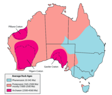
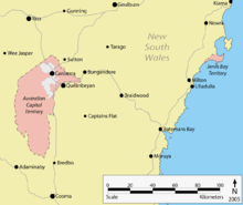
This is a list of maps I have created using Adobe Illustrator and released under the GFDL.
Most of my maps deal with the Canberra area or Australia. If you need a specific map drawn up please let me know.
The locator maps are designed to suit the {{Infobox Australian place}} or {{Australia state or territory}} templates.
Please feel free to re-use these images on any other relevant articles on Wikipedia.
Maps of Australia
 |
 |
 |
 |
Capital City Locator Maps
 |
 |
 |
 |
 |
 |
 |
 |
Other City Locator Maps
State Locator Maps
 |
 |
 |
 |
 |
 |
 |
 |
Misc Maps
 |
 |
 |
 |
 |
 |
ACT Locality Maps
I have created a map of the ACT in Adobe Illustrator and am gradually producing locality maps for places and suburbs. Please let me know if you have an article that could benifit from an ACT map.
InfoBox Maps
See main article (User:Martyman/My Images/Suburb_Infobox_Maps)
 |
 |
District Maps
See main article (UserMartyman/My Images/Maps/Canberra Districts)
 |
 |
Old Maps
See main article (User:Martyman/My Images/ACT_Maps)
 |
 |
Adelaide LGA Maps
See main article (User:Martyman/My_Images/Maps/Adelaide LGA Maps)


