Troy, Kentucky
Jump to navigation
Jump to search
This article needs additional citations for verification. (November 2015) |
Troy | |
|---|---|
 Troy Location within the state of Kentucky  Troy Troy (the United States) | |
| Coordinates: 37°54′36″N 84°41′41″W / 37.91000°N 84.69472°W | |
| Country | United States |
| State | Kentucky |
| County | Woodford |
| Elevation | 833 ft (254 m) |
| Time zone | UTC-5 (Eastern (EST)) |
| • Summer (DST) | UTC-4 (EST) |
| GNIS feature ID | 505522[1] |
Troy is an unincorporated community that straddles Woodford County and Jessamine County, Kentucky, United States. It is located at the junction of KY 33 and KY 1267. A post office with the name Troy operated at this location from 1859 to 1909. The town may have been named for the town of the same name in New York. The structures in Troy consist of a cluster of farm outbuildings and a few stately houses lining KY 33. The town is surrounded by rolling pastures and sunny fields.
References
Municipalities and communities of Woodford County, Kentucky, United States | ||
|---|---|---|
| Cities | 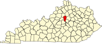 | |
| Unincorporated communities | ||
| Ghost town | ||
Municipalities and communities of Jessamine County, Kentucky, United States | ||
|---|---|---|
| Cities |  | |
| CDP | ||
| Other unincorporated communities | ||
This Woodford County, Kentucky state location article is a stub. You can help Wikipedia by expanding it. |
Categories:
- Pages using gadget WikiMiniAtlas
- Use mdy dates from July 2023
- Articles with short description
- Short description is different from Wikidata
- Articles needing additional references from November 2015
- All articles needing additional references
- Coordinates on Wikidata
- Unincorporated communities in Woodford County, Kentucky
- Unincorporated communities in Jessamine County, Kentucky
- Unincorporated communities in Kentucky
- All stub articles
- Woodford County, Kentucky geography stubs