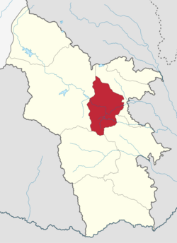
Tatev Municipality
Jump to navigation
Jump to search
Tatev
Տաթև | |
|---|---|
 | |
| Coordinates: 39°25′N 46°18′E / 39.417°N 46.300°E | |
| Country | Armenia |
| Province | Syunik |
| Formed | 24 November 2015 |
| Administrative centre | Tatev |
| Government | |
| • Mayor | Samvel Lalayan |
| Population (2011 census) | |
| • Total | 6,260 |
| Time zone | AMT (UTC+04) |
| Postal code | 3201–3519 |
| ISO 3166 code | AM-SU |
| FIPS 10-4 | AM08 |
Tatev Municipality, referred to as Tatev Community (Armenian: Տաթև Համայնք Tatev Hamaynk), is a rural community and administrative subdivision of Syunik Province of Armenia, at the south of the country. Consisted of a group of settlements, its administrative centre is the village of Tatev.[1]
Included settlements
| Settlement | Type | Population (2011 census)[2] |
|---|---|---|
| Shinuhayr | Village, administrative centre | 2,661 |
| Halidzor | Village | 551 |
| Harzhis | Village | 879 |
| Kashuni | Village | 11 |
| Khot | Village | 942 |
| Svarants | Village | 264 |
| Tandzatap | Village | 88 |
| Tatev | Village | 864 |
Politics
Tatev Municipal Assembly (Armenian: Տաթևի համայնքապետարան, Tatevi hamaynqapetaran) is the representative body in Tatev Municipality, consisting of 15 members which are elected every five years. The last election was held in October 2021. Samvel Lalayan of Shant Alliance Nationalist Party was elected mayor.
| Party | 2021 | Current Municipal Assembly | |||||||
|---|---|---|---|---|---|---|---|---|---|
| Civil Contract | 7 | ||||||||
| Shant Alliance Nationalist Party | 6 | ||||||||
| Country of Living | 2 | ||||||||
| Total | 15 | ||||||||
Ruling coalition or party marked in bold.
