Tarapacá
San Lorenzo de Tarapacá
Tarapacá | |
|---|---|
Town | |
 San Lorenzo Church in Tarapacá | |
| Coordinates: 19°54′S 69°30′W / 19.900°S 69.500°W | |
| Country | |
| Region | Tarapacá |
| Province | Tamarugal |
| Commune | Huara |
| Founded | 1532 |
| Elevation | 1,350 m (4,430 ft) |
| Population | |
| • Estimate (2002) | 135 |
| Demonym | Tarapacan |
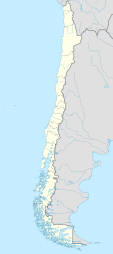
San Lorenzo de Tarapacá, also known simply as Tarapacá, is a town in the region of the same name in Chile.[1]
History
The town has likely been inhabited since the 12th century, when it formed part of the Inca trail.[1] When Spanish explorer Diego de Almagro reached the settlement in 1536 it was already inhabited by locals.[1] After being conquered by the Spanish, the town was part of the Viceroyalty of Peru, and then of the Peruvian state. Tarapacá saw itself the protagonist of the Battle of Tarapacá during the War of the Pacific. Despite the Peruvian victory,[2] the troops located in the area relocated to nearby Arica in the direction of Tacna,[2] allowing the Chilean Army to occupy the area, creating a disadvantage, and was afterwards given to Chile under the Treaty of Ancón.[3][4][1] The war had a negative effect on the population,[1] the Peruvian refugees who had formerly inhabited the town were sent by the Peruvian government to the Loreto region in order to populate the area. The areas in which they settled were called Tarapacá and Puerto Arica, in Northern Amazonas. However, after the Salomón–Lozano Treaty, the area was ceded to Colombia, with the original inhabitants moving south to Maynas, next to the Napo River, founding another Puerto Arica and Tarapacá.[5]
The area, rich in saltpeter, contributed to the homonymous industry, and was of such importance that, around the 1920s, the province became a space of constant migration with the arrival of foreigners, mostly from Peru, Bolivia, England, Germany, Spain, as well as Croats from Yugoslavia, which increased the population in the area, going from around 54,000 inhabitants in 1885 to over 115,000 in 1920.[6] As the population increased, so did trade. Goods were imported from the central zone of Chile and neighboring countries, as well as Europe, North America and Asia.[6]
Because of its historical importance, architectural features and archaeological heritage, the town was declared Zona Típica by the Government of Chile in 1973.[1]
Notable people
- Ramón Castilla, President of Peru.[2]
- Antonio Gutiérrez de la Fuente, military leader and provisional President of Peru.[7]
- Bautista van Schouwen, Chilean marxist, founder of the Revolutionary Left Movement[8]
See also
References
- ^ a b c d e f "Pueblo de Tarapacá". Consejo de Monumentos Nacionales de Chile.
- ^ a b c Tauro del Pino, Alberto (2001). Enciclopedia ilustrada del Perú: TAB-UYU (in Spanish). Lima: Empresa Editora El Comercio S. A. pp. 2528–2529. ISBN 9972401499.
- ^ Esposito, Gabriele (20 Jan 2016). Armies of the War of the Pacific 1879–83: Chile, Peru & Bolivia. Bloomsbury Publishing. p. 10. ISBN 9781472814074.
- ^ Tamayo, José (1985). Nuevo Compendio de Historia del Perú. Editorial Lumen. p. 288-289.
- ^ Porras Barrenechea, Raúl. Historia de los límites del Perú (PDF). Librería Francesa Científica y Casa Editorial E. Rosay. p. 79-80. Archived from the original (PDF) on 6 November 2014.
- ^ a b "Tarapacá". Memoria Chilena.
- ^ Ayllón Dulanto, Fernando. Antonio Gutiérrez de la Fuente (PDF) (in Spanish). Congress of Peru. p. 1.
- ^ Hernández V., Martín (2004). El pensamiento revolucionario de Bautista van Schouwen (1943-1973) [The Revolutionary Thought of Bautista van Schouwen (1943-1973)] (PDF) (in Spanish). Archivo Chile. p. 7.
