Tancrémont
Jump to navigation
Jump to search
Tancrémont | |
|---|---|
 Marmol's castle in Tancrémont | |
Location of Tancrémont  | |
 Tancrémont Location in Belgium | |
| Coordinates: 50°33′N 05°47′E / 50.550°N 5.783°E | |
| Country | |
| Community | community |
| Region | region |
| Province | province |
| Postal codes | 4910 |
| Area codes | 087 |
Tancrémont is a hamlet of Wallonia split between the municipalities of Pepinster and Theux, located in the province of Liège, Belgium.
The north side of 666 National Road that crosses the hamlet is part of the municipality of Pepinster.[1]
Cuisine
Tancrémont is known for the quality of its large cakes called "roues de charrette" (cartwheels, with a diameter of about 40 centimetres (16 in)) and particularly for the rice cakes. These cakes are sold or consumed in the local bakeries.[2]
Gallery
-
 The National Route 666
 -
 The fort
 -
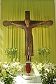
 The shrine
 -


See also
References
External links
Wikimedia Commons has media related to Tancrémont.
This Liège Province location article is a stub. You can help Wikipedia by expanding it. |
Categories:
- Pages using gadget WikiMiniAtlas
- Articles with short description
- Short description is different from Wikidata
- Infobox mapframe without OSM relation ID on Wikidata
- Coordinates on Wikidata
- Pages using infobox settlement with image map1 but not image map
- Commons category link from Wikidata
- Articles with VIAF identifiers
- Articles with WorldCat Entities identifiers
- Populated places in Liège Province
- Pepinster
- Theux
- All stub articles
- Liège geography stubs
- Pages using the Kartographer extension