Talk:Geography
| This is the talk page for discussing improvements to the Geography article. This is not a forum for general discussion of the article's subject. |
Article policies
|
| Find sources: Google (books · news · scholar · free images · WP refs) · FENS · JSTOR · TWL |
| Archives: Index, 1Auto-archiving period: 3 months |
| This article is written in British English with Oxford spelling (colour, realize, organization, analyse; note that -ize is used instead of -ise) and some terms that are used in it may be different or absent from other varieties of English. According to the relevant style guide, this should not be changed without broad consensus. |


Getting sources for the "Techniques" section.
The last weak point of this page in my opinion is the "Techniques" section. This needs a lot of citations for verification, and the qualitative techniques can be expanded in both detail and in examples. I would like to see the "Verification" banner taken off that section. If anyone wants to give that a look and hunt down citations for various statements, that would be great! GeogSage (⚔Chat?⚔) 18:21, 3 June 2023 (UTC)
Lead to short
@Freedom4U has added the template for "lead too short," which can be summarized as "where the lead section is much shorter than what is recommended, relative to the length of the article. The appropriate length of the lead section depends on the total length of the article. If the lead fails to provide an adequate summary of the article's key points, without necessarily being too short, use the template {{lead rewrite}} instead."
This talk section is to discuss improving the lead. Hopefully, Freedom4U can chime in with some advice. I will begin to increase the overall length of the lead by thinking of some summary points we can include to address the other sections. If anyone has any advice, or ideas to improve the lead, please be bold but be prepared to discuss here! GeogSage (⚔Chat?⚔) 16:34, 9 August 2023 (UTC)
- I think this is an article which would justify a four paragraph or so lead. I would suggest something along the lines of: (1) Broad overview and core concepts of geography; (2) Pre-1800s history; (3) Post-1800s history; (4) Techniques employed by geography/sub-disciplines of geography. Really a lead should try to touch on all of the sections of an article, though that wouldn't entirely be possible here. :3 F4U (they/it) 16:50, 9 August 2023 (UTC)
- Thank you for your feedback and suggestions! I will definitely keep this in mind and try to apply them. The main issue with including history, however, is that even in the page History of geography, we are not really super adequate in my opinion. This is mostly because the descriptions are often too narrowly focused on one aspect of the discipline, and generally only consider the western approaches to it. I will definitly try to take some history into account in a re-write, and will probably tag you when I do to ask your opinion (especially if I think the template could be ready to be removed. GeogSage (⚔Chat?⚔) 16:59, 9 August 2023 (UTC)
- @GeogSage Yes, I agree that history of geography is woefully inadequate and the subject of systemic bias. I had planned to work on that article a while ago, but I got distracted with other things. I believe a single paragraph on history (in a way that provides a bit more emphasis on the contemporary history of geography over ancient history) would work fine for now. :3 F4U (they/it) 17:01, 9 August 2023 (UTC)
- I have made some major/bold changes to the lead. Please take a look, and if they address your concerns on the lead being to short, please remove the message. Feel free to make any changes you think are necessary, add sources/information, or cut what I wrote. I hope this is a step towards addressing the issues you brought up. GeogSage (⚔Chat?⚔) 17:19, 15 August 2023 (UTC)
- @GeogSage Yes, I agree that history of geography is woefully inadequate and the subject of systemic bias. I had planned to work on that article a while ago, but I got distracted with other things. I believe a single paragraph on history (in a way that provides a bit more emphasis on the contemporary history of geography over ancient history) would work fine for now. :3 F4U (they/it) 17:01, 9 August 2023 (UTC)
- Thank you for your feedback and suggestions! I will definitely keep this in mind and try to apply them. The main issue with including history, however, is that even in the page History of geography, we are not really super adequate in my opinion. This is mostly because the descriptions are often too narrowly focused on one aspect of the discipline, and generally only consider the western approaches to it. I will definitly try to take some history into account in a re-write, and will probably tag you when I do to ask your opinion (especially if I think the template could be ready to be removed. GeogSage (⚔Chat?⚔) 16:59, 9 August 2023 (UTC)
- It has been one week since I made changes and this thread was last discussed. I will wait a few more days for comment, and unless I see further debate, will remove the "Lead to short" notice placed by @Freedom4U. GeogSage (⚔Chat?⚔) 15:59, 22 August 2023 (UTC)
Semi-protected edit request on 17 September 2023
This edit request has been answered. Set the |answered= or |ans= parameter to no to reactivate your request. |
Add an entry for "Deep Mapping" to qualitative methods:
Deep mapping (link to: https://en.wikipedia.org/wiki/Deep_map) is an interdisciplinary approach that combines geography and storytelling to produce a map with greater information than a two-dimensional image of places, names, and topography. This approach offers more inclusive strategies for connecting the complex layers that make up places. [citation 1]
[1]Butts, Shannon; Jones, Madison (2021-05-20). "Deep mapping for environmental communication design". Communication Design Quarterly. 9 (1): 4–19. doi:10.1145/3437000.3437001. S2CID 234794773. Choragrapher (talk) 20:05, 17 September 2023 (UTC)
- I added this concept as an example under the section for qualitative cartography. On a related note, the page Deep map needs a major overhaul. Anyone who wants a project could have a lot of room to improve it. GeogSage (⚔Chat?⚔) 20:42, 17 September 2023 (UTC)
 Done by GeogSage. Bestagon ⬡ 15:20, 18 September 2023 (UTC)
February 2024
All maps showing human geographic boundaries are political.
is that supposed to be a good reason to publish the latest controversial US political POV in an encyclopedia?
Updating the map to reflect updates make more sense then leaving an outdated version
what (other than the US political POV) needs updating and what part of the other map is "outdated" (whatever that means)?
The CIA world fact book is generally considered a reliable primary source
sources are reliable in context. How can the new CIA map be considered as reliable when it's inaccurate, controversial and at odds with every RS out there (a whole country is missing from it because of a unilateral decision of a passing US president)? If anything, having such fringe POV anywhere in our encyclopedia would be a gross violation of our non negotiable NPOV policy. M.Bitton (talk) 22:31, 3 February 2024 (UTC)
- The United States diplomatic perspective is not a "fringe" point of view. All maps are political, we will have to use some set of decided upon borders for this. Accuracy of political maps are relative. The previous map being replaced used the 2015 CIA world factbook as its source. The updated map uses the 2023 CIA world factbook as its source. Stating that the older CIA world factbook edition is better then the current one is a matter of opinion, but if we are using the CIA world factbook, we should use the most up to date ones. The opinions of others on what is accurate does not matter unless they are the source for the boundaries. GeogSage (⚔Chat?⚔) 23:12, 3 February 2024 (UTC)
- @M.Bitton It would help others if you actually stated what problems you believe there are with the map, rather than hinting at it. Escape Orbit (Talk) 23:15, 3 February 2024 (UTC)
- I didn't hint at it. I did mention that a country (Western Sahara, a founding member of the African Union) is missing. I also mentioned the NPOV policy (I assume that most readers are aware of what it means). M.Bitton (talk) 23:16, 3 February 2024 (UTC)
- Both maps use the CIA World Factbook as their source. The source has been updated. You disagree with the US political decision, which is fine, but to continue using a less updated version of the same dataset because of that disagreement is not a neutral POV. GeogSage (⚔Chat?⚔) 23:19, 3 February 2024 (UTC)
- Nope, the first is a derivative of a map that is in the public domain. I already explained what the issue is. Do you have anything to say about the policy that I mentioned? M.Bitton (talk) 23:21, 3 February 2024 (UTC)
- Both maps take sides in some territorial disputes, and to some extent it's impossible to not do so generally. The best solution would be to make a map that shows both the de facto and claimed borders, right? Similar to what the CIA map does in Kashmir and the Koreas. Elli (talk | contribs) 23:25, 3 February 2024 (UTC)
- This is not what this discussion is about, because I have to choose, then I'd go with the map of the UN and call it a day. M.Bitton (talk) 23:27, 3 February 2024 (UTC)
- The UN doesn't recognize Western Sahara either, it calls it a "non-self governing territory." GeogSage (⚔Chat?⚔) 23:33, 3 February 2024 (UTC)
- Is that a good reason to remove it altogether from the map? I don't think so. In any case, we're not calling it anything. In fact, the map of the UN makes even more sense than before. M.Bitton (talk) 23:36, 3 February 2024 (UTC)
- Fundamentally, the opinions of editors on what should or should not be included on a map are not important. You can argue that you think the UN opinion of what should be on a map is better for a variety of reasons, but it will still be disputed. The United States has an opinion, China has an opinion, Russia has an opinion, India has an opinion, etc.. We have to choose one of those authoritative opinions to go with, not cherry pick them to fit our world view of what should be on a map.
- Ultimately, we should probably just note the source of the map data in the image caption. Just state "Political map of Earth based on ____________." GeogSage (⚔Chat?⚔) 00:04, 4 February 2024 (UTC)
- Fundamentally, the NPOV policy is non negotiable. So far, you have yet to offer a single valid reason as to why we should promote a fringe POV. M.Bitton (talk) 00:06, 4 February 2024 (UTC)
- You want to keep an updated map, over the updated one, because you disagree with the decisions of the policy makers. You did not have a problem using the CIA world factbook until it said something you didn't agree with. I agree the source should be cited within the map better, and if we want to change the source of the map to something else that can be discussed. Not updating the map though, as you suggested, because we dislike the new data is taking an internal stance on the issue that is not neutral. GeogSage (⚔Chat?⚔) 00:18, 4 February 2024 (UTC)
- I did not have a problem using a map that doesn't grossly violate the NPOV policy. Neutrality (in Wikipedia) doesn't mean what you think it means. Also, please don't ever compare the UN (an intergovernmental organization) to a country. M.Bitton (talk) 00:21, 4 February 2024 (UTC)
- From Wikipedia:Neutral point of view:
- "The only bias that should be evident is the bias attributed to the source."
- "A neutral point of view should be achieved by balancing the bias in sources based on the weight of the opinion in reliable sources and not by excluding sources that do not conform to the editor's point of view. This does not mean any biased source must be used; it may well serve an article better to exclude the material altogether."
- From an essay titled "Wikipedia:Conflicting sources"
- "Prefer up-to-date sources. In the case of a conflict stemming from the fact that the general or academic consensus about the subject has changed over time, the current consensus should be given preference. Older works, if referenced at all, should then be clearly distinguished as such and be used primarily to show the historical development of the subject. Be aware that sometimes older works are re-published with very minor changes, which can make their statements seem newer than they really are."
- Not using the up-to-date source because of your opinion on the decision maker who caused it to be updated is not Neutral. The opinion of the United States federal government is not exactly "fringe." It does not matter if it was the Trump administration who made the change or not, the source says what it says. The image caption should state where the data are from, but not using the most updated data because you disagree with the decision is not neutral, and rather then replace a map with one from a source you consider "better," you have reverted the updated one multiple times in favor of one that is no longer up to date. Your approach does not seem very neutral. GeogSage (⚔Chat?⚔) 00:42, 4 February 2024 (UTC)
- What's that got to do with the fact that you're trying to promote a fringe POV?
The opinion of the United States federal government is not exactly "fringe
in this instance, it most certainly is.- Did you miss the part that says: "While it is important to account for all significant viewpoints on any topic, Wikipedia policy does not state or imply that every minority view, fringe theory, or extraordinary claim needs to be presented along with commonly accepted mainstream scholarship as if they were of equal validity."? M.Bitton (talk) 00:45, 4 February 2024 (UTC)
- I did not have a problem using a map that doesn't grossly violate the NPOV policy. Neutrality (in Wikipedia) doesn't mean what you think it means. Also, please don't ever compare the UN (an intergovernmental organization) to a country. M.Bitton (talk) 00:21, 4 February 2024 (UTC)
- You want to keep an updated map, over the updated one, because you disagree with the decisions of the policy makers. You did not have a problem using the CIA world factbook until it said something you didn't agree with. I agree the source should be cited within the map better, and if we want to change the source of the map to something else that can be discussed. Not updating the map though, as you suggested, because we dislike the new data is taking an internal stance on the issue that is not neutral. GeogSage (⚔Chat?⚔) 00:18, 4 February 2024 (UTC)
- We don't need to pick one country's point-of-view to make a map. Who has territorial control over areas, and what those claims are, isn't really in dispute. No one disputes that POLISARIO claims Western Sahara, nor that Morocco claims it, nor that Morocco has ~80% territorial control. The NPOV option would be to display all of this information, not to use one partisan perspective or another. Elli (talk | contribs) 00:46, 4 February 2024 (UTC)
- Fundamentally, the NPOV policy is non negotiable. So far, you have yet to offer a single valid reason as to why we should promote a fringe POV. M.Bitton (talk) 00:06, 4 February 2024 (UTC)
- Is that a good reason to remove it altogether from the map? I don't think so. In any case, we're not calling it anything. In fact, the map of the UN makes even more sense than before. M.Bitton (talk) 23:36, 3 February 2024 (UTC)
- The UN doesn't recognize Western Sahara either, it calls it a "non-self governing territory." GeogSage (⚔Chat?⚔) 23:33, 3 February 2024 (UTC)
- This is not what this discussion is about, because I have to choose, then I'd go with the map of the UN and call it a day. M.Bitton (talk) 23:27, 3 February 2024 (UTC)
- Both maps take sides in some territorial disputes, and to some extent it's impossible to not do so generally. The best solution would be to make a map that shows both the de facto and claimed borders, right? Similar to what the CIA map does in Kashmir and the Koreas. Elli (talk | contribs) 23:25, 3 February 2024 (UTC)
- Nope, the first is a derivative of a map that is in the public domain. I already explained what the issue is. Do you have anything to say about the policy that I mentioned? M.Bitton (talk) 23:21, 3 February 2024 (UTC)
- @M.Bitton I'd like to offer an opinion, and help stop the edit warring, but I wasn't willing to play spot the difference to find which country. It all rather depends on who recognises it as a country. Could you expand on that? Thanks. Escape Orbit (Talk) 23:31, 3 February 2024 (UTC)
- 84 countries have recognized it as a country, the others either have no clear position on it or consider it as a non-self-governing territory, while the US (since the Trump administration turned the US foreign policy on its head) is at odds with the rest of the world. M.Bitton (talk) M.Bitton (talk) 23:34, 3 February 2024 (UTC)
- Both maps use the CIA World Factbook as their source. The source has been updated. You disagree with the US political decision, which is fine, but to continue using a less updated version of the same dataset because of that disagreement is not a neutral POV. GeogSage (⚔Chat?⚔) 23:19, 3 February 2024 (UTC)
- I didn't hint at it. I did mention that a country (Western Sahara, a founding member of the African Union) is missing. I also mentioned the NPOV policy (I assume that most readers are aware of what it means). M.Bitton (talk) 23:16, 3 February 2024 (UTC)
- I couldn't find the difference even after knowing it was supposed to be Morocco/Western Sahara, the resolution is too low to see much of anything without zooming in. Anyway: I agree that that it doesn't make sense to use an older version of CIA's map when a newer one is available. I also agree that an United Nations map, if the UN maintains such a map, would be better since it's an intergovernmental agency. In any case, the caption should certainly and clearly include the source of the map, something like "Political map of the world according to the UN". TryKid [dubious – discuss] 00:50, 4 February 2024 (UTC)
- It's not an older version, it's a derivative that is kept up to date. For example, in the new political map, the political capital of Burundi is wrong (that's just one example). Why have a controversial and fringe map (that violates the NPOV policy) in the first place, when we have one that has been stable for years (like world maps are supposed to be, until a new country is created or disappears)? M.Bitton (talk) 00:55, 4 February 2024 (UTC)
- If the map is not reflective of the most up to date version of its underlying dataset, then it is not accurate. Throw in that all maps figure captions should probably also have the date the data was created, in addition to the data source.
- I have to change my county and census tract feature classes whenever the US government updates them. If the map is based on data published by the government, the borders are part of that data. Not doing so is a violation of Wikipedia:No original research regarding "Synthesis of published material." GeogSage (⚔Chat?⚔) 01:03, 4 February 2024 (UTC)
- If a scholar publishes a good map, we either use it or one of its derivatives (as we did in this case). If the same scholar publishes an asinine map that he describes as an update, then it makes no sense whatsoever for us to use it (under the pretext that it's an update), especially if it violates one of our core policies (as in this case). Does that make sense?
- Let me also re-quote the part of the policy that you missed previously: "While it is important to account for all significant viewpoints on any topic, Wikipedia policy does not state or imply that every minority view, fringe theory, or extraordinary claim needs to be presented along with commonly accepted mainstream scholarship as if they were of equal validity". M.Bitton (talk) 01:08, 4 February 2024 (UTC)
- The United States federal governments official view on international politics is not a "fringe theory." Saying a map is based on that is not an extraordinary claim. "Minority view" is not really applicable to the opinions of a super power and member of the UN security council. The views of these countries can be disputed, but they are not quite the same as a minority view in an academic context. Your view is that the data published by the US CIA World Factbook was less "asinine" in 2015 then it is today, but where the lines are drawn has always been contentious. The CIA World Factbook is one of the best sources for global statistics internationally, and is a primary source used by mainstream scholarship. It is perfectly acceptable as a source as long as it is properly attributed. All boundaries must align with the data as they publish it, however, or we are making a synthesis of published material. Like all sources, a more current one is better then an older one. Your opinion on the current one does not mean that an established source of data that represents the view of the third most populous country, that has a massive impact on global politics and culture, is suddenly a "minority view, or fringe theory." Your justification not to use a more up to date set of boundary files is not a neutral opinion. GeogSage (⚔Chat?⚔) 01:27, 4 February 2024 (UTC)
The United States federal governments official view on international politics is not a "fringe theory."
given the context, that's just plain wrong! In this instance, it most certainly is. In fact, stating such a thing after my reply to Escape Orbit, proves that you're not even reading what I'm writing. M.Bitton (talk) 01:31, 4 February 2024 (UTC)- There are no wrong opinions in territorial disputes, only ones that can be enforced and agreed upon by others. The US opinion is one that is heavily considered by other countries when making their own. The United States is a Superpower, which "are states so influential that no significant action can be taken by the global community without first considering the positions of the superpowers on the issue." The opinions of the US government in international politics are not "fringe." I read what you wrote, it doesn't change the US opinion, just that you think it was a better opinion in the past so we should not update maps to reflect changes to it. GeogSage (⚔Chat?⚔) 01:50, 4 February 2024 (UTC)
- There are fringe ones, such as the one that you are trying to promote by making baseless claims. What the US stands for is irrelevant to the fact that its view on WS is super fringe. That's an undisputed fact! M.Bitton (talk) 01:53, 4 February 2024 (UTC)
- I'm not trying to promote an opinion. I'm trying to advocate for using up to date sources, while stating that the source in question is widely used, and that the opinion of the US on international borders is not a "Fringe" opinion in the same way that the opinion of pseudoscientist questioning relativity is fringe. You are free to disagree with the US opinion on a topic, but not updating a map based on that opinion because of your disagreement is not neutral. GeogSage (⚔Chat?⚔) 02:01, 4 February 2024 (UTC)
- You are trying to promote a super fringe view that violates one of our core policies.
the opinion of the US on international borders is not a "Fringe" opinion
It most certainly is in this case, and since I'm tired of repeating the obvious, I will leave you with some articles[1][2][3][4][5] with the hope that they may help you to understand how fringe the support of illegality is (worldwide and in the US itself). M.Bitton (talk) 02:06, 4 February 2024 (UTC)- The CIA World Factbook says what it says. What it says can change. There is always dispute about borders, and I absolutely guarantee you that there is not a single map you can give me of the world where I can not give you a list of articles describing problems. This means we cite our sources, it does not mean we don't publish maps. Your opinion, and the opinions of others, do not change what the source says, do not make the official opinion of the US "fringe," and are not a reason to use out dated maps when using the US as a source for data. GeogSage (⚔Chat?⚔) 02:20, 4 February 2024 (UTC)
- I think GeogSage has it mostly right here. The article should clearly have one widely published and recognised source's map, rather than having editors maintain derivative maps and deciding which countries' claims should be recognised on case by case basis. We aren't dealing with a scholar producing an asinine update here, but an institution as a whole changing its stance. If the current position is fringe, was CIA World Factbook's position in 2015 any less fringe? I'm sure several, maybe even most, countries and sources disagreed with many of their positions even then. Anyway, if there's a UN world map, let's have that, it would probably be an improvement over the CIA or "CIA map modified with Wikipedia editor discretion on which countries are legitimate". TryKid [dubious – discuss] 03:36, 4 February 2024 (UTC)
- The widely published maps look similar to the current one (they all show Western Sahara). The only changes that were made in the derivative are the cosmetic and small changes such as city names, there was no changes to countries and what they claim.
was CIA World Factbook's position in 2015 any less fringe?
yes, absolutely, and while (as you rightly said), there were some countries and sources that disagreed with many of their positions even then, it still wasn't as bad as the recent one (that literally removed a country).- I agree with you regarding the UN map: the more I think about it, the more convinced I am that it's the best way forward. M.Bitton (talk) 03:44, 4 February 2024 (UTC)
The CIA World Factbook says what it says.
the recent one is saying nonsense by pretending that an entire country ceased to exist (while contradicting what it said for decades).What it says can change
sure, but facts don't change because it says so.Your opinion, and the opinions of others, do not change what the source says
we don't change the sources that promote falsehoods, we just ignore them.do not make the official opinion of the US "fringe"
they made their own opinion fringe. That's an undisputed fact (if you don't want to read all the sources, just read the first one in the list).- For the last time (this is getting tiring), the current map is a derivative of a map that is in the public domain (which just so happens to be the 2016 CIA map). While updating things like city names and making some cosmetic changes is fine, there is no reason whatsoever to "update" it with the recent US fringe POV. M.Bitton (talk) 03:37, 4 February 2024 (UTC)
- I think this discussion would make greater progress if you drop the WP:NPOV argument and the "falsehoods" argument. Every map is the opinion, to a greater or lesser extent, of its publisher. Whether that opinion is false or not is an opinion in itself. What we have here is a discussion about which map is the most appropriate for this article. Since this article is Geography and not List of Countries, I don't think use of any particular map is overly expressing any opinion about the existence of any country. --Escape Orbit (Talk) 20:55, 4 February 2024 (UTC)
- As the maps will always change, and opinions may vary wildly, we could find a historic map of human geography. For example, if this is going to be a huge problem, we could use one of the many existing copies of Ptolemy's maps.
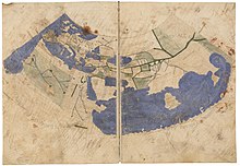
A damaged Greek map of the inhabited world along the lines of Ptolemy's 2nd projection 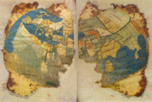
A damaged Greek map of the inhabited world along the lines of Ptolemy's 2nd projection - GeogSage (⚔Chat?⚔) 21:24, 4 February 2024 (UTC)
- @GeogSage Or remove the political map and replace it with something else entirely. Does the article need to lead with two quite similar maps of the world? Geography is much more than maps. Escape Orbit (Talk) 20:14, 5 February 2024 (UTC)
- I think this discussion would make greater progress if you drop the WP:NPOV argument and the "falsehoods" argument. Every map is the opinion, to a greater or lesser extent, of its publisher. Whether that opinion is false or not is an opinion in itself. What we have here is a discussion about which map is the most appropriate for this article. Since this article is Geography and not List of Countries, I don't think use of any particular map is overly expressing any opinion about the existence of any country. --Escape Orbit (Talk) 20:55, 4 February 2024 (UTC)
- I think GeogSage has it mostly right here. The article should clearly have one widely published and recognised source's map, rather than having editors maintain derivative maps and deciding which countries' claims should be recognised on case by case basis. We aren't dealing with a scholar producing an asinine update here, but an institution as a whole changing its stance. If the current position is fringe, was CIA World Factbook's position in 2015 any less fringe? I'm sure several, maybe even most, countries and sources disagreed with many of their positions even then. Anyway, if there's a UN world map, let's have that, it would probably be an improvement over the CIA or "CIA map modified with Wikipedia editor discretion on which countries are legitimate". TryKid [dubious – discuss] 03:36, 4 February 2024 (UTC)
- The CIA World Factbook says what it says. What it says can change. There is always dispute about borders, and I absolutely guarantee you that there is not a single map you can give me of the world where I can not give you a list of articles describing problems. This means we cite our sources, it does not mean we don't publish maps. Your opinion, and the opinions of others, do not change what the source says, do not make the official opinion of the US "fringe," and are not a reason to use out dated maps when using the US as a source for data. GeogSage (⚔Chat?⚔) 02:20, 4 February 2024 (UTC)
- I'm not trying to promote an opinion. I'm trying to advocate for using up to date sources, while stating that the source in question is widely used, and that the opinion of the US on international borders is not a "Fringe" opinion in the same way that the opinion of pseudoscientist questioning relativity is fringe. You are free to disagree with the US opinion on a topic, but not updating a map based on that opinion because of your disagreement is not neutral. GeogSage (⚔Chat?⚔) 02:01, 4 February 2024 (UTC)
- There are fringe ones, such as the one that you are trying to promote by making baseless claims. What the US stands for is irrelevant to the fact that its view on WS is super fringe. That's an undisputed fact! M.Bitton (talk) 01:53, 4 February 2024 (UTC)
- There are no wrong opinions in territorial disputes, only ones that can be enforced and agreed upon by others. The US opinion is one that is heavily considered by other countries when making their own. The United States is a Superpower, which "are states so influential that no significant action can be taken by the global community without first considering the positions of the superpowers on the issue." The opinions of the US government in international politics are not "fringe." I read what you wrote, it doesn't change the US opinion, just that you think it was a better opinion in the past so we should not update maps to reflect changes to it. GeogSage (⚔Chat?⚔) 01:50, 4 February 2024 (UTC)
- The United States federal governments official view on international politics is not a "fringe theory." Saying a map is based on that is not an extraordinary claim. "Minority view" is not really applicable to the opinions of a super power and member of the UN security council. The views of these countries can be disputed, but they are not quite the same as a minority view in an academic context. Your view is that the data published by the US CIA World Factbook was less "asinine" in 2015 then it is today, but where the lines are drawn has always been contentious. The CIA World Factbook is one of the best sources for global statistics internationally, and is a primary source used by mainstream scholarship. It is perfectly acceptable as a source as long as it is properly attributed. All boundaries must align with the data as they publish it, however, or we are making a synthesis of published material. Like all sources, a more current one is better then an older one. Your opinion on the current one does not mean that an established source of data that represents the view of the third most populous country, that has a massive impact on global politics and culture, is suddenly a "minority view, or fringe theory." Your justification not to use a more up to date set of boundary files is not a neutral opinion. GeogSage (⚔Chat?⚔) 01:27, 4 February 2024 (UTC)
- It's not an older version, it's a derivative that is kept up to date. For example, in the new political map, the political capital of Burundi is wrong (that's just one example). Why have a controversial and fringe map (that violates the NPOV policy) in the first place, when we have one that has been stable for years (like world maps are supposed to be, until a new country is created or disappears)? M.Bitton (talk) 00:55, 4 February 2024 (UTC)


- Wikipedia articles that use Oxford spelling
- Wikipedia articles that use British English
- B-Class vital articles
- Wikipedia level-2 vital articles
- Wikipedia vital articles in Geography
- B-Class level-2 vital articles
- Wikipedia level-2 vital articles in Geography
- B-Class vital articles in Geography
- B-Class geography articles
- Top-importance geography articles
- WikiProject Geography articles