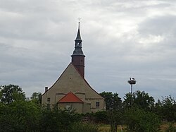
Studniska Dolne
Jump to navigation
Jump to search
Studniska Dolne | |
|---|---|
Village | |
 Village church | |
| Coordinates: 51°06′10″N 15°03′42″E / 51.10278°N 15.06167°E | |
| Country | |
| Voivodeship | |
| County | Zgorzelec |
| Gmina | Sulików |
| Population | 670 |
Studniska Dolne [studˈniska ˈdɔlnɛ] is a village in the administrative district of Gmina Sulików, within Zgorzelec County, Lower Silesian Voivodeship, in south-western Poland, close to the Czech border.[1]
It lies approximately 4 kilometres (2 mi) north of Sulików, 7 kilometres (4 mi) south-east of Zgorzelec, and 139 kilometres (86 mi) west of the regional capital Wrocław.
Gallery
-
Wall of the cemetery
-
Old barn on the cross roads
-
Community house
-
Houses by road
References
Wikimedia Commons has media related to Studniska Dolne.
Categories:
- Pages using gadget WikiMiniAtlas
- CS1 Polish-language sources (pl)
- Articles with short description
- Short description is different from Wikidata
- Coordinates on Wikidata
- Commons category link is on Wikidata
- Articles with VIAF identifiers
- Villages in Zgorzelec County
- All stub articles
- Zgorzelec County geography stubs


