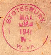
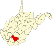
Stotesbury, West Virginia
Stotesbury | |
|---|---|
| Coordinates: 37°40′54″N 81°17′19″W / 37.68167°N 81.28861°W | |
| Country | United States |
| State | West Virginia |
| County | Raleigh |
| Elevation | 1,841 ft (561 m) |
| Time zone | UTC-5 (Eastern (EST)) |
| • Summer (DST) | UTC-4 (EDT) |
| ZIP codes | 25929 |
| GNIS feature ID | 1555722[1] |
Stotesbury is an unincorporated community and former coal town in Raleigh County in the U.S. state of West Virginia that flourished during the 1930s. The community was named for Edward T. Stotesbury,[2][3] then the president of Beaver Coal Company.[4]
Stotesbury was the home of the late eight-term U.S. Senator Robert C. Byrd.[5] Currently there are only a handful of houses left from the once bustling town.
Mining
The Stotesbury mining camp is located in the Winding Gulf Coalfield.[6] It was originally operated by the E.E. White Coal Co. and named for Edward T. Stotesbury, who was president of Beaver Coal Co. at the time. Mining was in the Beckley seam. In the late 1930s, the Koppers Coal Company took over coal mining operations in Stotesbury, which ended in 1958. In the mid-1960s, Eastern Associated Coal rebuilt the mine and operated in Stotesbury until the mid-1980s. White Mountain LLC rebuilt the mine in 2001, but closed it down one year later, in 2002.[7]
Other buildings
Stotesbury's St. John's Baptist Church has fallen into total ruin and as of 2013, only the foundation stones remain.[8] St. John's Baptist Church was listed as an "Endangered Building" by the National Trust for Historic Preservation. The owners of the Stotesbury Coal Camp are still affiliated with Beaver Coal Company in 2006.
The Stotesbury Community church is still active[8] The town itself does still have original residential housing.[7]
Gallery
References
- ^ a b U.S. Geological Survey Geographic Names Information System: Stotesbury, West Virginia
- ^ Kenny, Hamill (1945). West Virginia Place Names: Their Origin and Meaning, Including the Nomenclature of the Streams and Mountains. Piedmont, WV: The Place Name Press. p. 605.
- ^ "Historical Footprints". www.wvgenweb.org.
- ^ "West Virginia-Raleigh County Indenture of Lease - Beaver Coal Corp. to New River Co. - Sample Contracts and Business Forms". contracts.onecle.com.
- ^ "Senator Byrd - Senate Speeches".
- ^ Raleigh County, West Virginia General Highway Map (PDF) (Map). West Virginia Department of Transportation. 2011. p. 3. Archived from the original (PDF) on April 25, 2012. Retrieved December 12, 2011.
- ^ a b "STOTESBURY, WV". www.coalcampusa.com.
- ^ a b "Historic WV Church Destroyed by Roof Collapse". www.whsv.com. Archived from the original on February 22, 2014.


