Steffenberg
Steffenberg | |
|---|---|
 Coat of arms | |
Location of Steffenberg within Marburg-Biedenkopf district 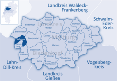 | |
 Steffenberg  Steffenberg | |
| Coordinates: 50°51′N 08°28′E / 50.850°N 8.467°E | |
| Country | Germany |
| State | Hesse |
| Admin. region | Gießen |
| District | Marburg-Biedenkopf |
| Government | |
| • Mayor (2022–28) | Gernot Wege[1] (Ind.) |
| Area | |
| • Total | 24.32 km2 (9.39 sq mi) |
| Highest elevation | 550 m (1,800 ft) |
| Lowest elevation | 330 m (1,080 ft) |
| Population (2022-12-31)[2] | |
| • Total | 4,052 |
| • Density | 170/km2 (430/sq mi) |
| Time zone | UTC+01:00 (CET) |
| • Summer (DST) | UTC+02:00 (CEST) |
| Postal codes | 35239 |
| Dialling codes | 06464 |
| Vehicle registration | MR |
| Website | www.steffenberg.de |
Steffenberg is a municipality in Marburg-Biedenkopf district in Hesse, Germany.
Geography
Location
Steffenberg lies at the southern foothills of the Rothaargebirge between the towns of Dillenburg (20 km) and Marburg (35 km).
Neighbouring communities
Steffenberg borders in the north on the community of Breidenbach, in the east on the community of Dautphetal, in the south on the communities of Bad Endbach and Angelburg (all in Marburg-Biedenkopf), and in the west on the community of Eschenburg (Lahn-Dill-Kreis).
Divisions
The community consists of the following six centres:
- Niedereisenhausen
- Oberhörlen
- Quotshausen
- Steinperf
- Obereisenhausen
- Niederhörlen
History
On 1 April 1972, the formerly independent communities of Niedereisenhausen, Obereisenhausen, Niederhörlen and Oberhörlen joined together of their own free will into the community of Steffenberg. On 1 July 1974, the communities of Steinperf and Quotshausen were amalgamated by state law with Steffenberg to form the current greater community.
Politics
Gemeinderat
This section needs to be updated. (July 2021) |
These are the results of the municipal election held on 26 March 2006:
| Parties and voter coalitions | Share in % | Seats | |
| CDU | Christian Democratic Union | 22.2 | 5 |
| SPD | Social Democratic Party of Germany | 38.9 | 9 |
| BLS | Bürgerliste Steffenberg (citizens' coalition) | 38.9 | 9 |
| total | 100 | 23 | |
Coat of arms
The civic coat of arms might be described thus: In Or a low fess wavy azure; above, a bear statant sable.
The arms are a visual representation of the river Perf, which flows through the community, and whose name means as much as "bear water".
Partnerships
References
- ^ "Ergebnisse der letzten Direktwahl aller hessischen Landkreise und Gemeinden" (XLS) (in German). Hessisches Statistisches Landesamt. 5 September 2022.
- ^ "Bevölkerung in Hessen am 31.12.2022 nach Gemeinden" (XLS) (in German). Hessisches Statistisches Landesamt. June 2023.
Towns and municipalities in the district of Marburg-Biedenkopf | ||
|---|---|---|
 | ||
| International | |
|---|---|
| National | |
- Pages using gadget WikiMiniAtlas
- CS1 German-language sources (de)
- Articles with short description
- Short description is different from Wikidata
- Coordinates on Wikidata
- Municipalities in Hesse
- Pages using infobox German place with an elevation range
- Wikipedia articles in need of updating from July 2021
- All Wikipedia articles in need of updating
- Articles with VIAF identifiers
- Articles with WorldCat Entities identifiers
- Articles with GND identifiers
- Articles with J9U identifiers
- Articles with LCCN identifiers
- Marburg-Biedenkopf
- Rothaar Mountains