Routhulapudi
Jump to navigation
Jump to search
Rowthulapudi | |
|---|---|
 Dynamic map | |
.svg) Rowthulapudi Location in Andhra Pradesh, India | |
| Coordinates: 17°23′00″N 82°23′00″E / 17.3833°N 82.3833°E | |
| Country | India |
| State | Andhra Pradesh |
| District | Kakinada |
| Mandal | Rowthulapudi |
| Area | |
| • Total | 250 km2 (100 sq mi) |
| Languages | |
| • Official | Telugu |
| Time zone | UTC+5:30 (IST) |
Rowthulapudi is a village in Kakinada district of the Indian state of Andhra Pradesh. It is located in Rowthulapudi Mandal.[1]
Geography
Rowthulapudi is located in the east part of India.[2] It has an average elevation of 150 metres (1067 ft).
Demographics
Rowthulapudi's total population is 91,400; 61.6% male and 38.4% female. About 13.48% of the population is under age six.
Government Buildings in Rowthulapudi
-
 Current Office
 -
 Grama Sachivalayam1
 -
 Grama Sachivalyam2
 -
 Post Office
 -
 Police Station
 -
 Thasildar Office
 -
 Mandal Praja Parishath Office
 -
 Government Hospital
 -
 Integrated Welfare Hostel
 -
 Raithu Barosa Kendram
 -
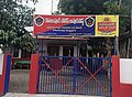
 ZP High School


Temples in Rowthulapudi
-
 Shree Uma Ramalingeswara Swamy Temple
 -
 Kanaka Durga Bhavani Temple
 -
 Devi Nookambika Temple
 -
 Hanuman Temple


References
- ^ "District Level Mandal wise List of Villages in Andhra Pradesh" (PDF). Chief Commissioner of Land Administration. National Informatics Centre. p. 19. Archived from the original (PDF) on 14 December 2014. Retrieved 19 September 2015.
- ^ Ravutulapudi at Fallingrain.com
Categories:
- Pages using gadget WikiMiniAtlas
- Use dmy dates from July 2018
- Use Indian English from July 2018
- All Wikipedia articles written in Indian English
- Articles with short description
- Short description is different from Wikidata
- Infobox mapframe without OSM relation ID on Wikidata
- Coordinates on Wikidata
- Villages in Rowthulapudi mandal
- All stub articles
- Kakinada district geography stubs
- Pages using the Kartographer extension