Robinstown, County Meath
Jump to navigation
Jump to search
Robinstown
Baile Roibín | |
|---|---|
Village | |
 Robinstown's Catholic church | |
| Coordinates: 53°35′40″N 6°43′39″W / 53.5945°N 6.7274°W | |
| Country | Ireland |
| Province | Leinster |
| County | County Meath |
| Population (2016)[1] | 374 |
| Time zone | UTC+0 (WET) |
| • Summer (DST) | UTC-1 (IST (WEST)) |
| Irish Grid Reference | N842612 |
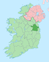
Robinstown (Irish: Baile Roibín),[2] in the townland of Balbradagh (Irish: An Baile Bradach),[3] is a village in County Meath, Ireland.
As of the 2016 census, the village (known for census purposes as Balbradagh) had a population of 374 people.[1] The local national (primary) school, Robinstown National School, had an enrollment of over 180 pupils as of 2014.[4][5]
Robinstown Roman Catholic church (built c. 1970)[6] is in the parish of Dunderry,[7] and is listed on the Record of Protected Structures for County Meath.[8] Archaeological sites in the area include a ringfort site to the west of the village in Balbradagh townland.[9]
References
- ^ a b "Balbradagh (Ireland) Census Town". citypopulation.de. Retrieved 26 May 2021.
- ^ "Baile Roibín / Robinstown". logainm.ie. Placenames Database of Ireland. Retrieved 26 May 2021.
- ^ "An Baile Bradach / Balbradagh". logainm.ie. Placenames Database of Ireland. Retrieved 26 May 2021.
- ^ "Whole School Evaluation Management, Leadership and Learning Report - Scoil Mhuire, Robinstown, Co. Meath" (PDF). education.ie. Department of Education. 2 April 2014. Archived from the original (PDF) on 26 May 2021.
- ^ "Robinstown National School - Contact". robinstownns.com. Retrieved 26 May 2021.
- ^ "Robinstown Roman Catholic Church, Balbradagh, Robinstown, Meath". buildingsofireland.ie. National Inventory of Architectural Heritage. Retrieved 26 May 2021.
- ^ "Parishes - Dunderry". dioceseofmeath.ie. Diocese of Meath. Retrieved 26 May 2021.
- ^ "CDP07 Record of Protected Structures" (PDF). meath.ie. Meath County Council. 2019. Retrieved 26 May 2021.
- ^ "ME01368 - Balbradagh - Ringfort - Rath". meathheritage.com. Retrieved 26 May 2021.
Categories:
- Pages using gadget WikiMiniAtlas
- Articles with short description
- Short description is different from Wikidata
- Use dmy dates from May 2021
- Use Hiberno-English from May 2021
- All Wikipedia articles written in Hiberno-English
- Articles containing Irish-language text
- Coordinates on Wikidata
- Articles with OS grid coordinates
- Untranslated Irish place names
- Towns and villages in County Meath
- All stub articles
- Ireland geography stubs

