Rafah Governorate
Jump to navigation
Jump to search
Rafah Governorate
محافظة رفح | |
|---|---|
 | |
| Country | |
| Area | |
| • Total | 65 km2 (25 sq mi) |
| Population (2017 Census)[1] | |
| • Total | 233,878 |
| • Density | 3,600/km2 (9,300/sq mi) |
|
|

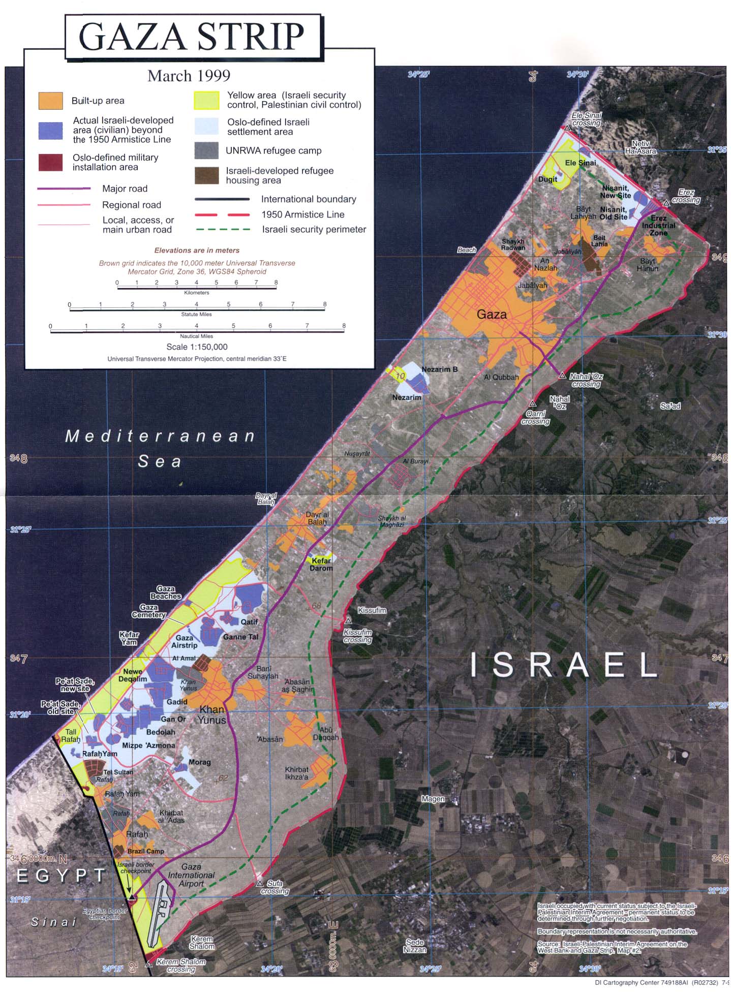
The Rafah Governorate (Arabic: محافظة رفح Muḥāfaẓat Rafaḥ) is a Governorate of Palestine in the southernmost portion of the Gaza Strip. Its district capital or muhfaza is the city of Rafah located on the border with Egypt. According to the Palestinian Central Bureau of Statistics, the governorate had a population of 267,635 in mid-year 2022.[2] It contains the closed down Yasser Arafat International Airport.
Localities
Refugee camps
References
Wikimedia Commons has media related to Rafah Governorate.
- ^ "Main Indicators by Type of Locality - Population, Housing and Establishments Census 2017" (PDF). Palestinian Central Bureau of Statistics (PCBS). Retrieved 2021-01-19.
- ^ "Projected Mid -Year Population for Rafah Governorate by Locality 2017-2026". pcbs.gov.ps. Palestinian Central Bureau of Statistics. May 30, 2021. Retrieved December 4, 2023.
- http://www.lib.utexas.edu/maps/middle_east_and_asia/gaza_strip_1999.jpg
- http://www.pcbs.gov.ps/Portals/_pcbs/populati/pop16.aspx
| Authority control databases: Geographic |
|---|
31°18′N 34°15′E / 31.3°N 34.25°E
This geography of the State of Palestine article is a stub. You can help Wikipedia by expanding it. |
Categories:
- Articles with short description
- Short description is different from Wikidata
- Articles containing Arabic-language text
- Pages using infobox settlement with no coordinates
- Commons category link is on Wikidata
- Rafah Governorate
- Articles with MusicBrainz area identifiers
- Coordinates on Wikidata
- Governorates of the Palestinian National Authority in the Gaza Strip
- All stub articles
- Palestine geography stubs