Puerto Rico Highway 113
Jump to navigation
Jump to search
Highway 113 | ||||
|---|---|---|---|---|
| Ruta 113 | ||||
| Route information | ||||
| Maintained by Puerto Rico DTPW | ||||
| Length | 19.8 km[1][2] (12.3 mi) | |||
| Existed | 1953[3]–present | |||
| Major junctions | ||||
| West end | ||||
| ||||
| East end | ||||
| Location | ||||
| Country | United States | |||
| Territory | Puerto Rico | |||
| Municipalities | Isabela, Quebradillas, Camuy | |||
| Highway system | ||||
| ||||

Puerto Rico Highway 113 (PR-113) is a rural road that travels from Isabela, Puerto Rico to Quebradillas. It begins at downtown Isabela and ends at its intersection with PR-119 near Guajataca Lake.[4][5]
-
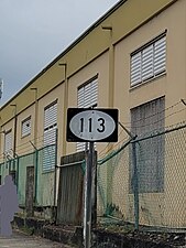 Eastbound sign for PR-113 in Isabela
.jpg)
Major intersections
| Municipality | Location | km[1][2] | mi | Destinations | Notes |
|---|---|---|---|---|---|
| Isabela | Isabela barrio-pueblo | 0.0 | 0.0 | Western terminus of PR-113; PR-459 access via Calle Juan González | |
| 0.1– 0.2 | 0.062– 0.12 | ||||
| 0.9 | 0.56 | ||||
| 1.1 | 0.68 | ||||
| Guayabos–Mora– Coto tripoint | 2.2 | 1.4 | |||
| Guayabos–Coto line | 4.3 | 2.7 | |||
| Coto | 7.3 105.1[a] | 4.5 65.3 | Western terminus of PR-2 concurrency; right turn only | ||
| Río Guajataca | 104.4[a] | 64.9 | Puente Elvira[6] | ||
| Quebradillas | Terranova | 103.6[a] 7.4 | 64.4 4.6 | Eastern terminus of PR-2 concurrency; right turn only | |
| Quebradillas barrio-pueblo | 10.3– 10.4 | 6.4– 6.5 | One-way street; eastbound access via Calle Ramón Saavedra | ||
| 10.5 | 6.5 | One-way street | |||
| Quebradillas barrio-pueblo–Terranova– Cacao tripoint | 11.3– 11.4 | 7.0– 7.1 | |||
| Cacao–San Antonio line | 13.9 | 8.6 | |||
| San Antonio | 16.0 | 9.9 | |||
| 17.9 | 11.1 | ||||
| Camuy | Piedra Gorda | 19.8 | 12.3 | Eastern terminus of PR-113 | |
| 1.000 mi = 1.609 km; 1.000 km = 0.621 mi | |||||
See also
References
- ^ a b Google (9 March 2020). "PR-113 west" (Map). Google Maps. Google. Retrieved 9 March 2020.
- ^ a b Google (9 March 2020). "PR-113 east" (Map). Google Maps. Google. Retrieved 9 March 2020.
- ^ "Quebradillas, Memoria Núm. 62" (PDF). Puerto Rico Planning Board (in Spanish). 1955. Retrieved 4 August 2020.
- ^ National Geographic Maps (2011). Puerto Rico (Map). 1:125,000. Adventure Map (Book 3107). Evergreen, Colorado: National Geographic Maps. ISBN 978-1566955188. OCLC 756511572.
- ^ "Tránsito Promedio Diario (AADT)". Transit Data (Datos de Transito) (in Spanish). DTOP PR. p. 64. Archived from the original on 1 April 2019.
- ^ Luis F. Pumarada O’Neill (1991). "Los Puentes Históricos de Puerto Rico" (PDF) (in Spanish). p. 115. Retrieved 10 March 2020.
External links
 Media related to Puerto Rico Highway 113 at Wikimedia Commons
This Puerto Rican location article is a stub. You can help Wikipedia by expanding it. |
This Puerto Rico road-related article is a stub. You can help Wikipedia by expanding it. |
Categories:
- CS1 Spanish-language sources (es)
- Articles with short description
- Short description matches Wikidata
- Use dmy dates from August 2019
- Articles containing Spanish-language text
- Infobox road maps tracking category
- Infobox road instances in Puerto Rico
- Commons category link from Wikidata
- Highways in Puerto Rico
- All stub articles
- Puerto Rico geography stubs
- Puerto Rico road stubs