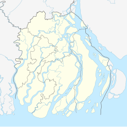
Pirojpur
Jump to navigation
Jump to search
This article needs additional citations for verification. (August 2019) |
Pirojpur
পিরোজপুর | |
|---|---|
| Coordinates: 22°34′41″N 89°58′05″E / 22.578°N 89.968°E | |
| Country | |
| Division | Barisal |
| District | Pirojpur |
| Municipality Eshtablished | |
| Area | |
| • Total | 29.50 km2 (11.39 sq mi) |
| Population (2011) | |
| • Total | 60,056 |
| • Density | 2,000/km2 (5,300/sq mi) |
| Website | pirojpurmunicipality |
Pirojpur (Bengali: পিরোজপুর) is a town in Pirojpur district in the division of Barisal in southern Bangladesh.[1] It is the administrative headquarter and the largest town of Pirojpur district. The town covers an area of 29.50 square kilometres (11.39 sq mi) with a population of 78,057, as of the 2011 census.
Demographics
At the time of the 2011 census, Pirojpur had 13,646 households and a population of 60,056. 11,515 (19.17%) were under 10 years of age. Pirojpur has a sex ratio of 999 females per 1000 males and a literacy rate of 77.81%.[2]
References
- ^ পিরোজপুর পৌরসভা সম্পর্কে তথ্য. www.Paurainfo.gov.bd (in Bengali). Archived from the original on 2 June 2015. Retrieved 31 May 2015.
- ^ a b "Community Report: Pirojpur" (PDF). Population & Housing Census 2011. Bangladesh Bureau of Statistics.
Categories:
- CS1 uses Bengali-language script (bn)
- CS1 Bengali-language sources (bn)
- Use Bangladeshi English from February 2023
- All Wikipedia articles written in Bangladeshi English
- Articles needing additional references from August 2019
- All articles needing additional references
- Use dmy dates from August 2019
- Articles with short description
- Short description is different from Wikidata
- Coordinates on Wikidata
- Articles containing Bengali-language text
- Towns in Bangladesh
- Municipalities of Bangladesh
- Populated places in Pirojpur District

