Pine Springs, Texas
Pine Springs, Texas | |
|---|---|
 Pine Springs Location of Pine Springs in Texas  Pine Springs Location of Pine Springs in the USA | |
| Coordinates: 31°53′33″N 104°48′56″W / 31.89250°N 104.81556°W | |
| Country | |
| State | |
| County | Culberson |
| Elevation | 5,633 ft (1,717 m) |
| Population (2000) | |
| • Total | 51 |
| Time zone | UTC-7 (Mountain (MST)) |
| • Summer (DST) | UTC-6 (MDT) |
| GNIS feature ID | 1380360[1] |
Pine Springs is an unincorporated community in northern Culberson County, Texas, United States. According to the Handbook of Texas, the community had a population of 20 in 2000.
History
19th-century visitors who crossed Guadalupe Pass were aware of the location; among them were Lt. Francis Theodore Bryan, Capt. Randolph B. Marcy, John Russell Bartlett, and Capt. John Pope in 1849, who camped there. At this location, the Butterfield Overland Mail constructed the Pinery, a stage station, in 1858. Only a palisade corral had been constructed when the first westbound mail arrived on September 28, 1858, and station keeper Henry Ramstein and his helpers were still living in tents. November 1858 saw the completion of the Pinery, but it was abandoned in August 1859 when the mail route was moved to the south to benefit from the defenses provided by forts Stockton and Davis. The site was the meeting point for troops under Maj. Albert Morrow from Fort Quitman and reinforcements from Forts Stockton and Davis in 1870, in preparation for reconnaissance missions against the Mescalero Apaches in the Guadalupes. The soldiers advanced into McKittrick Canyon and quickly got disoriented, though they did manage to come across a Mescalero community, which they pillaged with great zeal. Soldiers, freighters, and other vagrants continued to use the Pinery as a sanctuary in the mid-1880s, long after the Mescaleros had been declared no longer a danger. Rancher Walter Glover had moved to the area in 1907 after purchasing the land where the Pinery now stood. He brought his wife, Bertha, to Pine Springs ten years later. The Pine Springs Cafe was constructed in 1928 in response to the opening of U.S. Highway 62. It quickly became a popular rest stop for drivers between El Paso and Carlsbad, New Mexico, and Bertha Glover operated it until her passing in 1982. When a post office opened in 1942, Pine Springs' population was reported to be 50 and she was appointed postmistress; the post office closed the following year. By the mid-1940s, three enterprises were operating for an estimated population of 70. However, by the mid-1960s, that number had dropped to 10. The estimated population increased to 20 after Guadalupe Mountains National Park was established and opened to the public in 1972. The majority of the residents were employed by the park or the state transportation agency. The community's population of 20 was still listed in 1990. Pine Springs declares itself to be Texas' windiest town. Winds that average between fifty and eighty miles per hour, with occasional gusts up to 105 miles per hour, batter the town every year between February and April. The population of 20 persisted in 2000.[2]
On May 12, 1986, a Bell 206B crashed while returning with food for a station crew that was making reports from a remote area.[3] It was caused by improper maintenance resulting in the main drive shaft uncoupling. Two people died.[4]
In 1914, the Van Horn Valley Land and Railway built a line from Van Horn north to the New Mexico state line around Pine Springs.[5]
Geography
Pine Springs is located at the crossroads of U.S. Routes 62 and 180, 60 mi (97 km) north of Van Horn and 3 mi (4.8 km) southeast of Guadalupe Peak in northwestern Culberson County.[2]
Climate
According to the Köppen climate classification, Pine Springs has a semiarid climate, abbreviated BSk on climate maps.[6]
The city of Livingston, Montana, is the second windiest place in the U.S. after Pine Springs.[7] During the March 2019 North American blizzard, wind gusts of 103 mph (166 km/h) were recorded in Pine Springs.[8]
Education
Today, the community is served by the Culberson County-Allamoore Independent School District.
References
- ^ a b U.S. Geological Survey Geographic Names Information System: Pine Springs, Texas
- ^ a b Pine Springs, TX (Culberson County) from the Handbook of Texas Online
- ^ "Crash Kills Two". The Times-News. Associated Press. May 13, 1986. Archived from the original on January 21, 2016. Retrieved July 31, 2014.
- ^ "NTSB Identification: FTW86FA085". NTSB. Archived from the original on June 10, 2022. Retrieved December 25, 2009.
- ^ Railway Age Gazette Vol. 57 1914 p. 780
- ^ Climate Summary for Pine Springs, Texas
- ^ "Climatological Extremes for Contiguous United States". Western Regional Climate Center.
- ^ "Damaging storms spawn tornadoes in New Mexico, leave thousands without power in Texas - AccuWeather.com". m.accuweather.com. Retrieved March 15, 2019.
Municipalities and communities of Culberson County, Texas, United States | ||
|---|---|---|
| Town | 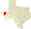 | |
| Unincorporated communities | ||
| Ghost towns | ||