Peninsulas of California
Jump to navigation
Jump to search

Many coastal peninsulas of California are properly headlands and are often called points, as in Oxford English Dictionary's senses 19b "projecting part of anything of a more or less tapering form...a sharp prominence" and 22 "a promontory or cape; the tip of a piece of land running out to sea...frequently in place names."[1]
This is a list of landmark coastal peninsulas of the U.S. state of California, ordered north to south. Unless otherwise noted, source is plate 144 from the Atlas of the War of the Rebellion, drawn 1867, and published 1895.[2]
- Point St. George
- Patrick's Point, also Rocky Point (see Sue-meg State Park)
- Cape Fortuna, or False Mendocino[3]
- Cape Mendocino
- Punta Gorda (see also Punta Gorda Light)
- Point Arena (see also Point Arena Light and Point Arena State Marine Conservation Area)
- Bodega Head (see also Bodega Head State Marine Conservation Arena)
- Point Tomales (see Tomales Bay)
- Tiburon Peninsula
- Point Reyes
- Duxbury Reef (see Duxbury Reef State Marine Conservation Area)
- Marin Headlands
- San Francisco Peninsula
- Point Bonita (see Point Bonita Lighthouse)
- Point Lobos
- Point San Pedro
- Pillar Point
- Pigeon Point (see Pigeon Point Lighthouse)
- Point Año Nuevo (see also Año Nuevo Island, Año Nuevo State Park, Año Nuevo State Marine Conservation Area and Greyhound Rock State Marine Conservation Area)
- Monterey Peninsula
- Point Pinos (see Point Pinos Lighthouse)
- Point Cypress
- Point Carmel
- Point Sur (see also Point Sur Lighthouse and Point Sur State Marine Reserve and Marine Conservation Area)
- Cape San Martin[4] (originally another Point Gorda, Punta Gorda "fat tip" in Spanish,[2] see Gorda, California)
- Piedras Blancas (see also Piedras Blancas Light Station and Piedras Blancas State Marine Reserve and Marine Conservation Area)
- Cayucos Point
- Point Buchon (see also Point Buchon State Marine Reserve and Marine Conservation Area)
- Point San Luis (see also Point San Luis Lighthouse and Port San Luis harbor)
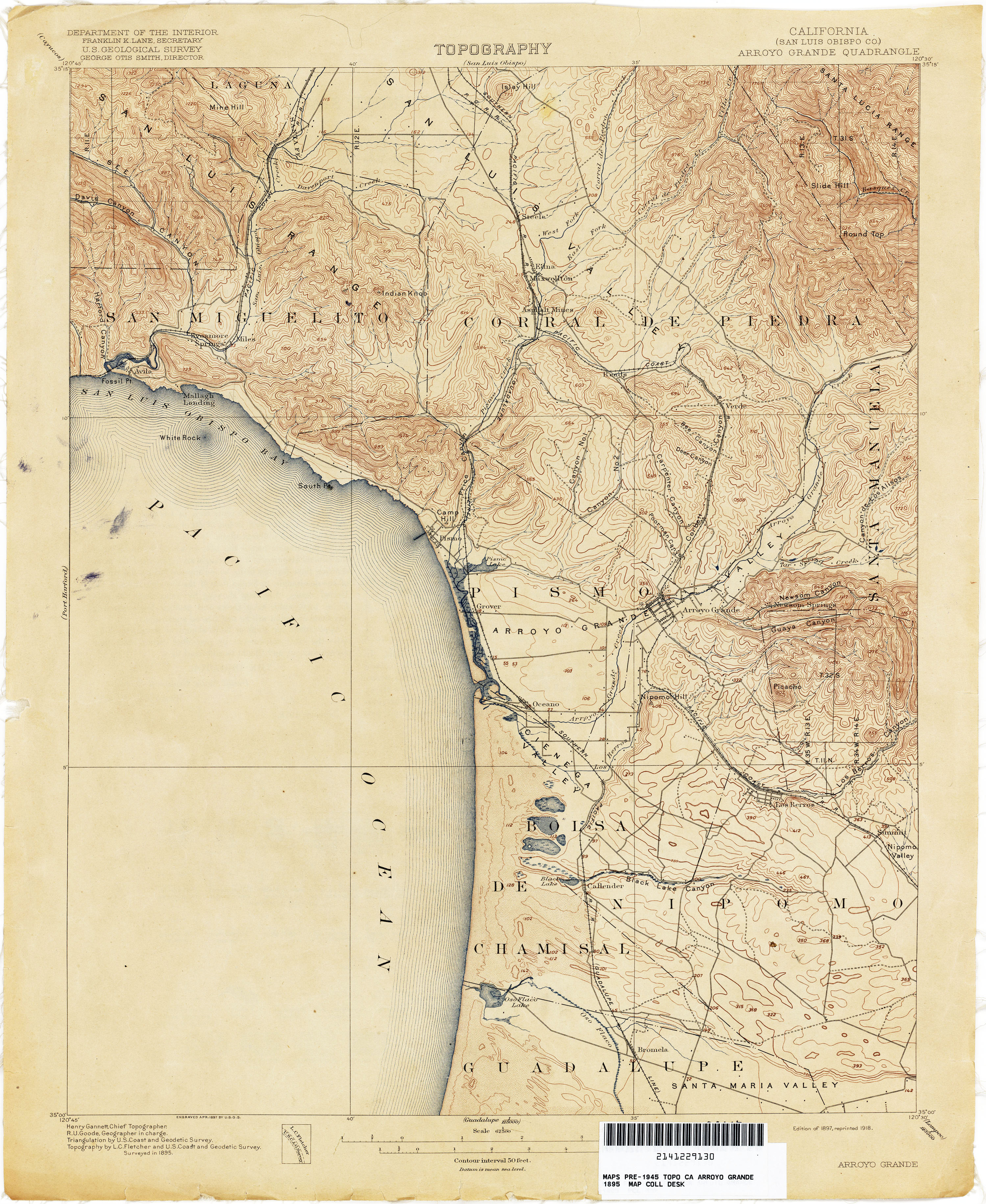
- Fossil Point[5]
- Mallagh Landing[5]
- South Point[5]
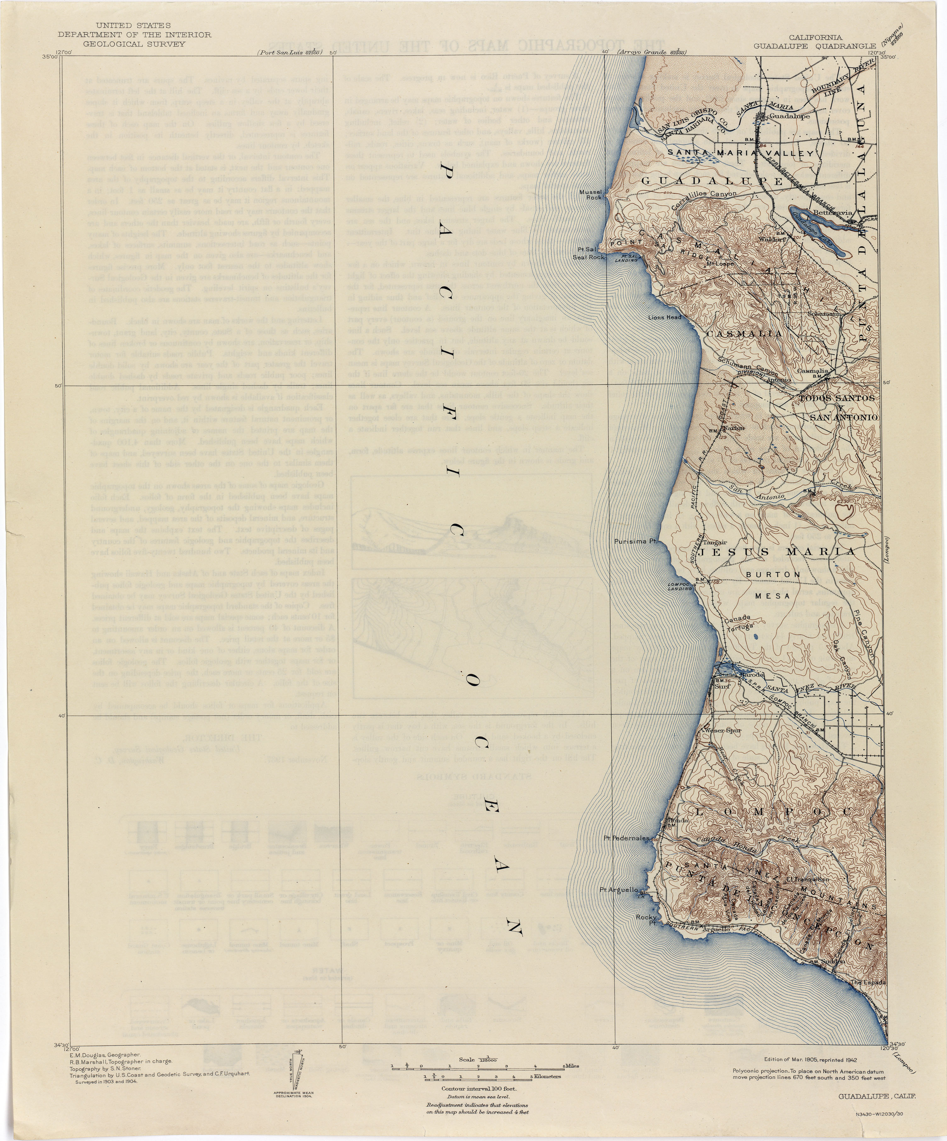
- Mussel Rock[6]
- Point Sal[6] (see also Point Sal State Beach)
- Purísima Point (see also La Purísima Mission)
- Point Pedernales, aka Honda Point (see also Honda, California, Honda Point disaster, and Vandenberg Space Force Base)
- Point Arguello (see also Point Arguello Light)
- Rocky Point[6]
- Point Conception (see also Point Conception Light and Point Conception State Marine Reserve)
- Point Salinas
- Point Mugu (see also Point Mugu State Park)
- Point Dume (see also Point Dume State Marine Conservation Area)
- Point Vicente (see Point Vicente Lighthouse)
- Palos Verdes Peninsula
- Point Fermin (see Point Fermin Light)
- "False Point at False Bay" (gone, see Mission Bay (San Diego) § History)
- Point Loma
Other headlands, promontories and rocks

Ordered alphabetically:
- Black Point
- Comanche Point
- Dana Point
- Duncans Point
- Muir Beach Overlook
- Point Cabrillo (see also Point Cabrillo Light)
- Point Lobos
- Point Pinole Regional Shoreline
- Point San Quentin
- Point Potrero
- Potrero Point
- Ragged Point
- Steamboat Point
- Trinidad Head
- Salt Point (see Salt Point State Park)
- White Point
See also
- California Coastal National Monument
- California Coastal Trail
- List of lighthouses in California
- Baja California peninsula
- Peninsulas of Oregon
References
- ^ "point". Oxford English Dictionary (Online ed.). Oxford University Press. (Subscription or participating institution membership required.)
- ^ a b "The 'War of the Rebellion' Atlas". digitalcollections-baylor.quartexcollections.com. Retrieved 2023-03-21.
- ^ Bancroft, Hubert Howe (1884). Bancroft's Works History of the Northwest Coast vol 1. David O. McKay Library Brigham Young University-Idaho. San Francisco, A. L. Bancroft and Company.
- ^ "Cape San Martin". archives.csuchico.edu. Retrieved 2023-03-21.
- ^ a b c "Arroyo Grande (San Luis Obispo Co.) 1915 quadrangle map". maps.lib.utexas.edu.
- ^ a b c "1904 Guadalupe quadrangle USGS map". maps.lib.utexas.edu.