Penig
Jump to navigation
Jump to search
You can help expand this article with text translated from the corresponding article in German. (November 2013) Click [show] for important translation instructions.
|
Penig | |
|---|---|
 Coat of arms | |
Location of Penig within Mittelsachsen district 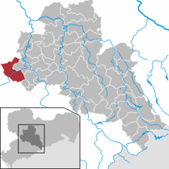 | |
 Penig  Penig | |
| Coordinates: 50°56′1″N 12°42′21″E / 50.93361°N 12.70583°E | |
| Country | Germany |
| State | Saxony |
| District | Mittelsachsen |
| Government | |
| • Mayor (2020–27) | André Wolf[1] (CDU) |
| Area | |
| • Total | 63.31 km2 (24.44 sq mi) |
| Elevation | 208 m (682 ft) |
| Population (2022-12-31)[2] | |
| • Total | 8,419 |
| • Density | 130/km2 (340/sq mi) |
| Time zone | UTC+01:00 (CET) |
| • Summer (DST) | UTC+02:00 (CEST) |
| Postal codes | 09322 |
| Dialling codes | 037381 |
| Vehicle registration | FG |
| Website | www.penig.de |
Penig (German: [ˈpeːnɪç] ⓘ) is a town in the district of Mittelsachsen, in the Free State of Saxony, Germany. It is situated on the river Zwickauer Mulde, 19 km northwest of Chemnitz. The old and the new castle were owned by the House of Schönburg from 1378 until 1945. Penig housed a concentration camp during World War II.
-
 The Old Castle
 -
 The New Castle


People
References
- ^ Wahlergebnisse 2020, Freistaat Sachsen, accessed 10 July 2021.
- ^ "Einwohnerzahlen nach Gemeinden als Excel-Arbeitsmappe" (XLS) (in German). Statistisches Landesamt des Freistaates Sachsen. 2024.
| International | |
|---|---|
| National | |
| Geographic | |
| Other | |
This Mittelsachsen location article is a stub. You can help Wikipedia by expanding it. |
Categories:
- Pages using the Phonos extension
- CS1 German-language sources (de)
- Articles needing translation from German Wikipedia
- Articles with short description
- Short description is different from Wikidata
- Coordinates on Wikidata
- Towns in Saxony
- Pages with German IPA
- Pages including recorded pronunciations
- Articles with VIAF identifiers
- Articles with GND identifiers
- Articles with NKC identifiers
- Articles with MusicBrainz area identifiers
- Articles with NARA identifiers
- Mittelsachsen
- All stub articles
- Mittelsachsen district geography stubs