Payneville, Kentucky
Jump to navigation
Jump to search
Payneville, Kentucky | |
|---|---|
 Payneville Location within the state of Kentucky  Payneville Payneville (the United States) | |
| Coordinates: 37°59′22″N 86°18′47″W / 37.98944°N 86.31306°W | |
| Country | United States |
| State | Kentucky |
| County | Meade |
| Elevation | 810 ft (250 m) |
| Time zone | UTC-5 (Eastern (EST)) |
| • Summer (DST) | UTC-4 (EST) |
| ZIP code | 40157[1] |
| Area code(s) | 270 and 364 |
| GNIS feature ID | 500299[2] |
Payneville is a rural unincorporated community in Meade County, Kentucky, United States. It is a small community of 1300 residents that lies 7.5 miles west of Brandenburg on KY 144 at its intersection with KY 376.
Located near here are the Payneville Petroglyphs, listed in the National Register of Historic Places.
References
- ^ "Payneville ZIP Code". zipdatamaps.com. 2022. Retrieved November 11, 2022.
- ^ U.S. Geological Survey Geographic Names Information System: Payneville, Kentucky
Municipalities and communities of Meade County, Kentucky, United States | ||
|---|---|---|
| Cities | 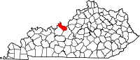 | |
| CDPs | ||
| Other communities | ||
| Footnotes | ‡This populated place also has portions in an adjacent county or counties | |
| International | |
|---|---|
| National | |
This Meade County, Kentucky state location article is a stub. You can help Wikipedia by expanding it. |
Categories:
- Pages using gadget WikiMiniAtlas
- Articles with short description
- Short description is different from Wikidata
- Use mdy dates from July 2023
- Coordinates on Wikidata
- Pages using infobox settlement with possible area code list
- Articles with VIAF identifiers
- Articles with J9U identifiers
- Articles with LCCN identifiers
- Unincorporated communities in Meade County, Kentucky
- Louisville metropolitan area
- Unincorporated communities in Kentucky
- All stub articles
- Meade County, Kentucky geography stubs