Parippally
Parippally
Parippalli | |
|---|---|
Town | |
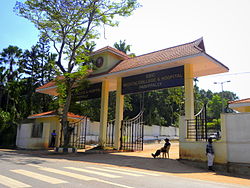
 Govt Medical College KOLLAM | |
| Coordinates: 8°48′44″N 76°45′32″E / 8.812361°N 76.758775°E | |
| Country | |
| State | Kerala |
| District | Kollam |
| Government | |
| • Body | Kalluvathukkal Panchayath |
| Languages | |
| • Official | Malayalam, English |
| Time zone | UTC+5:30 (IST) |
| Vehicle registration | KL-02 |
| Nearest city | Kollam City (24 Km) |
| Assembly constituency | Chathannoor |
| Lok Sabha constituency | Kollam |
Parippally is a town in kalluvathukkal panchayat Kollam , Kerala, India. Parippally is 22 kilometres (14 mi) South of Kollam City along NH66 and 44 kilometres (27 mi) North of Thiruvananthapuram along NH66. Kollam Govt. Medical College is situated in Parippally. Varkala sivagiri is nearest major Railway station 12 km(7.5 mi).
Transportation
Parippally is well connected by road from major places in kerala .A major town in NH 66 on the way kollam to Thiruvananthapuram.Nearest Airport is The Trivandrum International Airport which is 45 kilometres (28 mi) away. Kollam Helipad (Asramam) is about 23 kilometres (14 mi) away from Parippally and Varkala Helipad (Cliff) is about 13 kilometres (8.1 mi) away.
There are 4 major roads which connect Madathara, Paravur, Kollam, Thiruvananthapuram. It is only 13 kilometers away from the famous Varkala Sivagiri, Varkala Beach, and Varkala Temple.
Administration
Parippally is the part of Kalluvathukkal Panchayath.
Institutions
1) UKF Engineering College is in Parippally.
2) Govt Medical College, Kollam is situated in Paripally.
Temples
One of the most famous temple in Parippally is Kodimoottil Sri Bhadrakaali Temple . Gajamela and Pongala which are associated with the temple festival are very famous. Thousands of devotees come to watch the Gajamela.
References
- Kerala Atlas
- Manorama year book: 2006
