Portal:Tropical cyclones
The Tropical Cyclones Portal
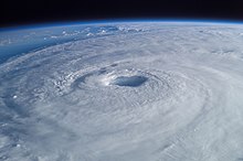
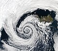
A tropical cyclone is a storm system characterized by a large low-pressure center, a closed low-level circulation and a spiral arrangement of numerous thunderstorms that produce strong winds and heavy rainfall. Tropical cyclones feed on the heat released when moist air rises, resulting in condensation of water vapor contained in the moist air. They are fueled by a different heat mechanism than other cyclonic windstorms such as Nor'easters, European windstorms and polar lows, leading to their classification as "warm core" storm systems. Most tropical cyclones originate in the doldrums, approximately ten degrees from the Equator.
The term "tropical" refers to both the geographic origin of these systems, which form almost exclusively in tropical regions of the globe, as well as to their formation in maritime tropical air masses. The term "cyclone" refers to such storms' cyclonic nature, with anticlockwise rotation in the Northern Hemisphere and clockwise rotation in the Southern Hemisphere. Depending on its location and intensity, a tropical cyclone may be referred to by names such as "hurricane", "typhoon", "tropical storm", "cyclonic storm", "tropical depression" or simply "cyclone".
Types of cyclone: 1. A "Typhoon" is a tropical cyclone located in the North-west Pacific Ocean which has the most cyclonic activity and storms occur year-round. 2. A "Hurricane" is also a tropical cyclone located at the North Atlantic Ocean or North-east Pacific Ocean which have an average storm activity and storms typically form between May 15 and November 30. 3. A "Cyclone" is a tropical cyclone that occurs in the South Pacific and Indian Oceans.
Selected named cyclone -
Hurricane Alex was the first tropical cyclone of the 2010 Atlantic hurricane season, and a rare June Atlantic hurricane. Originating from an area of disturbed weather on June 25, 2010, it slowly developed in the western Caribbean Sea and struck Belize as a strong tropical storm. After entering the Gulf of Mexico, Alex became very large and encountered conditions favorable for gradual development. Early on June 30, the cyclone attained hurricane status as it approached northeastern Mexico, the first June hurricane in the Atlantic basin since Hurricane Allison in 1995, and the storm rapidly intensified just off the coast of Tamaulipas. Alex made landfall near Soto la Marina as a Category 2 hurricane on the Saffir-Simpson Hurricane Wind Scale. Alex rapidly weakened after landfall, with the storm losing its tropical status on July 2, before fully dissipating on July 6.
Alex caused the deaths of at least 51 people along its path, and produced over $1.5 billion (2010 USD) in damage. The precursor of the hurricane produced substantial rainfall across the Greater Antilles, causing one death in the Dominican Republic. Fourteen people were killed in Central America as a result of flooding during the first landfall of Alex. In Mexico, the storm's outer rainbands killed three people in Acapulco, one person in Oaxaca, and another in Chiapas. At its final landfall, Alex caused at least fifteen deaths in Nuevo León, eight in Coahuila, six in Guanajuato, and one in both Tamaulipas and San Luis Potosí; an additional twenty persons were reported missing. (Full article...)Selected article -
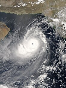
The 1999 Odisha cyclone (IMD designation BOB 06, JTWC designation 05B) was the most intense recorded tropical cyclone in the North Indian Ocean and among the most destructive in the region. The 1999 Odisha cyclone organized into a tropical depression in the Andaman Sea on 25 October, though its origins could be traced back to an area of convection in the Sulu Sea four days prior. The disturbance gradually strengthened as it took a west-northwesterly path, reaching cyclonic storm strength the next day. Aided by highly favorable conditions, the storm rapidly intensified, attaining super cyclonic storm intensity on 28 October, before peaking on the next day with winds of 260 km/h (160 mph) and a record-low pressure of 912 mbar (hPa; 26.93 inHg). The storm maintained this intensity as it made landfall on Odisha on 29 October. The cyclone steadily weakened due to persistent land interaction and dry air, remaining quasi-stationary for two days before slowly drifting offshore as a much weaker system; the storm dissipated on 4 November over the Bay of Bengal.
Although its primary effects were felt in a localized area of India, the outer fringes of the super cyclone impacted Myanmar and Bangladesh. Ten people were killed in the former, while two were killed in the latter by the storm's rainbands. The storm was the most severe to strike Odisha in the 20th century, raking the state and adjacent areas with high storm surge, powerful winds, and torrential rainfall. The storm's impacts exacerbated the damage caused by a very severe cyclone that struck the same region less than two weeks earlier. The 5–6 m (16–20 ft) surge brought water up to 35 km (20 mi) inland, carrying along with it coastal debris and inundating towns and villages. The surge combined with heavy rains to produce widespread flooding, damaging around 1.6 million homes and causing rivers to breach 20,005 flood embankments. The storm's effects destroyed numerous crops, including sugar cane, rice, and other winter-time harvests. Although estimates of the death toll varied significantly—at times suggesting 30,000 fatalities—the Government of India enumerated 9,887 fatalities in the country, of which a majority were caused by storm surge; over 8,000 deaths occurred in Jagatsinghpur. The total damage cost of the destruction wrought by the super cyclone amounted to US$4.44 billion. (Full article...)Selected image -
Selected season -

The 2020 Atlantic hurricane season was the most active Atlantic hurricane season on record, in terms of number of systems. It featured a total of 31 tropical or subtropical cyclones, with all but one cyclone becoming a named storm. Of the 30 named storms, 14 developed into hurricanes, and a record-tying seven further intensified into major hurricanes. It was the second and final season to use the Greek letter storm naming system, the first being 2005, the previous record. Of the 30 named storms, 11 of them made landfall in the contiguous United States, breaking the record of nine set in 1916. During the season, 27 tropical storms established a new record for earliest formation date by storm number. This season also featured a record ten tropical cyclones that underwent rapid intensification, tying it with 1995, as well as tying the record for most Category 4 hurricanes in a singular season in the Atlantic Basin. This unprecedented activity was fueled by a La Niña that developed in the summer months of 2020, continuing a stretch of above-average seasonal activity that began in 2016. Despite the record-high activity, this was the first season since 2015 in which no Category 5 hurricanes formed.
The season officially started on June 1 and officially ended on November 30. However, tropical cyclogenesis is possible at any time of the year, as demonstrated by the early formation of Tropical Storms Arthur and Bertha, on May 16 and 27, respectively. This was the sixth consecutive year with a pre-season system and the second of these seasons to have two, with the other being 2016. The first hurricane, Hurricane Hanna, made landfall in Texas on July 25. Hurricane Isaias formed on July 31, and made landfall in The Bahamas and North Carolina in early August, both times as a Category 1 hurricane; Isaias caused $4.8 billion in damage overall. In late August, Laura made landfall in Louisiana as a Category 4 hurricane, becoming the strongest tropical cyclone on record in terms of wind speed to make landfall in the state, alongside the 1856 Last Island hurricane and Ida. Laura caused at least $19 billion in damage and 77 deaths. September was the most active month on record in the Atlantic, with ten named storms. Slow-moving Hurricane Sally impacted the United States Gulf Coast, causing severe flooding. The Greek alphabet was used for only the second time, starting on September 17 with Subtropical Storm Alpha, which made landfall in Portugal on the following day. (Full article...)Related portals
Currently active tropical cyclones

Italicized basins are unofficial.
- North Atlantic (2024)
- No active systems
- East and Central Pacific (2024)
- No active systems
- West Pacific (2024)
- No active systems
- North Indian Ocean (2024)
- No active systems
- Mediterranean (2024–25)
- No active systems
- South-West Indian Ocean (2024–25)
- No active systems
- Australian region (2024–25)
- No active systems
- South Pacific (2024–25)
- No active systems
- South Atlantic (2024–25)
- No active systems
Last updated: 18:07, 9 July 2024 (UTC)
Tropical cyclone anniversaries

July 12,
- 1976 - Typhoon Therese reached maximum intensity with winds of 250 km/h (155 mph) and a minimum pressure of 905 hPa. Therese affected Japan causing millions of damage with only three fatalities.
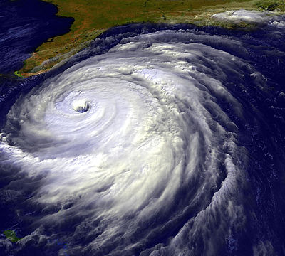
- 1996 - Hurricane Bertha (pictured) impacted North Carolina as a Category 2 hurricane. Bertha killed 12 people and caused $270 million of damage.

July 13,
- 1965 - Typhoon Freda made landfall on northern Luzon in the Philippines. Freda caused heavy flooding in the Philippines and southern China.
- 2006 - Hurricane Bud briefly reaches Category 3 major hurricane intensity.
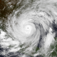
- 2010 - Typhoon Conson (pictured) makes landfall and impacts Luzon, killing a total of 102 people and leaving about PhP380 million (US$8.3 million) worth of damages.

July 14,
- 1972 - Typhoon Tess attains its peak as a Category 4 typhoon with winds of 230 km/h (145 mph).
- 2006 - Tropical Storm Bilis (pictured) hit Fujian, China as a tropical storm. Bilis killed over 600 people and caused $4.4 billion of damage in southeastern part of China.
Did you know…
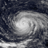


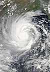
- …that the Joint Typhoon Warning Center considers that Typhoon Vera (pictured) of 1986 is actually two distinct systems, formed from two separated low-level circulations?
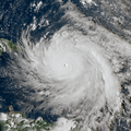
- …that Hurricane Agatha (pictured) was the strongest Pacific hurricane to make landfall in Mexico in May since records began in 1949?
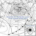
- …that Cyclone Raquel (track pictured) travelled between the Australian and South Pacific basins between the 2014–15 and 2015–16 seasons, spanning both seasons in both basins?
- …that Cyclone Amphan (pictured) in 2020 was the first storm to be classified as a Super Cyclonic Storm in the Bay of Bengal since 1999?
General images -
Topics
Subcategories
Related WikiProjects
WikiProject Tropical cyclones is the central point of coordination for Wikipedia's coverage of tropical cyclones. Feel free to help!
WikiProject Weather is the main center point of coordination for Wikipedia's coverage of meteorology in general, and the parent project of WikiProject Tropical cyclones. Three other branches of WikiProject Weather in particular share significant overlaps with WikiProject Tropical cyclones:
- The Non-tropical storms task force coordinates most of Wikipedia's coverage on extratropical cyclones, which tropical cyclones often transition into near the end of their lifespan.
- The Floods task force takes on the scope of flooding events all over the world, with rainfall from tropical cyclones a significant factor in many of them.
- WikiProject Severe weather documents the effects of extreme weather such as tornadoes, which landfalling tropical cyclones can produce.
Things you can do
 |
Here are some tasks awaiting attention:
|
Wikimedia
The following Wikimedia Foundation sister projects provide more on this subject:
-
Commons
Free media repository -
Wikibooks
Free textbooks and manuals -
Wikidata
Free knowledge base -
Wikinews
Free-content news -
Wikiquote
Collection of quotations -
Wikisource
Free-content library -
Wikiversity
Free learning tools -
Wikivoyage
Free travel guide -
Wiktionary
Dictionary and thesaurus
- Manually maintained portal pages from June 2018
- All manually maintained portal pages
- Portals with triaged subpages from June 2018
- All portals with triaged subpages
- All portals
- Portals with named maintainer
- Random portal component with 31–40 available image subpages
- Tropical cyclones portal
- Physical science portals
- Tropical cyclones
- Redirect targets of redirected portals with existing subpages
- WikiProject Tropical cyclones
