Ovelgönne
Ovelgönne | |
|---|---|
Location of Ovelgönne within Wesermarsch district 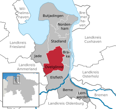 | |
 Ovelgönne  Ovelgönne | |
| Coordinates: 53°21′N 8°24′E / 53.350°N 8.400°E | |
| Country | Germany |
| State | Lower Saxony |
| District | Wesermarsch |
| Subdivisions | 4 districts |
| Government | |
| • Mayor (2021–26) | Sascha Stolorz[1] (CDU) |
| Area | |
| • Total | 123.81 km2 (47.80 sq mi) |
| Elevation | 4 m (13 ft) |
| Population (2022-12-31)[2] | |
| • Total | 5,405 |
| • Density | 44/km2 (110/sq mi) |
| Time zone | UTC+01:00 (CET) |
| • Summer (DST) | UTC+02:00 (CEST) |
| Postal codes | 26939 |
| Dialling codes | 04480 |
| Vehicle registration | BRA |
| Website | www.ovelgoenne.de |
Ovelgönne is a municipality in the district of Wesermarsch, in Lower Saxony, Germany. It is situated approximately 27 km northeast of Oldenburg, and 40 km northwest of Bremen. The municipality of Ovelgönne has its administration in the village of Oldenbrok and not in the homonymous village of Ovelgönne.
History
Ovelgönne has its origins in the "Oevelgünne" fortress which was constructed by Count Johann V of Oldenburg (1482–1526) at the end of June 1514 in order to enforce his rule over the surrounding area.
In 1583, Ovelgönne was given additional fortifications. From 1628 to 1631, Imperial Troops were quartered at Ovelgönne during the Thirty Years' War.
References
Towns and municipalities in Wesermarsch (district) | ||
|---|---|---|
 | ||
| International | |
|---|---|
| National | |
![]() Media related to Ovelgönne at Wikimedia Commons
Media related to Ovelgönne at Wikimedia Commons
This Wesermarsch district location article is a stub. You can help Wikipedia by expanding it. |
- Pages using gadget WikiMiniAtlas
- CS1 German-language sources (de)
- Articles with short description
- Short description matches Wikidata
- Coordinates on Wikidata
- Municipalities in Lower Saxony
- Articles with VIAF identifiers
- Articles with GND identifiers
- Articles with LCCN identifiers
- Commons category link from Wikidata
- Wesermarsch
- Populated places established in 1514
- All stub articles
- Weser-Ems region geography stubs