Nimy
Jump to navigation
Jump to search
Nimy
Nîmi (Walloon) | |
|---|---|
 Grand Large | |
 Coat of arms | |
Location of Nimy  | |
 Location of Nimy in Mons | |
 Nimy  Nimy | |
| Coordinates: 50°28′33″N 3°57′17″E / 50.47583°N 3.95472°E | |
| Country | |
| Community | |
| Region | |
| Province | |
| Arrondissement | Mons |
| Municipality | Mons |
| Area | |
| • Total | 4.16 km2 (1.61 sq mi) |
| Population (2020-01-01) | |
| • Total | 4,751 |
| • Density | 1,100/km2 (3,000/sq mi) |
| Postal codes | 7020 |
| Area codes | 065 |
Nimy (French pronunciation: [nimi]; Walloon: Nîmi) is a sub-municipality of the city of Mons located in the province of Hainaut, Wallonia, Belgium. It was a separate municipality until 1972. On 1 January 1972, it was merged into Mons.[1]
History
In 1914, it was the scene of heavy fighting during the Battle of Mons, the first action of the British Expeditionary Force in World War I. Notable for its earthenware pottery.
Gallery
-
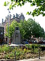 Old Town Hall.
 -
 St. Mary Church.


References
- ^ Arrêté royal du 18 février 1971 portant fusion des communes de Mons, Cuesmes, Ghlin, Hyon, Nimy et Obourg.
Wikimedia Commons has media related to Nimy.
| National | |
|---|---|
| Geographic | |
This Hainaut Province location article is a stub. You can help Wikipedia by expanding it. |
Categories:
- Pages using gadget WikiMiniAtlas
- Articles with short description
- Short description is different from Wikidata
- Articles containing Walloon-language text
- Infobox mapframe without OSM relation ID on Wikidata
- Coordinates on Wikidata
- Pages with French IPA
- Commons category link is on Wikidata
- Articles with J9U identifiers
- Articles with Pleiades identifiers
- Sub-municipalities of Mons
- Former municipalities of Hainaut (province)
- All stub articles
- Hainaut geography stubs
- Pages using the Kartographer extension