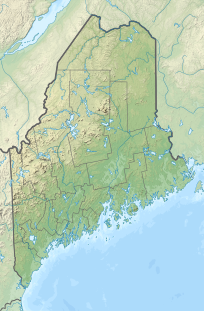
Mount Pisgah (Kennebec County, Maine)
| Mount Pisgah | |
|---|---|
Winthrop, Maine, U.S. | |
| Highest point | |
| Elevation | 815 ft (248 m) |
| Coordinates | 44°18′24″N 70°01′05″W / 44.30667°N 70.01806°W |
| Geography | |
| Location | Winthrop, Maine, U.S. |
| Topo map | USGS Winthrop |
Mount Pisgah is a mountain located in the town of Winthrop, Maine. Its summit is the fifth highest in Kennebec County.[1]
A popular hiking loop, made up of the .7 mile Tower Trail and 1.3 mile Blueberry Trail, provides access to a fire tower at the top of Mount Pisgah. The tower offers a 360° view reaching from the Camden Hills in the East to New Hampshire's Mount Washington in the West.[2]
History
Ezekiel Holmes, an American agriculturalist and politician known as the "father of Maine agriculture" resided on Mt. Pisgah in the mid 1800s.[3]
From 1949-1992 the Maine Forest Service operated a fire lookout on Mount Pisgah. The 60’ Aermotor fire tower is owned and maintained by the Town of Winthrop and the Kennebec Land Trust and open to the public[4]
As of 2017[update], the Kennebec Land Trust was expanding the trail.[5][6]
References
- ^ "Kennebec County ME Peaks List". listsofjohn.com. Retrieved 2019-07-17.
- ^ "Mt. Pisgah Conservation Area". Kennebec Land Trust. Retrieved 2019-07-17.
- ^ "Mt. Pisgah Conservation Area". Kennebec Land Trust. Retrieved 2019-07-17.
- ^ "Mount Pisgah Fire Tower | National Historic Lookout Register". nhlr.org. Retrieved 2019-07-17.
- ^ Eichacker, Charles (2017-08-07). "Expansion of Mount Pisgah trails reaches halfway point". Press Herald. Retrieved 2019-07-18.
- ^ Writer, Charles EichackerStaff (2017-08-06). "Kennebec Land Trust expands trail system on Mount Pisgah in Winthrop". Kennebec Journal and Morning Sentinel. Retrieved 2019-07-18.
