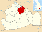
Molesey Heath
Jump to navigation
Jump to search
| Molesey Heath | |
|---|---|
 | |
 | |
| Type | Local Nature Reserve |
| Location | Molesey, Surrey |
| OS grid | TQ 132 671 |
| Area | 17.8 hectares (44 acres) |
| Managed by | Elmbridge Borough Council |
Molesey Heath is a 17.8-hectare (44-acre) Local Nature Reserve in Molesey in Surrey. It is owned and managed by Elmbridge Borough Council.[1][2]
This site was formerly a gravel pit and then a landfill site. It has been colonised naturally by rough grassland and scrub. Fauna include burrowing bees, wasps and diverse bird species such as little ringed plovers and redshanks.[1]
There is access from Approach Road. The heath can also be accessed on foot via the Walton and Weybridge Footpath and Bridleway[3] from Lower Green, Esher.[4]
Wikimedia Commons has media related to Molesey Heath.
References
- ^ a b "Molesey Heath". Local Nature Reserves. Natural England. Retrieved 26 November 2018.
- ^ "Map of Molesey Heath". Local Nature Reserves. Natural England. Retrieved 26 November 2018.
- ^ "Surrey Interactive Map". surreymaps.surreycc.gov.uk. Retrieved 2020-03-28.
- ^ "Lower Green 10k run". Lower Green Esher. 2020-03-21. Retrieved 2020-03-28.
