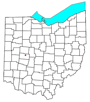
Mingo, Ohio
Jump to navigation
Jump to search

Mingo is an unincorporated community in northern Wayne Township, Champaign County, Ohio, United States.[1] It has the ZIP code 43047.[2] It is located along State Route 245.

Mingo was originally known as Mulberry, and under the latter name was platted in 1866.[3][4] It was later renamed for the historic Iroquoian Mingo people.
References
- ^ U.S. Geological Survey Geographic Names Information System: Mingo
- ^ USPS – Cities by ZIP Code
- ^ Middleton, Evan P. (1917). History of Champaign County, Ohio: Its People, Industries and Institutions, Volume 1. B.F. Bowen. p. 242.
- ^ The History of Champaign County, Ohio. W.H. Beers & Company. 1881. pp. 558.
40°12′29″N 83°38′18″W / 40.20806°N 83.63833°W
Categories:
- Pages using gadget WikiMiniAtlas
- Articles with short description
- Short description is different from Wikidata
- Use mdy dates from July 2023
- Coordinates on Wikidata
- Unincorporated communities in Champaign County, Ohio
- Unincorporated communities in Ohio
- All stub articles
- Dayton-Springfield-Greenville geography stubs
