Malek Ashtar Garrison
Jump to navigation
Jump to search
Malek Ashtar Garrison
Persian: پادگان مالک اشتر | |
|---|---|
Village and Military Installation | |
| Coordinates: 34°03′00″N 49°48′35″E / 34.05000°N 49.80972°E[1] | |
| Country | Iran |
| Province | Markazi |
| County | Arak |
| District | Central |
| Rural District | Hajjiabad |
| Population (2016)[2] | |
| • Total | 2,447 |
| Time zone | UTC+3:30 (IRST) |
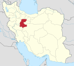
Malek Ashtar Garrison (Persian: پادگان مالک اشتر), Romanized as Pādegān-e Mālek Ashtar, is a village and military installation in Hajjiabad Rural District of the Central District of Arak County, Markazi province, Iran.
At the 2006 National Census, its population was 231 in 64 households, when it was in Masumiyeh Rural District.[3] The following census in 2011 counted 2,668 people in 91 households, by which time the locality had been transferred to the newly established Hajjiabad Rural District.[4] The latest census in 2016 showed a population of 2,447 people in 51 households. It was the most populous locality in its rural district.[2]
References
- ^ OpenStreetMap contributors (29 August 2023). "Malek Ashtar Garrison, Arak County" (Map). OpenStreetMap. Retrieved 29 August 2023.
- ^ a b "Census of the Islamic Republic of Iran, 1395 (2016)". AMAR (in Persian). The Statistical Center of Iran. p. 00. Archived from the original (Excel) on 17 October 2020. Retrieved 19 December 2022.
- ^ "Census of the Islamic Republic of Iran, 1385 (2006)". AMAR (in Persian). The Statistical Center of Iran. p. 00. Archived from the original (Excel) on 20 September 2011. Retrieved 25 September 2022.
- ^ "Census of the Islamic Republic of Iran, 1390 (2011)". Syracuse University (in Persian). The Statistical Center of Iran. p. 00. Archived from the original (Excel) on 19 January 2023. Retrieved 19 December 2022.

