List of trails of Sanders County, Montana
Jump to navigation
Jump to search
There are at least 35 named trails in Sanders County, Montana according to the U.S. Geological Survey, Board of Geographic Names. A trail is defined as: "Route for passage from one point to another; does not include roads or highways (jeep trail, path, ski trail)."[1]
- Bear Creek Trail, 47°50′24″N 115°21′50″W / 47.84000°N 115.36389°W, el. 5,971 feet (1,820 m) [2]
- Bear Paw Trail, 47°57′56″N 115°37′57″W / 47.96556°N 115.63250°W, el. 3,635 feet (1,108 m) [3]
- Berray Mountain Trail, 48°08′10″N 115°47′49″W / 48.13611°N 115.79694°W, el. 4,816 feet (1,468 m) [4]
- Black Peak Trail, 47°45′26″N 115°41′52″W / 47.75722°N 115.69778°W, el. 5,856 feet (1,785 m) [5]
- Cabinet Divide Trail, 47°56′20″N 115°33′29″W / 47.93889°N 115.55806°W, el. 6,050 feet (1,840 m) [6]
- Canyon Peak Trail, 47°53′50″N 115°32′58″W / 47.89722°N 115.54944°W, el. 5,679 feet (1,731 m) [7]
- Cataract Creek Trail, 47°49′21″N 115°23′19″W / 47.82250°N 115.38861°W, el. 6,001 feet (1,829 m) [8]
- Daisy Creek Trail, 47°49′28″N 115°05′33″W / 47.82444°N 115.09250°W, el. 5,508 feet (1,679 m) [9]
- Elk Mountain Trail, 47°52′33″N 115°26′18″W / 47.87583°N 115.43833°W, el. 4,639 feet (1,414 m) [10]
- Emma Peak Pack Trail, 47°40′16″N 115°38′25″W / 47.67111°N 115.64028°W, el. 4,242 feet (1,293 m) [11]
- Engle Lake Trail, 47°59′04″N 115°39′18″W / 47.98444°N 115.65500°W, el. 4,101 feet (1,250 m) [12]
- Engle Peak Trail, 48°00′28″N 115°39′47″W / 48.00778°N 115.66306°W, el. 5,325 feet (1,623 m) [13]
- Goat Peak Trail, 47°59′07″N 115°36′27″W / 47.98528°N 115.60750°W, el. 5,489 feet (1,673 m) [14]
- Goat Ridge Trail, 47°57′57″N 115°36′21″W / 47.96583°N 115.60583°W, el. 5,220 feet (1,590 m) [15]
- Green Mountain Trail, 47°57′19″N 115°40′14″W / 47.95528°N 115.67056°W, el. 4,734 feet (1,443 m) [16]
- Grouse Mountain Trail, 47°50′11″N 115°24′05″W / 47.83639°N 115.40139°W, el. 5,860 feet (1,790 m) [17]
- Huckleberry Mountain Trail, 47°56′47″N 115°47′32″W / 47.94639°N 115.79222°W, el. 4,885 feet (1,489 m) [18]
- Loveland Peak Trail, 47°59′14″N 115°53′45″W / 47.98722°N 115.89583°W, el. 4,974 feet (1,516 m) [19]
- Miller Creek Trail, 47°49′22″N 115°21′47″W / 47.82278°N 115.36306°W, el. 5,738 feet (1,749 m) [20]
- Moose Peak Trail, 47°52′58″N 115°18′46″W / 47.88278°N 115.31278°W, el. 4,944 feet (1,507 m) [21]
- Old Daly Trail, 48°06′12″N 115°43′10″W / 48.10333°N 115.71944°W, el. 5,817 feet (1,773 m) [22]
- Reader Gulch Pack Trail, 47°44′53″N 115°36′51″W / 47.74806°N 115.61417°W, el. 3,881 feet (1,183 m) [23]
- Revais Creek Trail, 47°14′59″N 114°25′11″W / 47.24972°N 114.41972°W, el. 4,308 feet (1,313 m) [24]
- Rice Draw Trail, 48°00′37″N 115°56′00″W / 48.01028°N 115.93333°W, el. 3,871 feet (1,180 m) [25]
- Slide Rock Mountain Trail, 47°47′22″N 115°20′49″W / 47.78944°N 115.34694°W, el. 6,227 feet (1,898 m) [26]
- State Line Trail (Montana), 47°53′19″N 115°56′13″W / 47.88861°N 115.93694°W, el. 5,620 feet (1,710 m) [27]
- Stevens Creek Trail, 47°55′40″N 115°47′53″W / 47.92778°N 115.79806°W, el. 4,157 feet (1,267 m) [28]
- Stevens Ridge Trail, 47°55′22″N 115°51′02″W / 47.92278°N 115.85056°W, el. 4,997 feet (1,523 m) [29]
- Thompson River Mount Headley Trail, 47°45′14″N 115°13′35″W / 47.75389°N 115.22639°W, el. 6,900 feet (2,100 m) [30]
- Twenty Odd Peak Trail, 47°53′08″N 115°34′41″W / 47.88556°N 115.57806°W, el. 5,095 feet (1,553 m) [31]
- Water Hill Trail, 47°48′41″N 115°27′15″W / 47.81139°N 115.45417°W, el. 6,142 feet (1,872 m) [32]
- West Fork Fishtrap Trail, 47°46′19″N 115°13′04″W / 47.77194°N 115.21778°W, el. 6,063 feet (1,848 m) [33]
- West Fork Trail, 47°49′34″N 115°27′35″W / 47.82611°N 115.45972°W, el. 4,534 feet (1,382 m) [34]
- White Pine Ridge Trail, 47°46′27″N 115°34′53″W / 47.77417°N 115.58139°W, el. 4,360 feet (1,330 m) [35]
- Windfall Peak Trail, 47°47′17″N 115°44′40″W / 47.78806°N 115.74444°W, el. 4,695 feet (1,431 m) [36]
Further reading
- Arthur, Jean (2000). Winter Trails Montana: The Best Cross-Country Ski & Snowshoe Trails. Guilford, CT: Globe Pequot. ISBN 0-7627-0730-5.
- Spring, Ira (1974). Wilderness trails Northwest;: A hiker's and climber's overview-guide to national parks and wilderness areas in Wyoming, Montana, Idaho, Northern California, . British Columbia, Canadian Rockies. Touchstone Press. ISBN 0-911518-25-8.
- Willard, John A. (1986). Adventure Trails in Montana. Pruett Publishing Co. ISBN 0-87108-726-X.
- Howard, Lynna and Leland (2000). Along Montana & Idaho's Continental Divide Trail. Westcliff Publishers. ISBN 1-56579-343-9.
- Wolf, John R. (1992). Guide to the Continental Divide Trail: Northern Montana. Continental Divide Trail Society. ISBN 0-934326-01-0.
- Barnett, Carellen (1997). Trail Riding Western Montana. Guilford, CT: Falcon Press Publishing. ISBN 1-56044-336-7.
- Schneider, Bill (1995). Hiking Montana. Guilford, CT: Falcon Press Publishing. ISBN 1-56044-381-2.
See also
Notes
- ^ "Geographic Names Information System (GNIS) Feature Class Definitions". U.S. Geological Survey. Retrieved 2011-07-26.
- ^ "Bear Creek Trail". Geographic Names Information System. United States Geological Survey, United States Department of the Interior.
- ^ "Bear Paw Trail". Geographic Names Information System. United States Geological Survey, United States Department of the Interior.
- ^ "Berray Mountain Trail". Geographic Names Information System. United States Geological Survey, United States Department of the Interior.
- ^ "Black Peak Trail". Geographic Names Information System. United States Geological Survey, United States Department of the Interior.
- ^ "Cabinet Divide Trail". Geographic Names Information System. United States Geological Survey, United States Department of the Interior.
- ^ "Canyon Peak Trail". Geographic Names Information System. United States Geological Survey, United States Department of the Interior.
- ^ "Cataract Creek Trail". Geographic Names Information System. United States Geological Survey, United States Department of the Interior.
- ^ "Daisy Creek Trail". Geographic Names Information System. United States Geological Survey, United States Department of the Interior.
- ^ "Elk Mountain Trail". Geographic Names Information System. United States Geological Survey, United States Department of the Interior.
- ^ "Emma Peak Pack Trail". Geographic Names Information System. United States Geological Survey, United States Department of the Interior.
- ^ "Engle Lake Trail". Geographic Names Information System. United States Geological Survey, United States Department of the Interior.
- ^ "Engle Peak Trail". Geographic Names Information System. United States Geological Survey, United States Department of the Interior.
- ^ "Goat Peak Trail". Geographic Names Information System. United States Geological Survey, United States Department of the Interior.
- ^ "Goat Ridge Trail". Geographic Names Information System. United States Geological Survey, United States Department of the Interior.
- ^ "Green Mountain Trail". Geographic Names Information System. United States Geological Survey, United States Department of the Interior.
- ^ "Grouse Mountain Trail". Geographic Names Information System. United States Geological Survey, United States Department of the Interior.
- ^ "Huckleberry Mountain Trail". Geographic Names Information System. United States Geological Survey, United States Department of the Interior.
- ^ "Loveland Peak Trail". Geographic Names Information System. United States Geological Survey, United States Department of the Interior.
- ^ "Miller Creek Trail". Geographic Names Information System. United States Geological Survey, United States Department of the Interior.
- ^ "Moose Peak Trail". Geographic Names Information System. United States Geological Survey, United States Department of the Interior.
- ^ "Old Daly Trail". Geographic Names Information System. United States Geological Survey, United States Department of the Interior.
- ^ "Reader Gulch Pack Trail". Geographic Names Information System. United States Geological Survey, United States Department of the Interior.
- ^ "Revais Creek Trail". Geographic Names Information System. United States Geological Survey, United States Department of the Interior.
- ^ "Rice Draw Trail". Geographic Names Information System. United States Geological Survey, United States Department of the Interior.
- ^ "Slide Rock Mountain Trail". Geographic Names Information System. United States Geological Survey, United States Department of the Interior.
- ^ "State Line Trail". Geographic Names Information System. United States Geological Survey, United States Department of the Interior.
- ^ "Stevens Creek Trail". Geographic Names Information System. United States Geological Survey, United States Department of the Interior.
- ^ "Stevens Ridge Trail". Geographic Names Information System. United States Geological Survey, United States Department of the Interior.
- ^ "Thompson River Mount Headley Trail". Geographic Names Information System. United States Geological Survey, United States Department of the Interior.
- ^ "Twenty Odd Peak Trail". Geographic Names Information System. United States Geological Survey, United States Department of the Interior.
- ^ "Water Hill Trail". Geographic Names Information System. United States Geological Survey, United States Department of the Interior.
- ^ "West Fork Fishtrap Trail". Geographic Names Information System. United States Geological Survey, United States Department of the Interior.
- ^ "West Fork Trail". Geographic Names Information System. United States Geological Survey, United States Department of the Interior.
- ^ "White Pine Ridge Trail". Geographic Names Information System. United States Geological Survey, United States Department of the Interior.
- ^ "Windfall Peak Trail". Geographic Names Information System. United States Geological Survey, United States Department of the Interior.
Municipalities and communities of Sanders County, Montana, United States | ||
|---|---|---|
| City | 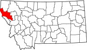 | |
| Towns | ||
| CDPs | ||
| Indian reservation | ||
| Footnotes | ‡This populated place also has portions in an adjacent county or counties | |