List of trails of Powell County, Montana
Jump to navigation
Jump to search
There are at least 29 named trails in Powell County, Montana according to the U.S. Geological Survey, Board of Geographic Names. A trail is defined as: "Route for passage from one point to another; does not include roads or highways (jeep trail, path, ski trail)."[1]
- Blackfoot Divide Trail, 47°15′24″N 113°21′48″W / 47.25667°N 113.36333°W, el. 7,290 feet (2,220 m) [2]
- Camp Creek Pass Trail, 47°28′04″N 113°06′23″W / 47.46778°N 113.10639°W, el. 6,227 feet (1,898 m) [3]
- Catchem Creek Trail, 47°28′25″N 113°11′37″W / 47.47361°N 113.19361°W, el. 4,734 feet (1,443 m) [4]
- Center Creek Trail, 47°15′14″N 113°11′23″W / 47.25389°N 113.18972°W, el. 6,339 feet (1,932 m) [5]
- Center Ridge Trail, 47°11′36″N 113°11′02″W / 47.19333°N 113.18389°W, el. 6,237 feet (1,901 m) [6]
- Conger Creek Trail, 47°12′53″N 113°04′45″W / 47.21472°N 113.07917°W, el. 6,614 feet (2,016 m) [7]
- Conger Point Trail, 47°12′41″N 113°05′45″W / 47.21139°N 113.09583°W, el. 7,743 feet (2,360 m) [8]
- Danaher Hahn Creek Trail, 47°21′13″N 113°04′45″W / 47.35361°N 113.07917°W, el. 5,958 feet (1,816 m) [9]
- Dunham Lodgepole Trail, 47°09′48″N 113°11′33″W / 47.16333°N 113.19250°W, el. 4,390 feet (1,340 m) [10]
- Dunham Trail, 47°11′25″N 113°15′26″W / 47.19028°N 113.25722°W, el. 5,394 feet (1,644 m) [11]
- Dwight Creek Trail, 47°14′03″N 113°05′53″W / 47.23417°N 113.09806°W, el. 7,880 feet (2,400 m) [12]
- Falls Canyon Trail, 47°11′23″N 113°04′03″W / 47.18972°N 113.06750°W, el. 6,588 feet (2,008 m) [13]
- Fenn Mountain Trail, 47°11′55″N 113°06′54″W / 47.19861°N 113.11500°W, el. 7,631 feet (2,326 m) [14]
- Foolhen Creek Trail, 47°21′45″N 113°07′41″W / 47.36250°N 113.12806°W, el. 5,620 feet (1,710 m) [15]
- Foolhen Mountain Trail, 47°20′06″N 113°03′39″W / 47.33500°N 113.06083°W, el. 5,610 feet (1,710 m) [16]
- Haystack Mountain Trail, 47°35′11″N 113°09′32″W / 47.58639°N 113.15889°W, el. 6,565 feet (2,001 m) [17]
- Holland Gordon Trail, 47°25′46″N 113°26′43″W / 47.42944°N 113.44528°W, el. 5,407 feet (1,648 m) [18]
- Jumbo Lookout Trail, 47°24′38″N 113°08′14″W / 47.41056°N 113.13722°W, el. 6,099 feet (1,859 m) [19]
- Lake Otatsy Trail, 47°09′47″N 113°01′53″W / 47.16306°N 113.03139°W, el. 6,201 feet (1,890 m) [20]
- Limestone Pass Trail, 47°15′37″N 113°08′03″W / 47.26028°N 113.13417°W, el. 6,657 feet (2,029 m) [21]
- Lodgepole Trail, 47°13′25″N 113°11′48″W / 47.22361°N 113.19667°W, el. 5,338 feet (1,627 m) [22]
- McCabe Lake Creek Trail, 47°08′39″N 113°02′32″W / 47.14417°N 113.04222°W, el. 5,853 feet (1,784 m) [23]
- McDermott Trail, 47°08′31″N 112°56′32″W / 47.14194°N 112.94222°W, el. 4,902 feet (1,494 m) [24]
- Meadow Creek Trail, 47°04′51″N 112°50′18″W / 47.08083°N 112.83833°W, el. 6,489 feet (1,978 m) [25]
- Mineral Creek Trail, 47°07′17″N 112°54′41″W / 47.12139°N 112.91139°W, el. 6,598 feet (2,011 m) [26]
- Monture Haun Trail, 47°11′39″N 113°09′20″W / 47.19417°N 113.15556°W, el. 4,754 feet (1,449 m) [27]
- Monture Trail, 47°16′24″N 113°10′59″W / 47.27333°N 113.18306°W, el. 5,574 feet (1,699 m) [28]
- Morrell Falls National Recreation Trail, 47°17′07″N 113°27′44″W / 47.28528°N 113.46222°W, el. 4,793 feet (1,461 m) [29]
- Pyramid Pass Trail, 47°15′28″N 113°24′25″W / 47.25778°N 113.40694°W, el. 5,951 feet (1,814 m) [30]
Further reading
- Arthur, Jean (2000). Winter Trails Montana: The Best Cross-Country Ski & Snowshoe Trails. Guilford, CT: Globe Pequot. ISBN 0-7627-0730-5.
- Spring, Ira (1974). Wilderness trails Northwest;: A hiker's and climber's overview-guide to national parks and wilderness areas in Wyoming, Montana, Idaho, Northern California, . British Columbia, Canadian Rockies. Touchstone Press. ISBN 0-911518-25-8.
- Willard, John A. (1986). Adventure Trails in Montana. Pruett Publishing Co. ISBN 0-87108-726-X.
- Howard, Lynna and Leland (2000). Along Montana & Idaho's Continental Divide Trail. Westcliff Publishers. ISBN 1-56579-343-9.
- Wolf, John R. (1992). Guide to the Continental Divide Trail: Northern Montana. Continental Divide Trail Society. ISBN 0-934326-01-0.
- Barnett, Carellen (1997). Trail Riding Western Montana. Guilford, CT: Falcon Press Publishing. ISBN 1-56044-336-7.
- Schneider, Bill (1995). Hiking Montana. Guilford, CT: Falcon Press Publishing. ISBN 1-56044-381-2.
See also
Notes
- ^ "Geographic Names Information System (GNIS) Feature Class Definitions". U.S. Geological Survey. Retrieved 2011-07-26.
- ^ "Blackfoot Divide Trail". Geographic Names Information System. United States Geological Survey, United States Department of the Interior.
- ^ "Camp Creek Pass Trail". Geographic Names Information System. United States Geological Survey, United States Department of the Interior.
- ^ "Catchem Creek Trail". Geographic Names Information System. United States Geological Survey, United States Department of the Interior.
- ^ "Center Creek Trail". Geographic Names Information System. United States Geological Survey, United States Department of the Interior.
- ^ "Center Ridge Trail". Geographic Names Information System. United States Geological Survey, United States Department of the Interior.
- ^ "Conger Creek Trail". Geographic Names Information System. United States Geological Survey, United States Department of the Interior.
- ^ "Conger Point Trail". Geographic Names Information System. United States Geological Survey, United States Department of the Interior.
- ^ "Danaher Hahn Creek Trail". Geographic Names Information System. United States Geological Survey, United States Department of the Interior.
- ^ "Dunham Lodgepole Trail". Geographic Names Information System. United States Geological Survey, United States Department of the Interior.
- ^ "Dunham Trail". Geographic Names Information System. United States Geological Survey, United States Department of the Interior.
- ^ "Dwight Creek Trail". Geographic Names Information System. United States Geological Survey, United States Department of the Interior.
- ^ "Falls Canyon Trail". Geographic Names Information System. United States Geological Survey, United States Department of the Interior.
- ^ "Fenn Mountain Trail". Geographic Names Information System. United States Geological Survey, United States Department of the Interior.
- ^ "Foolhen Creek Trail". Geographic Names Information System. United States Geological Survey, United States Department of the Interior.
- ^ "Foolhen Mountain Trail". Geographic Names Information System. United States Geological Survey, United States Department of the Interior.
- ^ "Haystack Mountain Trail". Geographic Names Information System. United States Geological Survey, United States Department of the Interior.
- ^ "Holland Gordon Trail". Geographic Names Information System. United States Geological Survey, United States Department of the Interior.
- ^ "Jumbo Lookout Trail". Geographic Names Information System. United States Geological Survey, United States Department of the Interior.
- ^ "Lake Otatsy Trail". Geographic Names Information System. United States Geological Survey, United States Department of the Interior.
- ^ "Limestone Pass Trail". Geographic Names Information System. United States Geological Survey, United States Department of the Interior.
- ^ "Lodgepole Trail". Geographic Names Information System. United States Geological Survey, United States Department of the Interior.
- ^ "McCabe Lake Creek Trail". Geographic Names Information System. United States Geological Survey, United States Department of the Interior.
- ^ "McDermott Trail". Geographic Names Information System. United States Geological Survey, United States Department of the Interior.
- ^ "Meadow Creek Trail". Geographic Names Information System. United States Geological Survey, United States Department of the Interior.
- ^ "Mineral Creek Trail". Geographic Names Information System. United States Geological Survey, United States Department of the Interior.
- ^ "Monture Haun Trail". Geographic Names Information System. United States Geological Survey, United States Department of the Interior.
- ^ "Monture Trail". Geographic Names Information System. United States Geological Survey, United States Department of the Interior.
- ^ "Morrell Falls National Recreation Trail". Geographic Names Information System. United States Geological Survey, United States Department of the Interior.
- ^ "Pyramid Pass Trail". Geographic Names Information System. United States Geological Survey, United States Department of the Interior.
Municipalities and communities of Powell County, Montana, United States | ||
|---|---|---|
| City | 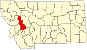 | |
| CDPs | ||
| Other community | ||