List of trails in Fremont County, Wyoming
Jump to navigation
Jump to search
There are at least 69 named trails in Fremont County, Wyoming according to the U.S. Geological Survey, Board of Geographic Names. A trail is defined as: "Route for passage from one point to another; does not include roads or highways (jeep trail, path, ski trail)."[1]
- Absaroka Trail, 43°50′5″N 109°22′15″W / 43.83472°N 109.37083°W, el. 10,787 feet (3,288 m) [2]
- Bear Creek Trail, 43°47′5″N 109°23′09″W / 43.78472°N 109.38583°W, el. 9,350 feet (2,850 m) [3]
- Bears Ears Trail, 42°49′5″N 109°15′03″W / 42.81806°N 109.25083°W, el. 11,696 feet (3,565 m) [4]
- Blue Trail, 42°55′5″N 108°59′05″W / 42.91806°N 108.98472°W, el. 7,779 feet (2,371 m) [5]
- Boundary Trail, 43°39′5″N 109°31′57″W / 43.65139°N 109.53250°W, el. 7,533 feet (2,296 m) [6]
- Burroughs Creek Trail, 43°41′5″N 109°39′00″W / 43.68472°N 109.65000°W, el. 8,602 feet (2,622 m) [7]
- C M Trail, 43°28′5″N 109°39′08″W / 43.46806°N 109.65222°W, el. 7,392 feet (2,253 m) [8]
- Christina Lake Trail, 42°36′5″N 108°54′28″W / 42.60139°N 108.90778°W, el. 9,649 feet (2,941 m) [9]
- Christina Lake Trail, 42°34′5″N 109°01′58″W / 42.56806°N 109.03278°W, el. 8,730 feet (2,660 m) [10]
- Cold Spring Trail, 42°44′5″N 108°53′51″W / 42.73472°N 108.89750°W, el. 8,894 feet (2,711 m) [11]
- Cougar Pass Trail, 43°52′5″N 109°38′07″W / 43.86806°N 109.63528°W, el. 9,340 feet (2,850 m) [12]
- Devils Hole Trail, 43°34′5″N 109°56′19″W / 43.56806°N 109.93861°W, el. 8,878 feet (2,706 m) [13]
- Dinwoody Trail, 43°20′5″N 109°31′12″W / 43.33472°N 109.52000°W, el. 10,059 feet (3,066 m) [14]
- Dry Creek Trail, 43°15′5″N 109°28′44″W / 43.25139°N 109.47889°W, el. 10,239 feet (3,121 m) [15]
- Du Noir Trail, 43°44′5″N 109°51′37″W / 43.73472°N 109.86028°W, el. 8,163 feet (2,488 m) [16]
- DuNoir Trail, 43°46′5″N 109°58′06″W / 43.76806°N 109.96833°W, el. 9,616 feet (2,931 m) [17]
- East Du Noir Trail, 43°47′5″N 109°49′12″W / 43.78472°N 109.82000°W, el. 8,517 feet (2,596 m) [18]
- East Fork Trail, 43°49′5″N 109°19′47″W / 43.81806°N 109.32972°W, el. 10,230 feet (3,120 m) [19]
- Farlow Trail, 42°47′5″N 108°58′05″W / 42.78472°N 108.96806°W, el. 9,685 feet (2,952 m) [20]
- Fish Lake Trail, 43°35′5″N 109°57′56″W / 43.58472°N 109.96556°W, el. 8,920 feet (2,720 m) [21]
- Frontier Creek Trail, 43°50′5″N 109°35′10″W / 43.83472°N 109.58611°W, el. 8,622 feet (2,628 m) [22]
- Gaylord Lake Trail, 42°51′5″N 109°10′21″W / 42.85139°N 109.17250°W, el. 10,210 feet (3,110 m) [23]
- Geyser Creek Trail, 43°32′5″N 109°44′22″W / 43.53472°N 109.73944°W, el. 7,999 feet (2,438 m) [24]
- Glacier Trail, 43°11′5″N 109°37′34″W / 43.18472°N 109.62611°W, el. 10,800 feet (3,300 m) [25]
- High Meadow Trail, 42°47′5″N 109°04′19″W / 42.78472°N 109.07194°W, el. 9,025 feet (2,751 m) [26]
- Ice Lakes Trail, 42°45′5″N 109°05′29″W / 42.75139°N 109.09139°W, el. 9,878 feet (3,011 m) [27]
- Indian Point Trail, 43°44′5″N 109°31′05″W / 43.73472°N 109.51806°W, el. 9,121 feet (2,780 m) [28]
- Indian Trail, 42°38′5″N 108°49′18″W / 42.63472°N 108.82167°W, el. 8,704 feet (2,653 m) [29]
- Ink Wells Trail, 43°17′5″N 109°31′09″W / 43.28472°N 109.51917°W, el. 11,132 feet (3,393 m) [30]
- Jakeys Fork Trail, 43°29′5″N 109°40′05″W / 43.48472°N 109.66806°W, el. 8,924 feet (2,720 m) [31]
- Johnson Trail, 43°26′5″N 108°08′38″W / 43.43472°N 108.14389°W, el. 5,945 feet (1,812 m) [32]
- Kisinger Lakes Trail, 43°43′5″N 109°56′26″W / 43.71806°N 109.94056°W, el. 10,029 feet (3,057 m) [33]
- Lake of the Woods Trail, 43°29′5″N 109°57′13″W / 43.48472°N 109.95361°W, el. 9,508 feet (2,898 m) [34]
- Leeds Creek Trail, 43°30′5″N 109°59′10″W / 43.50139°N 109.98611°W, el. 8,730 feet (2,660 m) [35]
- Little Sweetwater Trail, 42°32′5″N 108°59′34″W / 42.53472°N 108.99278°W, el. 8,461 feet (2,579 m) [36]
- Lizard Head Trail, 42°48′5″N 109°10′58″W / 42.80139°N 109.18278°W, el. 11,863 feet (3,616 m) [37]
- Louis Lake Trail, 42°35′5″N 108°52′11″W / 42.58472°N 108.86972°W, el. 9,331 feet (2,844 m) [38]
- Marston Pass Trail, 43°56′5″N 109°54′00″W / 43.93472°N 109.90000°W, el. 9,918 feet (3,023 m) [39]
- Middle Fork Trail, 42°43′5″N 108°54′15″W / 42.71806°N 108.90417°W, el. 8,140 feet (2,480 m) [40]
- Moon Lake Trail, 43°28′5″N 109°47′14″W / 43.46806°N 109.78722°W, el. 10,062 feet (3,067 m) [41]
- Moss Lake Trail, 42°51′5″N 109°10′54″W / 42.85139°N 109.18167°W, el. 9,987 feet (3,044 m) [42]
- Ninemile Trail, 43°48′5″N 109°21′05″W / 43.80139°N 109.35139°W, el. 10,266 feet (3,129 m) [43]
- Oregon Trail, 42°30′5″N 107°49′08″W / 42.50139°N 107.81889°W, el. 6,306 feet (1,922 m) [44]
- Parque Creek Trail, 43°43′5″N 109°39′14″W / 43.71806°N 109.65389°W, el. 8,783 feet (2,677 m) [45]
- Pelham Lake Trail, 43°41′5″N 109°59′31″W / 43.68472°N 109.99194°W, el. 8,711 feet (2,655 m) [46]
- Petes Lake Trail, 42°44′5″N 108°56′11″W / 42.73472°N 108.93639°W, el. 9,406 feet (2,867 m) [47]
- Pine Creek Trail, 42°30′5″N 108°53′23″W / 42.50139°N 108.88972°W, el. 8,651 feet (2,637 m) [48]
- Pinnacle Trail, 43°44′5″N 109°57′59″W / 43.73472°N 109.96639°W, el. 9,472 feet (2,887 m) [49]
- Pinto Park Trail, 42°44′5″N 109°03′13″W / 42.73472°N 109.05361°W, el. 10,036 feet (3,059 m) [50]
- Ramshorn Trail, 43°41′5″N 109°41′36″W / 43.68472°N 109.69333°W, el. 9,455 feet (2,882 m) [51]
- Ramshorn Trail, 43°45′5″N 109°47′48″W / 43.75139°N 109.79667°W, el. 8,697 feet (2,651 m) [52]
- Ross Lake Trail, 43°27′5″N 109°38′07″W / 43.45139°N 109.63528°W, el. 10,400 feet (3,200 m) [53]
- Sheridan Trail, 43°37′5″N 109°59′04″W / 43.61806°N 109.98444°W, el. 9,055 feet (2,760 m) [54]
- Shoshone Stock Driveway, 42°36′5″N 108°48′37″W / 42.60139°N 108.81028°W, el. 8,281 feet (2,524 m) [55]
- Sioux Pass Trail, 42°33′5″N 108°54′13″W / 42.55139°N 108.90361°W, el. 9,170 feet (2,800 m) [56]
- Smith Lake Trail, 42°48′5″N 109°04′14″W / 42.80139°N 109.07056°W, el. 9,429 feet (2,874 m) [57]
- South Fork Fish Creek Trail, 43°30′5″N 110°02′25″W / 43.50139°N 110.04028°W, el. 8,166 feet (2,489 m) [58]
- Squaw Creek Trail, 42°46′5″N 108°58′21″W / 42.76806°N 108.97250°W, el. 10,312 feet (3,143 m) [59]
- Stough Creek Basin Trail, 42°40′5″N 109°01′17″W / 42.66806°N 109.02139°W, el. 10,082 feet (3,073 m) [60]
- Sweetwater Trail, 42°35′5″N 109°04′17″W / 42.58472°N 109.07139°W, el. 9,071 feet (2,765 m) [61]
- Tepee Creek Trail, 43°44′5″N 109°23′08″W / 43.73472°N 109.38556°W, el. 10,669 feet (3,252 m) [62]
- Twilight Creek Trail, 43°49′5″N 109°39′30″W / 43.81806°N 109.65833°W, el. 10,417 feet (3,175 m) [63]
- Union Pass Trail, 43°30′5″N 109°50′16″W / 43.50139°N 109.83778°W, el. 9,774 feet (2,979 m) [64]
- Washakie Trail, 42°51′5″N 109°10′19″W / 42.85139°N 109.17194°W, el. 10,203 feet (3,110 m) [65]
- Whiskey Mountain Trail, 43°26′5″N 109°39′40″W / 43.43472°N 109.66111°W, el. 9,121 feet (2,780 m) [66]
- Wiggins Fork Trail, 43°48′5″N 109°32′41″W / 43.80139°N 109.54472°W, el. 8,150 feet (2,480 m) [67]
- Wolf Trail, 42°39′5″N 108°48′11″W / 42.65139°N 108.80306°W, el. 7,861 feet (2,396 m) [68]
- Yellow Trail, 43°10′5″N 109°12′49″W / 43.16806°N 109.21361°W, el. 6,854 feet (2,089 m) [69]
See also
Notes
- ^ "Geographic Names Information System (GNIS) Feature Class Definitions". U.S. Geological Survey. Retrieved 2011-07-26.
- ^ "Absaroka Trail". Geographic Names Information System. United States Geological Survey, United States Department of the Interior.
- ^ "Bear Creek Trail". Geographic Names Information System. United States Geological Survey, United States Department of the Interior.
- ^ "Bears Ears Trail". Geographic Names Information System. United States Geological Survey, United States Department of the Interior.
- ^ "Blue Trail". Geographic Names Information System. United States Geological Survey, United States Department of the Interior.
- ^ "Boundary Trail". Geographic Names Information System. United States Geological Survey, United States Department of the Interior.
- ^ "Burroughs Creek Trail". Geographic Names Information System. United States Geological Survey, United States Department of the Interior.
- ^ "C M Trail". Geographic Names Information System. United States Geological Survey, United States Department of the Interior.
- ^ "Christina Lake Trail". Geographic Names Information System. United States Geological Survey, United States Department of the Interior.
- ^ "Christina Lake Trail". Geographic Names Information System. United States Geological Survey, United States Department of the Interior.
- ^ "Cold Spring Trail". Geographic Names Information System. United States Geological Survey, United States Department of the Interior.
- ^ "Cougar Pass Trail". Geographic Names Information System. United States Geological Survey, United States Department of the Interior.
- ^ "Devils Hole Trail". Geographic Names Information System. United States Geological Survey, United States Department of the Interior.
- ^ "Dinwoody Trail". Geographic Names Information System. United States Geological Survey, United States Department of the Interior.
- ^ "Dry Creek Trail". Geographic Names Information System. United States Geological Survey, United States Department of the Interior.
- ^ "Du Noir Trail". Geographic Names Information System. United States Geological Survey, United States Department of the Interior.
- ^ "DuNoir Trail". Geographic Names Information System. United States Geological Survey, United States Department of the Interior.
- ^ "East Du Noir Trail". Geographic Names Information System. United States Geological Survey, United States Department of the Interior.
- ^ "East Fork Trail". Geographic Names Information System. United States Geological Survey, United States Department of the Interior.
- ^ "Farlow Trail". Geographic Names Information System. United States Geological Survey, United States Department of the Interior.
- ^ "Fish Lake Trail". Geographic Names Information System. United States Geological Survey, United States Department of the Interior.
- ^ "Frontier Creek Trail". Geographic Names Information System. United States Geological Survey, United States Department of the Interior.
- ^ "Gaylord Lake Trail". Geographic Names Information System. United States Geological Survey, United States Department of the Interior.
- ^ "Geyser Creek Trail". Geographic Names Information System. United States Geological Survey, United States Department of the Interior.
- ^ "Glacier Trail". Geographic Names Information System. United States Geological Survey, United States Department of the Interior.
- ^ "High Meadow Trail". Geographic Names Information System. United States Geological Survey, United States Department of the Interior.
- ^ "Ice Lakes Trail". Geographic Names Information System. United States Geological Survey, United States Department of the Interior.
- ^ "Indian Point Trail". Geographic Names Information System. United States Geological Survey, United States Department of the Interior.
- ^ "Indian Trail". Geographic Names Information System. United States Geological Survey, United States Department of the Interior.
- ^ "Ink Wells Trail". Geographic Names Information System. United States Geological Survey, United States Department of the Interior.
- ^ "Jakeys Fork Trail". Geographic Names Information System. United States Geological Survey, United States Department of the Interior.
- ^ "Johnson Trail". Geographic Names Information System. United States Geological Survey, United States Department of the Interior.
- ^ "Kisinger Lakes Trail". Geographic Names Information System. United States Geological Survey, United States Department of the Interior.
- ^ "Lake of the Woods Trail". Geographic Names Information System. United States Geological Survey, United States Department of the Interior.
- ^ "Leeds Creek Trail". Geographic Names Information System. United States Geological Survey, United States Department of the Interior.
- ^ "Little Sweetwater Trail". Geographic Names Information System. United States Geological Survey, United States Department of the Interior.
- ^ "Lizard Head Trail". Geographic Names Information System. United States Geological Survey, United States Department of the Interior.
- ^ "Louis Lake Trail". Geographic Names Information System. United States Geological Survey, United States Department of the Interior.
- ^ "Marston Pass Trail". Geographic Names Information System. United States Geological Survey, United States Department of the Interior.
- ^ "Middle Fork Trail". Geographic Names Information System. United States Geological Survey, United States Department of the Interior.
- ^ "Moon Lake Trail". Geographic Names Information System. United States Geological Survey, United States Department of the Interior.
- ^ "Moss Lake Trail". Geographic Names Information System. United States Geological Survey, United States Department of the Interior.
- ^ "Ninemile Trail". Geographic Names Information System. United States Geological Survey, United States Department of the Interior.
- ^ "Oregon Trail". Geographic Names Information System. United States Geological Survey, United States Department of the Interior.
- ^ "Parque Creek Trail". Geographic Names Information System. United States Geological Survey, United States Department of the Interior.
- ^ "Pelham Lake Trail". Geographic Names Information System. United States Geological Survey, United States Department of the Interior.
- ^ "Petes Lake Trail". Geographic Names Information System. United States Geological Survey, United States Department of the Interior.
- ^ "Pine Creek Trail". Geographic Names Information System. United States Geological Survey, United States Department of the Interior.
- ^ "Pinnacle Trail". Geographic Names Information System. United States Geological Survey, United States Department of the Interior.
- ^ "Pinto Park Trail". Geographic Names Information System. United States Geological Survey, United States Department of the Interior.
- ^ "Ramshorn Trail". Geographic Names Information System. United States Geological Survey, United States Department of the Interior.
- ^ "Ramshorn Trail". Geographic Names Information System. United States Geological Survey, United States Department of the Interior.
- ^ "Ross Lake Trail". Geographic Names Information System. United States Geological Survey, United States Department of the Interior.
- ^ "Sheridan Trail". Geographic Names Information System. United States Geological Survey, United States Department of the Interior.
- ^ "Shoshone Stock Driveway". Geographic Names Information System. United States Geological Survey, United States Department of the Interior.
- ^ "Sioux Pass Trail". Geographic Names Information System. United States Geological Survey, United States Department of the Interior.
- ^ "Smith Lake Trail". Geographic Names Information System. United States Geological Survey, United States Department of the Interior.
- ^ "South Fork Fish Creek Trail". Geographic Names Information System. United States Geological Survey, United States Department of the Interior.
- ^ "Squaw Creek Trail". Geographic Names Information System. United States Geological Survey, United States Department of the Interior.
- ^ "Stough Creek Basin Trail". Geographic Names Information System. United States Geological Survey, United States Department of the Interior.
- ^ "Sweetwater Trail". Geographic Names Information System. United States Geological Survey, United States Department of the Interior.
- ^ "Tepee Creek Trail". Geographic Names Information System. United States Geological Survey, United States Department of the Interior.
- ^ "Twilight Creek Trail". Geographic Names Information System. United States Geological Survey, United States Department of the Interior.
- ^ "Union Pass Trail". Geographic Names Information System. United States Geological Survey, United States Department of the Interior.
- ^ "Washakie Trail". Geographic Names Information System. United States Geological Survey, United States Department of the Interior.
- ^ "Whiskey Mountain Trail". Geographic Names Information System. United States Geological Survey, United States Department of the Interior.
- ^ "Wiggins Fork Trail". Geographic Names Information System. United States Geological Survey, United States Department of the Interior.
- ^ "Wolf Trail". Geographic Names Information System. United States Geological Survey, United States Department of the Interior.
- ^ "Yellow Trail". Geographic Names Information System. United States Geological Survey, United States Department of the Interior.
Municipalities and communities of Fremont County, Wyoming, United States | ||
|---|---|---|
| Cities | 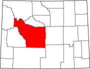 | |
| Towns | ||
| CDPs | ||
| Unincorporated communities | ||
| Ghost town | ||
| Indian reservation | ||