Laurel Springs, North Carolina
Jump to navigation
Jump to search
Laurel Springs, North Carolina | |
|---|---|
 Entering Laurel Springs | |
 Laurel Springs, North Carolina  Laurel Springs, North Carolina | |
| Coordinates: 36°24′41″N 81°15′46″W / 36.41139°N 81.26278°W | |
| Country | United States |
| State | North Carolina |
| County | Alleghany |
| Elevation | 2,749 ft (838 m) |
| Time zone | UTC-5 (Eastern (EST)) |
| • Summer (DST) | UTC-4 (EDT) |
| ZIP code | 28644 |
| Area code | 336 |
| GNIS feature ID | 1021119[1] |
Laurel Springs is an unincorporated community in Alleghany County, North Carolina, United States. Laurel Springs is located at the junction of North Carolina Highway 18 and North Carolina Highway 88 near the Ashe County line, 10.2 miles (16.4 km) southwest of Sparta.[2] The Blue Ridge Parkway also crosses the center of the community. Laurel Springs has a post office with ZIP code 28644.[3][4]
The Robert L. Doughton House was listed on the National Register of Historic Places in 1979.[5]
References
- ^ "Laurel Springs". Geographic Names Information System. United States Geological Survey, United States Department of the Interior.
- ^ Alleghany County, North Carolina (Map). North Carolina Department of Transportation. 2009.
- ^ United States Postal Service (2012). "USPS - Look Up a ZIP Code". Retrieved February 15, 2012.
- ^ "Postmaster Finder - Post Offices by ZIP Code". United States Postal Service. Retrieved March 24, 2013.
- ^ "National Register Information System". National Register of Historic Places. National Park Service. July 9, 2010.
Municipalities and communities of Alleghany County, North Carolina, United States | ||
|---|---|---|
| Town | 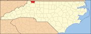 | |
| Townships | ||
| Unincorporated communities | ||
Categories:
- Pages using gadget WikiMiniAtlas
- Articles using NRISref without a reference number
- Use mdy dates from July 2023
- Articles with short description
- Short description is different from Wikidata
- Coordinates on Wikidata
- Unincorporated communities in Alleghany County, North Carolina
- Unincorporated communities in North Carolina
- All stub articles
- Western North Carolina geography stubs