Lake Tekapo Airport
This article includes a list of general references, but it lacks sufficient corresponding inline citations. (January 2023) |
Lake Tekapo Airport | |||||||||||
|---|---|---|---|---|---|---|---|---|---|---|---|
 The airport terminal in 2014 | |||||||||||
| Summary | |||||||||||
| Airport type | Private | ||||||||||
| Operator | Air Safaris Ltd | ||||||||||
| Serves | Lake Tekapo | ||||||||||
| Elevation AMSL | 2,496 ft / 761 m | ||||||||||
| Coordinates | 44°00′18″S 170°26′37″E / 44.0049°S 170.4436°E | ||||||||||
| Runways | |||||||||||
| |||||||||||
Lake Tekapo Airport (IATA: N/A, ICAO: NZTL) is a Non-Certificated Airport 1.5 NM (2.8 km; 1.7 mi) west of Lake Tekapo township in the Mackenzie District of the South Island in New Zealand. The airport was constructed by Air Safaris in 1974 for scenic charter flights over the Southern Alps.
Operational information
Movements restricted to paved areas.
Non-standard RWY markings for Air Safaris reference and use only.
CAUTION: Main highway on approach to RWY 11. Maintain adequate clearance.
CAUTION: Tekapo/Mackenzie heliport located 1.5NM to SW of aerodrome.
VFR operations within NZB978 Southern Alps MBZ are subject to special procedures.
Refer to ENR 1.16 VFR Procedures, Mount Cook/Westland.
LED emergency lighting available – full length. VFR night operations limited to Air Safaris
approved pilots.
Fuel: Greenstone Energy Swipecard AVGAS, Jet A1
Gallery
-
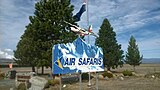 The sign on the highway by the Lake Tekapo Airport, 2014
 -
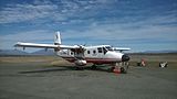 Air Safaris Gaf Nomad at Lake Tekapo Airport, 2014
 -
 View of Apron at the Lake Tekapo airport, 2014


Sources
- NZAIP Volume 4 AD
- AIP New Zealand (PDF)
This article about a New Zealand airport is a stub. You can help Wikipedia by expanding it. |
- Articles with short description
- Short description is different from Wikidata
- Use dmy dates from July 2023
- Use New Zealand English from May 2013
- All Wikipedia articles written in New Zealand English
- Articles lacking in-text citations from January 2023
- All articles lacking in-text citations
- Coordinates on Wikidata
- Transport in Canterbury, New Zealand
- Airports in New Zealand
- Transport buildings and structures in Canterbury, New Zealand
- All stub articles
- New Zealand airport stubs