Ladypool Primary School
| Ladypool Primary School | |
|---|---|
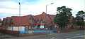
 Entrance of school | |
| Address | |
 | |
Stratford Road, Sparkbrook , , B11 1QT England | |
| Coordinates | 52°27′40″N 1°52′27″W / 52.4612°N 1.8742°W |
| Information | |
| Former name | Stratford Road School |
| Type | Community school |
| Established | 1885 |
| Local authority | Birmingham City Council |
| Department for Education URN | 103265 Tables |
| Ofsted | Reports |
| Head teacher | [1] |
| Gender | Mixed |
| Age range | 3–11 |
| Enrolment | 411 (2019)[2] |
| Capacity | 420[2] |
| Website | www |
Ladypool Primary School (formerly Stratford Road School) is a 3–11 mixed, community primary school in Sparkbrook, Birmingham, West Midlands, England. It is a Grade II* listed building,[3][4] and stands next to St Agatha's Church.
History
It was built as Stratford Road School in 1885 by architects Martin & Chamberlain as a Birmingham board school, one of around forty schools built by that firm in an innovative style as a result of the Elementary Education Act 1870.
The school was extensively damaged by the Birmingham tornado on 28 July 2005 and lost its distinctive Martin & Chamberlain tower. The school proposed building a replica of the tower. On 26 October 2006, Birmingham City Council Planning Department decided that the planning application should be referred to the Department for Communities and Local Government.
Gallery
-
 Post-tornado view of school without tower.

References
- ^ "Headteacher's Welcome". Ladypool Primary School. Retrieved 18 December 2018.
- ^ a b "Ladypool Primary School". Get information about schools. GOV.UK. Retrieved 27 July 2019.
- ^ Historic England. "Ladypool Primary School (Grade II*) (1343133)". National Heritage List for England. Retrieved 26 October 2015.
- ^ Historic England. "Picture including tower, lost in tornado 2005 (1343133)". National Heritage List for England. Retrieved 24 June 2006.
- Pevsner Architectural Guides - Birmingham, Andy Foster, 2005, ISBN 0-300-10731-5
- Victorian Architecture in Britain - Blue Guide, Julian Orbach, 1987, ISBN 0-393-30070-6
- Planning application for the reconstruction of tower[permanent dead link]
External links
This West Midlands school or sixth form college related article is a stub. You can help Wikipedia by expanding it. |
This article about a West Midlands building or structure is a stub. You can help Wikipedia by expanding it. |
- Use dmy dates from April 2022
- Use British English from February 2023
- Articles with short description
- Short description is different from Wikidata
- Infobox mapframe without OSM relation ID on Wikidata
- Coordinates on Wikidata
- All articles with dead external links
- Articles with dead external links from December 2017
- Articles with permanently dead external links
- Primary schools in Birmingham, West Midlands
- Community schools in Birmingham, West Midlands
- Grade II* listed buildings in the West Midlands (county)
- Educational institutions established in 1885
- 1885 establishments in England
- All stub articles
- West Midlands (county) school stubs
- West Midlands (county) building and structure stubs
- Pages using the Kartographer extension