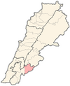
Khalouat
Jump to navigation
Jump to search
Khalouat
خلوات | |
|---|---|
village | |
| Coordinates: 33°24′58″N 35°44′19″E / 33.41611°N 35.73861°E | |
| Country | |
| Governorate | Nabatieh Governorate |
| District | Hasbaya District |
| Elevation | 950 m (3,120 ft) |
| Time zone | UTC+2 (EET) |
| • Summer (DST) | UTC+3 (EEST) |
Khalouat alt. Khalwat (Arabic: خلوات) is a local authority the Hasbaya District in Lebanon.
History
In 1838, during the Ottoman era, Eli Smith noted the population of el-Khulwat as being Druze.[1]
References
Bibliography
External links
- Khalouat, Localiban

