Karampur
Karampur | |
|---|---|
| Coordinates: 26°27′58″N 67°50′46″E / 26.466194°N 67.846169°E[1] | |
| Country | Pakistan |
| Region | Sindh |
| District | Jamshoro |
| Taluka | Sehwan |
| Population (2017)[2] | |
| • Total | 7,303 |
| Time zone | UTC+5 (PST) |
| • Summer (DST) | UTC+6 (PDT) |
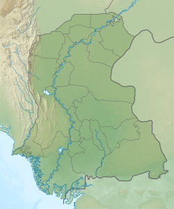
Karampur is a village and deh in Sehwan taluka of Jamshoro District, Sindh.[3] Said to have been founded by the Talpur dynasty ruler Mir Karam Ali Talpur, it is located just north of Sehwan on the road to Larkano.[4] The village contains the shrine of Hussain Shah, a Muslim saint who was buried here in the early 20th century.[5]
As of 2017, Karampur has a population of 7,303, in 1,436 households.[2] It belongs to the tappedar circle of Channa.[2]
Around 1874, Karampur was described as a predominantly agricultural village with a small police thana.[4] Its population was estimated to be about 1,000 people, including about 850 Muslims (mostly Utas) and 150 Hindus (mostly Lohanos).[4] Local trade included various types of grain, ghee, milk, and butter, while the goods manufactured in Karampur mainly consisted of coarse cloth and shoes.[4]
The 1951 census recorded the village of Karampur as having an estimated population of about 1,990, in about 350 houses.[6] It had a school at that point.[6]
In the 1990s, in order to combat waterlogging and increasing soil salinity on the right (west) bank of the Indus, a major drainage channel called the Right Bank Outfall Drain was planned to discharge into the Indus at Karampur.[7] After a major backlash from local residents, however, the plan was changed to discharge the channel directly into the Arabian Sea.[7]
References
- ^ "Geonames Search". Do a radial search using these coordinates here.
- ^ a b c Population and household detail from block to tehsil level (Jamshoro District) (PDF). 2017. pp. 11–2. Retrieved 1 January 2022.
- ^ "List of Dehs in Sindh" (PDF). Sindh Zameen. Retrieved 1 January 2022.
- ^ a b c d Hughes, A.W. (1874). A Gazetteer of the Province of Sindh. London: George Bell and Sons. p. 339. Retrieved 1 January 2022.
- ^ Shah, Syed Shakir Ali (2016). "Archaeological Investigations in Manchar Concession Area (Area of Operation)" (PDF). Journal of Multidisciplinary Studies in Archaeology. 4: 785–6. Retrieved 1 January 2022.
- ^ a b Census of Pakistan, 1951: Village List (PDF). p. 18 in section "Dadu District". Retrieved 1 January 2022.
- ^ a b Ghazanfar, Munir (2009). "The Environmental Case of Sindh" (PDF). Lahore Journal of Policy Studies. 3 (1): 135–6. Retrieved 1 January 2022.

