Körösszakál
Jump to navigation
Jump to search
Körösszakál
Săcal | |
|---|---|
| Country | |
| County | Hajdú-Bihar |
| Area | |
| • Total | 15.02 km2 (5.80 sq mi) |
| Population (2015) | |
| • Total | 833[1] |
| • Density | 55.6/km2 (144/sq mi) |
| Time zone | UTC+1 (CET) |
| • Summer (DST) | UTC+2 (CEST) |
| Postal code | 4136 |
| Area code | 54 |

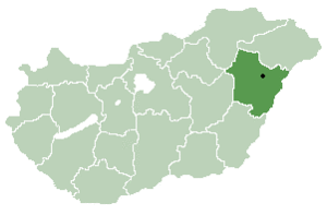
Körösszakál (Romanian: Săcal) is a village in Hajdú-Bihar county, in the Northern Great Plain region of eastern Hungary. The village is situated along the bank of the Crișul Repede.
Geography
It covers an area of 15.02 km2 (6 sq mi) and has a population of 833 people (2015).[1]
References
- ^ a b Gazetteer of Hungary, 1 January 2015. Hungarian Central Statistical Office. 3 September 2015
47°01′N 21°36′E / 47.017°N 21.600°E
Categories:
- Use dmy dates from November 2018
- Articles with short description
- Short description is different from Wikidata
- Pages using infobox settlement with no map
- Pages using infobox settlement with no coordinates
- Articles containing Romanian-language text
- Coordinates on Wikidata
- Articles with VIAF identifiers
- Articles with J9U identifiers
- Articles with LCCN identifiers
- Populated places in Hajdú-Bihar County
- Romanian communities in Hungary
- All stub articles
- Hajdú-Bihar geography stubs

