Juodžiai, Kėdainiai
Jump to navigation
Jump to search
Juodžiai | |
|---|---|
Village | |
,_2019.JPG) | |
 Juodžiai Location in Lithuania  Juodžiai Juodžiai (Lithuania) | |
| Coordinates: 55°17′20″N 23°37′59″E / 55.28889°N 23.63306°E | |
| Country | |
| County | |
| Municipality | Kėdainiai district municipality |
| Eldership | Pernarava Eldership |
| Population (2011) | |
| • Total | 62 |
| Time zone | UTC+2 (EET) |
| • Summer (DST) | UTC+3 (EEST) |
Juodžiai (formerly Russian: Іодзе, Polish: Jodzie)[1] is a village in Kėdainiai district municipality, in Kaunas County, in central Lithuania. According to the 2011 census, the village had a population of 62 people.[2] It is located 3 kilometres (1.9 mi) from Pernarava, nearby the Lapkalnys-Paliepiai Forest and the Bernaupis rivulet. The Lendrynė Ornitological Sanctuary is located nearby Juodžiai.
History
There was Juodžiai village and folwark (a property of Benedykt Tyszkiewicz) at the end of the 19th century. There was the Crucified Jesus chapel (built in 1780).[1]
Demography
|
| ||||||||||||||||||||||||||||||
| Source: 1902, 1923, 1959 & 1970, 1979, 1989, 2001, 2011 | |||||||||||||||||||||||||||||||
Images
-
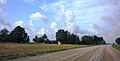
 Juodžiai from the Pernarava-Pašušvys road
 -
 Juodžiai homestead
 -
 Juodžiai homestead and the Lapkalnys-Paliepiai Forest
 -
 Lendrynė Sanctuary
.JPG)

,_2019,_sodyba.JPG)

References
- ^ a b "Jodzie". Geographical Dictionary of the Kingdom of Poland (in Polish). 15 pt. 2. Warszawa: Kasa im. Józefa Mianowskiego. 1902. p. 24. "Jodzie". Geographical Dictionary of the Kingdom of Poland (in Polish). 3. Warszawa: Kasa im. Józefa Mianowskiego. 1882. p. 592.
- ^ "2011 census". Statistikos Departamentas (Lithuania). Retrieved August 21, 2017.

Categories:
- Pages using gadget WikiMiniAtlas
- Articles with Polish-language sources (pl)
- Articles with short description
- Short description is different from Wikidata
- Coordinates on Wikidata
- Articles containing Russian-language text
- Articles containing Polish-language text
- Villages in Kaunas County
- Kėdainiai District Municipality
- All stub articles
- Kaunas County geography stubs