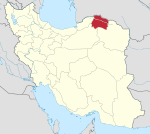
Jajarm
Jajarm
Persian: جاجرم | |
|---|---|
City | |
 Panoramic view of Jajarm from Narin Qaleh | |
| Coordinates: 36°57′07″N 56°22′33″E / 36.95194°N 56.37583°E[1] | |
| Country | Iran |
| Province | North Khorasan |
| County | Jajarm |
| District | Central |
| Elevation | 1,000 m (3,000 ft) |
| Population (2016)[2] | |
| • Total | 19,580 |
| Time zone | UTC+3:30 (IRST) |
Jajarm (Persian: جاجرم, also Romanized as Jājarm)[3] is a city in the Central District of Jajarm County, North Khorasan province, Iran, serving as capital of both the county and the district.[4]
At the 2006 census, its population was 24,368 in 6,332 households.[5] The following census in 2011 counted 18,547 people in 4,985 households.[6] The latest census in 2016 showed a population of 19,580 people in 5,616 households.[2]
Because of several historical and archeological sites, Jajarm is one of the most attractive cities in North Khorasan province. The city is placed on the border of Central Desert of Iran and has a unique vegetation. Jajarm has also known for its wildlife refuge which Iranian cheetah lives there. Jajarm has several bauxite mines and a plant is producing Alumina from bauxite.
Historical sites
The region of north-eastern Iran has not been explored archaeologically until recently. But now a lot of work is being done. Archaeological fieldwork in North Khorassan has already shown the richness of prehistoric cultures in the region.
Tepe Pahlavan
Tepe Pahlavan (Tappeh Pahlavan) is a prehistoric site near Jajarm city. It is a large Neolithic-Chalcolithic craft production site, located between the Alborz Mountains in the north, and the vast desert of Dasht-e Khavir in the south.[7]
In 2014, an Iranian-German team carried out the first systematic excavations at Tappe Pahlavan.[8]
The upper settlement horizon has been dated to the early sixth millennium BC. These are the earliest dates so far for the ceramic Neolithic period in Northeast Iran. The connections with the contemporary sites in Northeast Iran are evident, but also with the sites in Kopet Dag, 200 km to the east.
The ceramics are similar to the Cheshmeh Ali type. The Cheshmeh Ali cultural complex generally defines a Transitional Chalcolithic on the Iranian Central Plateau dating between 5500 and 4800 BC. Yet the radiocarbon dates at Pahlavan precede this period by 500 years. So Cheshmeh Ali type ceramics here may be a unique early local development.
The Jeitun ceramics, very common in Northeast Iran and southern Turkmenistan, are not found in Pahlavan. There is also very little evidence of agricultural activities here. Rather, this settlement seems to have been mostly occupied with bead production, processing the local semi-precious stone deposits.[8]
Jorbat
Petroglyphic site of Jorbat (This area is locally known as Sang Neveshteh or the "inscribed stone") to the north of the plain of Jajarm is one of the largest rock-art complexes of Iran. Ranging from late Bronze Age to the ethnographic period, the rock art imagery of Jorbat has close parallels both in petroglyphic sites of the Central plateau of Iran and the Central Asian steppes.[9]
References
- ^ OpenStreetMap contributors (18 May 2023). "Jajarm, Jajarm County" (Map). OpenStreetMap. Retrieved 18 May 2023.
- ^ a b "Census of the Islamic Republic of Iran, 1395 (2016)". AMAR (in Persian). The Statistical Center of Iran. p. 28. Archived from the original (Excel) on 27 October 2020. Retrieved 19 December 2022.
- ^ Jajarm can be found at GEOnet Names Server, at this link, by opening the Advanced Search box, entering "-3067531" in the "Unique Feature Id" form, and clicking on "Search Database".
- ^ Habibi, Hassan. "Creation and establishment of the Dasht-e Kuh District centered on Shoqan village and Jajarm County in Khorasan province". Lamtakam (in Persian). Ministry of Interior, Political-Defense Commission of the Government Board. Archived from the original on 11 January 2024. Retrieved 11 January 2024.
- ^ "Census of the Islamic Republic of Iran, 1385 (2006)". AMAR (in Persian). The Statistical Center of Iran. p. 28. Archived from the original (Excel) on 20 September 2011. Retrieved 25 September 2022.
- ^ "Census of the Islamic Republic of Iran, 1390 (2011)". Syracuse University (in Persian). The Statistical Center of Iran. p. 28. Archived from the original (Excel) on 19 January 2023. Retrieved 19 December 2022.
- ^ VAHDATI, Ali A., TEPE PAHLAVAN: A NEOLITHIC-CHALCOLITHIC SITE IN THE JAJARM PLAIN, NORTH-EASTERN IRAN Iranica Antiqua; 2010, Vol. 45, p7
- ^ a b KHARANAGHI, M. Hossein Azizi, THOMALSKY, Judith, KHANIPOOR, Morteza, JAFARI, M. Javad (2016), Archaeological Research at Tappeh Pahlavan, North Khorasan Province (Northeastern Iran); Report on the 2014 Season. Ancient Near Eastern Studies, Volume: 53 Pages: 59-79. At academia.edu
- ^ A.A. VAHDATI (2012), A Preliminary Report on a newly discovered Petroglyphic Complex near Jorbat, the Plain of Jajarm, North-eastern Iran. Paléorient, vol. 37.2, p. 177-187 - academia.edu
Sources
- Jajarm at GEOnet Names Server
- اطلس گیتاشناسی استانهای ایران [Atlas Gitashenasi Ostanhai Iran] (Gitashenasi Province Atlas of Iran)
- CS1 Persian-language sources (fa)
- Articles with short description
- Short description matches Wikidata
- Use dmy dates from May 2023
- Short description is different from Wikidata
- Articles containing Persian-language text
- Coordinates on Wikidata
- Articles with VIAF identifiers
- Prehistoric Iran
- Cities in North Khorasan Province
- Populated places in Jajrom County
- National works of Iran

