Index, Arkansas
Jump to navigation
Jump to search
Index, Arkansas | |
|---|---|
 Index  Index | |
| Coordinates: 33°32′49″N 94°02′31″W / 33.54694°N 94.04194°W | |
| Country | United States |
| State | Arkansas |
| County | Miller |
| Elevation | 276 ft (84 m) |
| Time zone | UTC-6 (Central (CST)) |
| • Summer (DST) | UTC-5 (CDT) |
| Area code | 870 |
| GNIS feature ID | 57966[1] |
Index is an unincorporated community in Miller County, Arkansas, United States. Index is located on U.S routes 59 and 71 in the northwest corner of the county, 8.4 miles (13.5 km) north of Texarkana.[2]
References
- ^ "Index". Geographic Names Information System. United States Geological Survey, United States Department of the Interior.
- ^ Miller County, Arkansas General Highway Map (PDF) (Map). Arkansas State Highway and Transportation Department. 2010. Archived from the original (PDF) on April 23, 2012. Retrieved June 13, 2012.
Municipalities and communities of Miller County, Arkansas, United States | ||
|---|---|---|
| Cities | 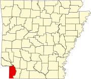 | |
| Town | ||
| CDP | ||
| Other unincorporated communities | ||
This article about a location in Miller County, Arkansas is a stub. You can help Wikipedia by expanding it. |
Categories:
- Pages using gadget WikiMiniAtlas
- Use mdy dates from July 2023
- Articles with short description
- Short description is different from Wikidata
- Coordinates on Wikidata
- Unincorporated communities in Miller County, Arkansas
- Unincorporated communities in Arkansas
- All stub articles
- South West Arkansas geography stubs