Iha Castle
| Iha Castle 伊波城 | |
|---|---|
| Uruma, Okinawa | |
 Map of the Iha Castle site | |
 Iha Castle 伊波城  Iha Castle 伊波城 | |
| Coordinates | 26°25′17.6″N 127°49′2.4″E / 26.421556°N 127.817333°E |
| Type | Gusuku |
| Site information | |
| Controlled by | |
| Open to the public | yes |
| Condition | Ruins |
| Site history | |
| Built | early 14th century |
| In use | early 14th century–15th century |
| Materials | Ryukyuan limestone, wood |
| Garrison information | |
| Occupants | Aji of Misato Magiri |
 | |
Iha Castle (伊波城, Iha jō, Okinawan: Ifa Gushiku[1]) is a Ryukyuan gusuku in Uruma, Okinawa. It sits on a cliff that separates Iha from Ishikawa, with a grand view of the Ishikawa Isthmus. The castle is in ruins, with nothing left of the original structures save the walls. There are also multiple Ryukyuan shrines in the bailey. Based on artifacts found in and around the castle, it has been estimated to have been in use around the 13th to 15th centuries.[2] The Okinawa Prefectural government erected a stone Torii in front of one of the castle gates, along with a plaque describing it.
-
 View of the bailey from a battlement.
 -
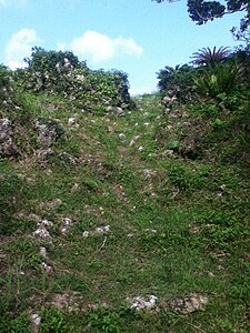
 Bailey of Iha Castle.
 -
 A battlement of Iha Castle.


References
- ^ "イファ". 首里・那覇方言音声データベース (in Japanese).
- ^ Flemming, Michael. "Iha Castle Ruins - An Okinawa prefecture cultural asset." Stars and Stripes Okinawa Nov 2013, n. pag. Web. 3 Feb. 2014. <http://o.okinawa.stripes.com/starsandstripesokinawa/#!/entry/iha-castle-ruins-an-okinawa-prefecture-cultural-asset,52959ba2025312186c91f668/1>. [dead link]
This Okinawa Prefecture location article is a stub. You can help Wikipedia by expanding it. |
This castle-related article is a stub. You can help Wikipedia by expanding it. |
- CS1 Japanese-language sources (ja)
- All articles with dead external links
- Articles with dead external links from August 2018
- Coordinates on Wikidata
- Infobox mapframe without OSM relation ID on Wikidata
- Articles containing Japanese-language text
- Castles in Okinawa Prefecture
- Designated historic sites of Okinawa Prefecture
- All stub articles
- Okinawa geography stubs
- Castle stubs
- Pages using the Kartographer extension