Hato Nuevo, Gurabo, Puerto Rico
Hato Nuevo | |
|---|---|
Barrio | |
 Rainy day in Sector María Jiménez in Hato Nuevo | |
 Location of Hato Nuevo within the municipality of Gurabo shown in red | |
 Hato Nuevo Location of Puerto Rico | |
| Coordinates: 18°16′00″N 65°57′09″W / 18.266571°N 65.952593°W[1] | |
| Commonwealth | |
| Municipality | |
| Area | |
| • Total | 4.39 sq mi (11.4 km2) |
| • Land | 4.37 sq mi (11.3 km2) |
| • Water | 0.02 sq mi (0.05 km2) |
| Elevation | 328 ft (100 m) |
| Population (2010) | |
| • Total | 9,345 |
| • Density | 2,138.4/sq mi (825.6/km2) |
| Source: 2010 Census | |
| Time zone | UTC−4 (AST) |
| ZIP Code | 00778 |
Hato Nuevo is a barrio in the municipality of Gurabo, Puerto Rico. Its population in 2010 was 9,345.[3][4][5]
History
Hato Nuevo was in Spain's gazetteers[6] until Puerto Rico was ceded by Spain in the aftermath of the Spanish–American War under the terms of the Treaty of Paris of 1898 and became an unincorporated territory of the United States. In 1899, the United States Department of War conducted a census of Puerto Rico finding that the population of Hato Nuevo barrio was 1,361.[7]
| Census | Pop. | Note | %± |
|---|---|---|---|
| 1900 | 1,361 | — | |
| 1910 | 1,866 | 37.1% | |
| 1920 | 1,884 | 1.0% | |
| 1930 | 1,973 | 4.7% | |
| 1940 | 2,038 | 3.3% | |
| 1950 | 2,022 | −0.8% | |
| 1960 | 2,183 | 8.0% | |
| 1970 | 2,922 | 33.9% | |
| 1980 | 3,382 | 15.7% | |
| 1990 | 5,236 | 54.8% | |
| 2000 | 7,377 | 40.9% | |
| 2010 | 9,345 | 26.7% | |
| U.S. Decennial Census 1899 (shown as 1900)[8] 1910-1930[9] 1930-1950[10] 1980-2000[11] 2010[12] | |||
Sectors
Barrios (which are, in contemporary times, roughly comparable to minor civil divisions)[13] in turn are further subdivided into smaller local populated place areas/units called sectores (sectors in English). The types of sectores may vary, from normally sector to urbanización to reparto to barriada to residencial, among others.[14][15][16][17][18]
The following sectors are in Hato Nuevo barrio:[19]
Extensión Alturas de Hato Nuevo, Los Rivera, Los Sueños, Parcelas Lomas Verdes, Parcelas María Jiménez, Parcelas Nuevas Celada, Parcelas Viejas Celada, Sector Álamo, Sector Alicea, Sector Cando Gómez, Sector Cantera, Sector Caraballo, Sector Catalino Gómez, Sector Concepción Ortiz, Sector Estancia, Sector Goytía, Sector Josean Boria, Sector Lomas Verdes, Sector Los Cruces, Sector Los Gómez, Sector Los Márquez, Sector Los Ortiz, Sector Los Resto, Sector Los Solares, Sector María Jiménez, Sector Montañez, Sector Monte Moriah, Sector Niño Díaz, Sector Prudo Pérez, Sector Querube, Sector Sico Díaz, Sector Valeriano Díaz (Camilo Díaz), Sector Valeriano Díaz, Sector Valle Verde, Sector Vázquez, Sector Vidal Santos, Terra Ciudad Jardín, Urbanización Alturas de Hato Nuevo, Urbanización Los Flamboyanes, Urbanización Los Paisajes, Urbanización Los Robles, and Urbanización Vistalago.
Gallery
-
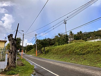 Sector María Jiménez

See also
References
- ^ a b "US Gazetteer 2019". US Census. US Government.
- ^ U.S. Geological Survey Geographic Names Information System: Hato Nuevo barrio
- ^ Picó, Rafael; Buitrago de Santiago, Zayda; Berrios, Hector H. Nueva geografía de Puerto Rico: física, económica, y social, por Rafael Picó. Con la colaboración de Zayda Buitrago de Santiago y Héctor H. Berrios. San Juan Editorial Universitaria, Universidad de Puerto Rico,1969.
- ^ Gwillim Law (20 May 2015). Administrative Subdivisions of Countries: A Comprehensive World Reference, 1900 through 1998. McFarland. p. 300. ISBN 978-1-4766-0447-3. Retrieved 25 December 2018.
- ^ Puerto Rico: 2010 Population and Housing Unit Counts.pdf (PDF). U.S. Dept. of Commerce, Economics and Statistics Administration, U.S. Census Bureau. 2010.
- ^ "Anuario del comercio, de la industria, de la magistratura y de la administración. 1881". Biblioteca Nacional de España (in Spanish). p. 1614. Retrieved 4 April 2023.
- ^ Joseph Prentiss Sanger; Henry Gannett; Walter Francis Willcox (1900). Informe sobre el censo de Puerto Rico, 1899, United States. War Dept. Porto Rico Census Office (in Spanish). Imprenta del gobierno. p. 163.
- ^ "Report of the Census of Porto Rico 1899". War Department Office Director Census of Porto Rico. Archived from the original on July 16, 2017. Retrieved September 21, 2017.
- ^ "Table 3-Population of Municipalities: 1930 1920 and 1910" (PDF). United States Census Bureau. Archived (PDF) from the original on August 17, 2017. Retrieved September 21, 2017.
- ^ "Table 4-Area and Population of Municipalities Urban and Rural: 1930 to 1950" (PDF). United States Census Bureau. Archived (PDF) from the original on August 30, 2015. Retrieved September 21, 2014.
- ^ "Table 2 Population and Housing Units: 1960 to 2000" (PDF). United States Census Bureau. Archived (PDF) from the original on July 24, 2017. Retrieved September 21, 2017.
- ^ Puerto Rico: 2010 Population and Housing Unit Counts.pdf (PDF). U.S. Dept. of Commerce Economics and Statistics Administration U.S. Census Bureau. 2010. Archived (PDF) from the original on 2017-02-20. Retrieved 2019-08-02.
- ^ "US Census Barrio-Pueblo definition". factfinder.com. US Census. Archived from the original on 13 May 2017. Retrieved 5 January 2019.
- ^ Mari Mut, José A. (28 August 2013). "Los pueblos de Puerto Rico y las iglesias de sus plazas" (in Spanish). Retrieved 19 June 2020 – via archive.org.
- ^ "Agencia: Oficina del Coordinador General para el Financiamiento Socioeconómico y la Autogestión (Proposed 2016 Budget)". Puerto Rico Budgets (in Spanish). Retrieved 28 June 2019.
- ^ Rivera Quintero, Marcia (2014), El vuelo de la esperanza : Proyecto de las Comunidades Especiales Puerto Rico, 1997-2004 (Primera edición ed.), San Juan, Puerto Rico Fundación Sila M. Calderón, ISBN 978-0-9820806-1-0
- ^ "Leyes del 2001". Lex Juris Puerto Rico (in Spanish). Retrieved 24 June 2019.
- ^ "Comunidades Especiales de Puerto Rico" (in Spanish). 8 August 2011. Retrieved 24 June 2019.
- ^ "PRECINTO ELECTORAL GURABO 084" (PDF). Comisión Estatal de Elecciones (in Spanish). PR Government. 21 September 2019. Retrieved 22 June 2020.
This Gurabo, Puerto Rico location article is a stub. You can help Wikipedia by expanding it. |
- CS1 Spanish-language sources (es)
- Articles with short description
- Short description is different from Wikidata
- Short description matches Wikidata
- Coordinates on Wikidata
- Articles containing Spanish-language text
- Barrios of Gurabo, Puerto Rico
- All stub articles
- Puerto Rico senatorial district VII geography stubs