Fraterville, Tennessee
Jump to navigation
Jump to search
Fraterville | |
|---|---|
 Fraterville Location within the state of Tennessee  Fraterville Fraterville (the United States) | |
| Coordinates: 36°11′48″N 84°10′20″W / 36.19667°N 84.17222°W | |
| Country | United States |
| State | Tennessee |
| County | Anderson |
| Elevation | 909 ft (277 m) |
| Time zone | UTC-5 (Eastern (EST)) |
| • Summer (DST) | UTC-4 (EDT) |
| GNIS feature ID | 1284843[1] |

Fraterville, Tennessee is an unincorporated community located on State Route 116 in Anderson County, Tennessee, between the towns of Rocky Top and Briceville. It is included in the Knoxville, Tennessee Metropolitan Statistical Area.
Fraterville, which has a history of coal mining, is known for the Fraterville Mine Disaster that occurred there in 1902.
The name of the community, which is derived from the Latin word frater, means "village of brothers."[2]
References
- ^ "Fraterville, Tennessee". Geographic Names Information System. United States Geological Survey, United States Department of the Interior.
- ^ Coal Creek: War and Disasters, Coal Creek Watershed Foundation, Inc., accessed September 15, 2008
Municipalities and communities of Anderson County, Tennessee, United States | ||
|---|---|---|
| Cities | 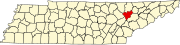 | |
| Town | ||
| CDPs | ||
| Other communities | ||
| Ghost towns/ neighborhoods | ||
| Footnotes | ‡This populated place also has portions in an adjacent county or counties | |
This Anderson County, Tennessee geography–related article is a stub. You can help Wikipedia by expanding it. |
Categories:
- Use mdy dates from July 2023
- Articles with short description
- Short description is different from Wikidata
- Coordinates on Wikidata
- Unincorporated communities in Anderson County, Tennessee
- Unincorporated communities in Tennessee
- Knoxville metropolitan area
- Coal towns in Tennessee
- All stub articles
- East Tennessee geography stubs