Fort Ter-Waw
This article includes a list of references, related reading, or external links, but its sources remain unclear because it lacks inline citations. (April 2021) |
| Fort Ter-Waw | |
|---|---|
 Location of Fort Ter-Waw in California | |
| Location | Ter-Wer Riffle and Klamath Glen Rds., Klamath, California |
| Coordinates | 41°30′36″N 123°59′19″W / 41.50992°N 123.98855°W |
| Reference no. | 544 |
Fort Ter-Waw was a fortified position of U.S. Army located at the site of the present-day town of Klamath Glen, California. The Location is six miles (9.7 km)upstream from the mouth of the Klamath River in the former Klamath River Reservation.
Fort Ter-Waw was a United States military post created to establish an occupying force on the Klamath River Reservation that could "keep the peace" between the Tolowa and Yurok Native American tribes and white settlers. It was established in what was then Klamath County, October 12, 1857, by First Lieutenant George Crook and the men of Company D, US 4th Infantry Regiment. The fort was part of the Humboldt Military District headquartered at Fort Humboldt. Most of the fort was destroyed during the Great Flood of 1862 in December 1861 and abandoned June 10, 1862. The garrison was moved to Camp Lincoln.
The site is now in Del Norte County and is marked by a California Historical Landmark (#544). Its location can be found from Hwy 101 taking Ter-Wer Valley exit (Hwy 169), going 3.4 mi to the end of the road, and turning right on Ter-Wer Riffle Road. The site is at the intersection of Ter-Wer Riffle Road and Trinity Way in Klamath Glen.
References
- "Del Norte". California Historical Landmarks. Office of Historic Preservation. Retrieved 2005-08-29.
- Historic California Posts: Fort Ter-Waw, The California State Military Museum
Municipalities and communities of Del Norte County, California, United States | ||
|---|---|---|
| City | 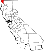 | |
| CDPs | ||
| Unincorporated communities | ||
| Indian reservations | ||
| Ghost towns | ||
This Del Norte County, California-related article is a stub. You can help Wikipedia by expanding it. |
- Pages using gadget WikiMiniAtlas
- Articles lacking in-text citations from April 2021
- All articles lacking in-text citations
- Articles with short description
- Short description matches Wikidata
- Coordinates on Wikidata
- Closed installations of the United States Army
- Forts in California
- California Historical Landmarks
- History of Del Norte County, California
- 1857 establishments in California
- American Civil War forts and army posts in California
- All stub articles
- Redwood Empire geography stubs